Liberty Township, New Jersey
| Liberty Township, New Jersey | |
|---|---|
| Township | |
| Township of Liberty | |
|
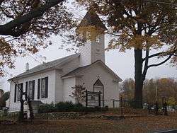
Free Union Church from Marble Hill Road | |
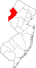
 Map of Liberty Township in Warren County. Inset: Location of Warren County highlighted in the State of New Jersey. | |
 Census Bureau map of Liberty Township, New Jersey | |
| Coordinates: 40°52′11″N 74°56′17″W / 40.86974°N 74.938064°WCoordinates: 40°52′11″N 74°56′17″W / 40.86974°N 74.938064°W[1][2] | |
| Country |
|
| State |
|
| County | Warren |
| Incorporated | April 30, 1926 |
| Government[3] | |
| • Type | Township |
| • Body | Township Committee |
| • Mayor | John E. Inscho (R, term ends December 31, 2016)[4][5] |
| • Administrator / Clerk | Diane M. Pflugfelder[4] |
| Area[1] | |
| • Total | 11.866 sq mi (30.733 km2) |
| • Land | 11.603 sq mi (30.051 km2) |
| • Water | 0.263 sq mi (0.682 km2) 2.22% |
| Area rank |
194th of 566 in state 14th of 22 in county[1] |
| Elevation[6] | 748 ft (228 m) |
| Population (2010 Census)[7][8][9] | |
| • Total | 2,942 |
| • Estimate (2015)[10] | 2,851 |
| • Rank |
456th of 566 in state 15th of 22 in county[11] |
| • Density | 253.6/sq mi (97.9/km2) |
| • Density rank |
490th of 566 in state 12th of 22 in county[11] |
| Time zone | Eastern (EST) (UTC-5) |
| • Summer (DST) | Eastern (EDT) (UTC-4) |
| ZIP Codes |
07823 - Belvidere[12] 07838 - Great Meadows[13] 07863 - Oxford[14] |
| Area code(s) | 908[15] |
| FIPS code | 3404140110[1][16][17] |
| GNIS feature ID | 0882245[1][18] |
| Website |
www |
Liberty Township is a township in Warren County, New Jersey, United States. As of the 2010 United States Census, the township's population was 2,942,[7][8][9] reflecting an increase of 177 (+6.4%) from the 2,765 counted in the 2000 Census, which had in turn increased by 272 (+10.9%) from the 2,493 counted in the 1990 Census.[19] It is part of the eastern region of the Lehigh Valley.
Liberty Township was incorporated as a township by an act of the New Jersey Legislature on March 26, 1926, from portions of Hope Township, based on the results of a referendum held on April 30, 1926.[20]
Geography
According to the United States Census Bureau, the township had a total area of 11.866 square miles (30.733 km2), including 11.603 square miles (30.051 km2) of land and 0.263 square miles (0.682 km2) of water (2.22%).[1][2]
Mountain Lake (with a 2010 Census population of 575[21]) is an unincorporated community and census-designated place (CDP) located within the township.[22][23][24] Other unincorporated communities, localities and place names located partially or completely within the township include Denville, Great Meadows and Townsbury.[25]
Mountain Lake is over 12,000 years old and is Warren County's largest, natural, glacial lake. Mountain Lake also has an area of 122 acres (0.49 km2), maximum depth of 38 feet (12 m) and an average depth of 17 feet (5.2 m). The Mountain Lake Community Association (MLCA) oversees the Mountain Lake Watershed and helps to maintain Mountain Lake's natural habitat.[26] South of Mountain Lake is High Rock where many visitors enjoy to go for hiking and a view of the lake and surrounding areas, including the Delaware Water Gap.
Demographics
| Historical population | |||
|---|---|---|---|
| Census | Pop. | %± | |
| 1930 | 419 | — | |
| 1940 | 441 | 5.3% | |
| 1950 | 529 | 20.0% | |
| 1960 | 760 | 43.7% | |
| 1970 | 1,229 | 61.7% | |
| 1980 | 1,730 | 40.8% | |
| 1990 | 2,493 | 44.1% | |
| 2000 | 2,765 | 10.9% | |
| 2010 | 2,942 | 6.4% | |
| Est. 2015 | 2,851 | [10][27] | −3.1% |
| Population sources: 1930[28] 1930-1990[29] 2000[30][31] 2010[7][8][9] | |||
The Township's economic data (as is all of Warren County) is calculated by the US Census Bureau as part of the Allentown-Bethlehem-Easton, PA-NJ Metropolitan Statistical Area.
Census 2010
The 2010 United States Census counted 2,942 people, 1,047 households, and 789.4 families residing in the township. The population density was 253.6 per square mile (97.9/km2). The CDP contained 1,151 housing units at an average density of 99.2 per square mile (38.3/km2). The racial makeup of the township was 95.65% (2,814) White, 1.02% (30) Black or African American, 0.20% (6) Native American, 1.50% (44) Asian, 0.00% (0) Pacific Islander, 0.44% (13) from other races, and 1.19% (35) from two or more races. Hispanics or Latinos of any race were 4.15% (122) of the population.[7]
Out of a total of 1,047 households, 35.8% had children under the age of 18 living with them, 63.0% were married couples living together, 7.4% had a female householder with no husband present, and 24.6% were non-families. 18.4% of all households were made up of individuals, and 7.3% had someone living alone who was 65 years of age or older. The average household size was 2.78 and the average family size was 3.21.[7]
In the township, 24.3% of the population were under the age of 18, 8.0% from 18 to 24, 23.4% from 25 to 44, 34.7% from 45 to 64, and 9.6% who were 65 years of age or older. The median age was 41.8 years. For every 100 females the census counted 104.3 males, but for 100 females at least 18 years old, it was 98.4 males.[7]
The Census Bureau's 2006-2010 American Community Survey showed that (in 2010 inflation-adjusted dollars) median household income was $73,750 (with a margin of error of +/- $7,599) and the median family income was $87,059 (+/- $12,952). Males had a median income of $55,625 (+/- $10,748) versus $49,511 (+/- $6,823) for females. The per capita income for the borough was $31,946 (+/- $3,591). About 0.0% of families and 4.3% of the population were below the poverty line, including 1.7% of those under age 18 and 9.9% of those age 65 or over.[32]
Census 2000
As of the 2000 United States Census[16] there were 2,765 people, 980 households, and 750 families residing in the township. The population density was 234.3 people per square mile (90.5/km²). There were 1,088 housing units at an average density of 92.2 per square mile (35.6/km²). The racial makeup of the township was 97.40% White, 0.36% African American, 0.11% Native American, 0.58% Asian, 0.54% from other races, and 1.01% from two or more races. Hispanic or Latino of any race were 2.68% of the population.[30][31]
There were 980 households out of which 40.6% had children under the age of 18 living with them, 68.2% were married couples living together, 5.7% had a female householder with no husband present, and 23.4% were non-families. 17.6% of all households were made up of individuals and 6.6% had someone living alone who was 65 years of age or older. The average household size was 2.79 and the average family size was 3.23.[30][31]
In the township the population was spread out with 28.4% under the age of 18, 5.0% from 18 to 24, 33.1% from 25 to 44, 25.2% from 45 to 64, and 8.5% who were 65 years of age or older. The median age was 38 years. For every 100 females there were 98.6 males. For every 100 females age 18 and over, there were 96.7 males.[30][31]
The median income for a household in the township was $62,535, and the median income for a family was $68,529. Males had a median income of $48,446 versus $33,529 for females. The per capita income for the township was $24,743. About 2.0% of families and 3.5% of the population were below the poverty line, including 3.4% of those under age 18 and 6.7% of those age 65 or over.[30][31]
Government
Local government
Liberty Township is governed under the Township form of government. The five-member Township Committee is elected directly by the voters at-large in partisan elections to serve three-year terms of office on a staggered basis, with either one or two seats coming up for election each year as part of the November general election in a three-year cycle.[3][33] At an annual reorganization meeting, the Township Committee selects one of its members to serve as Mayor.
As of 2016, members of the Liberty Township Committee are Mayor John E. Inscho (R, term on committee ends December 31, 2018; term as mayor ends 2016), Deputy Mayor Daniel B. Grover (R, term on committee and as deputy mayor ends 2016), Carl P. Cummins (R, 2016; elected to serve an unexpired term), Peter Karcher (R, 2017) and Ronald W. Petersen (R, 2017).[4][34][35][36][37][38]
Carl Cummins was appointed to fill the vacant seat of John Fisher, who had died in September 2013, after the deadline to remove his name from the ballot and who won a seat in the November 2013 general election. Fisher's term of office runs until December 2016.[39] Cummins served on an interim basis until the November 2014 general election when he was elected to serve the balance of the term.[37]
Federal, state and county representation
Liberty Township is located in the 5th Congressional District[40] and is part of New Jersey's 24th state legislative district.[8][41][42] Prior to the 2011 reapportionment following the 2010 Census, Liberty Township had been in the 23rd state legislative district.[43]
New Jersey's Fifth Congressional District is represented by Scott Garrett (R, Wantage Township).[44] New Jersey is represented in the United States Senate by Cory Booker (D, Newark, term ends 2021)[45] and Bob Menendez (D, Paramus, 2019).[46][47]
For the 2016–2017 session (Senate, General Assembly), the 24th Legislative District of the New Jersey Legislature is represented in the State Senate by Steve Oroho (R, Franklin) and in the General Assembly by Parker Space (R, Wantage Township) and Gail Phoebus (R, Andover Township).[48] The Governor of New Jersey is Chris Christie (R, Mendham Township).[49] The Lieutenant Governor of New Jersey is Kim Guadagno (R, Monmouth Beach).[50]
Warren County is governed by a Board of Chosen Freeholders whose three members are chosen at-large on a staggered basis in partisan elections with one seat coming up for election each year as part of the November general election. At an annual reorganization meeting held in the beginning of January, the board selects one of its members to serve as Freeholder Director and other as Deputy Director. As of 2014, Warren County's Freeholders are Freeholder Director Edward J. Smith (R, Asbury / Franklin Township, 2015), Freeholder Deputy Director Richard D. Gardner (R, Asbury / Franklin Township, 2014) and Freeholder Jason Sarnoski (R, Lopatcong Township, 2016).[51] Constitutional officers elected on a countywide basis are County Clerk Patricia J. Kolb (Blairstown Township),[52] Sheriff David Gallant (Blairstown Township) and Surrogate Kevin O'Neill (Hackettstown).[53][54] The County Administrator, Steve Marvin, is responsible for overseeing the day-to-day operation of the county and its departments.[55]
Politics
As of March 23, 2011, there were a total of 1,897 registered voters in Liberty Township, of which 386 (20.3% vs. 21.5% countywide) were registered as Democrats, 768 (40.5% vs. 35.3%) were registered as Republicans and 742 (39.1% vs. 43.1%) were registered as Unaffiliated. There was one voter registered to another party.[56] Among the township's 2010 Census population, 64.5% (vs. 62.3% in Warren County) were registered to vote, including 85.1% of those ages 18 and over (vs. 81.5% countywide).[56][57]
In the 2012 presidential election, Republican Mitt Romney received 709 votes (59.4% vs. 56.0% countywide), ahead of Democrat Barack Obama with 447 votes (37.5% vs. 40.8%) and other candidates with 24 votes (2.0% vs. 1.7%), among the 1,193 ballots cast by the township's 1,894 registered voters, for a turnout of 63.0% (vs. 66.7% in Warren County).[58][59] In the 2008 presidential election, Republican John McCain received 843 votes (57.6% vs. 55.2% countywide), ahead of Democrat Barack Obama with 585 votes (40.0% vs. 41.4%) and other candidates with 22 votes (1.5% vs. 1.6%), among the 1,463 ballots cast by the township's 1,912 registered voters, for a turnout of 76.5% (vs. 73.4% in Warren County).[60] In the 2004 presidential election, Republican George W. Bush received 909 votes (63.4% vs. 61.0% countywide), ahead of Democrat John Kerry with 491 votes (34.2% vs. 37.2%) and other candidates with 32 votes (2.2% vs. 1.3%), among the 1,434 ballots cast by the township's 1,809 registered voters, for a turnout of 79.3% (vs. 76.3% in the whole county).[61]
In the 2013 gubernatorial election, Republican Chris Christie received 73.9% of the vote (588 cast), ahead of Democrat Barbara Buono with 22.6% (180 votes), and other candidates with 3.5% (28 votes), among the 810 ballots cast by the township's 1,923 registered voters (14 ballots were spoiled), for a turnout of 42.1%.[62][63] In the 2009 gubernatorial election, Republican Chris Christie received 658 votes (63.4% vs. 61.3% countywide), ahead of Democrat Jon Corzine with 244 votes (23.5% vs. 25.7%), Independent Chris Daggett with 99 votes (9.5% vs. 9.8%) and other candidates with 21 votes (2.0% vs. 1.5%), among the 1,038 ballots cast by the township's 1,855 registered voters, yielding a 56.0% turnout (vs. 49.6% in the county).[64]
Education
Public school students in Kindergarten through eighth grade attend the Great Meadows Regional School District, together with students from Independence Township.[65] The New Jersey Superior Court, Appellate Division blocked a 2007 effort by Liberty Township to leave the Great Meadows district based on Liberty's greater share of district costs, with the court citing the inability of the two communities to provide an efficient education separately.[66] As of the 2011-12 school year, the district's three schools had an enrollment of 873 students and 72.1 classroom teachers (on an FTE basis), for a student–teacher ratio of 12.11:1.[67] Schools in the district (with 2011-12 school year enrollment from the National Center for Education Statistics[68]) are Central Elementary School[69] (247 students in grades K-2), Liberty Elementary School[70] (313; 3-5) and Great Meadows Middle School[71] (313; 6-8).[72][73]
Students attending public school for ninth through twelfth grades attend Hackettstown High School which serves students from Hackettstown, along with students from the townships of Allamuchy and Liberty, as part of a sending/receiving relationship with the Hackettstown School District.[73][74]
Students from the township and from all of Warren County are eligible to attend Ridge and Valley Charter School in Frelinghuysen Township (for grades K-8)[75] or Warren County Technical School in Washington borough (for 9-12),[76] with special education services provided by local districts supplemented throughout the county by the Warren County Special Services School District in Oxford Township (for PreK-12).[73][77]
Transportation
As of May 2010, the township had a total of 33.83 miles (54.44 km) of roadways, of which 24.74 miles (39.82 km) were maintained by the municipality, 5.91 miles (9.51 km) by Warren County and 3.18 miles (5.12 km) by the New Jersey Department of Transportation.[78]
The only major road to pass through is U.S. Route 46, which runs for 3.18 miles (5.12 km) in the township's southeastern area.[79]
The closest limited access road is Interstate 80 (the Bergen-Passaic Expressway) in neighboring Hope Township.
References
- 1 2 3 4 5 6 2010 Census Gazetteer Files: New Jersey County Subdivisions, United States Census Bureau. Accessed May 21, 2015.
- 1 2 US Gazetteer files: 2010, 2000, and 1990, United States Census Bureau. Accessed September 4, 2014.
- 1 2 2012 New Jersey Legislative District Data Book, Rutgers University Edward J. Bloustein School of Planning and Public Policy, March 2013, p. 103.
- 1 2 3 Officials & Contact Info, Liberty Township. Accessed August 8, 2016.
- ↑ 2016 New Jersey Mayors Directory, New Jersey Department of Community Affairs. Accessed June 14, 2016.
- ↑ U.S. Geological Survey Geographic Names Information System: Township of Liberty, Geographic Names Information System. Accessed March 7, 2013.
- 1 2 3 4 5 6 DP-1 - Profile of General Population and Housing Characteristics: 2010 for Liberty township, Warren County, New Jersey, United States Census Bureau. Accessed June 7, 2013.
- 1 2 3 4 Municipalities Grouped by 2011-2020 Legislative Districts, New Jersey Department of State, p. 11. Accessed January 6, 2013.
- 1 2 3 Profile of General Demographic Characteristics: 2010 for Liberty township, New Jersey Department of Labor and Workforce Development. Accessed June 7, 2013.
- 1 2 PEPANNRES - Annual Estimates of the Resident Population: April 1, 2010 to July 1, 2015 - 2015 Population Estimates for New Jersey municipalities, United States Census Bureau. Accessed May 22, 2016.
- 1 2 GCT-PH1 Population, Housing Units, Area, and Density: 2010 - State -- County Subdivision from the 2010 Census Summary File 1 for New Jersey, United States Census Bureau. Accessed June 7, 2013.
- ↑ Look Up a ZIP Code for Belvidere, NJ, United States Postal Service. Accessed June 7, 2013.
- ↑ Look Up a ZIP Code for Great Meadows, NJ, United States Postal Service. Accessed June 7, 2013.
- ↑ Look Up a ZIP Code for Oxford, NJ, United States Postal Service. Accessed June 7, 2013.
- ↑ Area Code Lookup - NPA NXX for Belvidere, NJ, Area-Codes.com. Accessed February 10, 2015.
- 1 2 American FactFinder, United States Census Bureau. Accessed September 4, 2014.
- ↑ A Cure for the Common Codes: New Jersey, Missouri Census Data Center. Accessed October 28, 2012.
- ↑ US Board on Geographic Names, United States Geological Survey. Accessed September 4, 2014.
- ↑ Table 7. Population for the Counties and Municipalities in New Jersey: 1990, 2000 and 2010, New Jersey Department of Labor and Workforce Development, February 2011. Accessed June 7, 2013.
- ↑ Snyder, John P. The Story of New Jersey's Civil Boundaries: 1606-1968, Bureau of Geology and Topography; Trenton, New Jersey; 1969. p. 247. Accessed October 26, 2012.
- ↑ DP-1 - Profile of General Population and Housing Characteristics: 2010 Demographic Profile Data for Mountain Lake CDP, New Jersey, United States Census Bureau. Accessed June 7, 2013.
- ↑ GCT-PH1 - Population, Housing Units, Area, and Density: 2010 - County -- County Subdivision and Place from the 2010 Census Summary File 1 for Warren County, New Jersey, United States Census Bureau. Accessed June 7, 2013.
- ↑ 2006-2010 American Community Survey Geography for New Jersey, United States Census Bureau. Accessed June 7, 2013.
- ↑ New Jersey: 2010 - Population and Housing Unit Counts - 2010 Census of Population and Housing (CPH-2-32), United States Census Bureau, p. III-5, August 2012. Accessed June 7, 2013.
- ↑ Locality Search, State of New Jersey. Accessed December 21, 2014.
- ↑ Mountain Lake Community Association, Liberty Township. Accessed June 7, 2013. "The 3,600 acre Mountain Lake Watershed lies entirely in Liberty Township. It includes Warren County's largest (122 acres), natural, glacial lake, Mountain Lake."
- ↑ Census Estimates for New Jersey April 1, 2010 to July 1, 2015, United States Census Bureau. Accessed May 22, 2016.
- ↑ Fifteenth Census of the United States : 1930 - Population Volume I, United States Census Bureau, p. 719. Accessed June 7, 2013.
- ↑ Table 6. New Jersey Resident Population by Municipality: 1930 - 1990, New Jersey Department of Labor and Workforce Development. Accessed June 28, 2015.
- 1 2 3 4 5 Census 2000 Profiles of Demographic / Social / Economic / Housing Characteristics for Liberty township, New Jersey, United States Census Bureau. Accessed October 31, 2016.
- 1 2 3 4 5 DP-1: Profile of General Demographic Characteristics: 2000 - Census 2000 Summary File 1 (SF 1) 100-Percent Data for Liberty township, Warren County, New Jersey, United States Census Bureau. Accessed June 7, 2013.
- ↑ DP03: Selected Economic Characteristics from the 2006-2010 American Community Survey 5-Year Estimates for Liberty township, Warren County, New Jersey, United States Census Bureau. Accessed June 7, 2013.
- ↑ "Forms of Municipal Government in New Jersey", p. 7. Rutgers University Center for Government Studies. Accessed June 3, 2015.
- ↑ 2016 Municipal User Friendly Budget for Liberty Township, New Jersey Department of Community Affairs. Accessed August 8, 2016.
- ↑ 2015 Official Directory Warren County, New Jersey, Warren County, New Jersey. Accessed August 7, 2016.
- ↑ General Election November 3, 2015 Warren County Official Tally, Warren County, New Jersey, updated November 6, 2015. Accessed August 7, 2016.
- 1 2 General Election November 4, 2014 Warren County Official Tally, Warren County, New Jersey, updated November 10, 2014. Accessed August 7, 2016.
- ↑ General Election November 5, 2013 Warren County Official Tally, Warren County, New Jersey, updated November 19, 2013. Accessed August 7, 2016.
- ↑ Lee, Christine. "Liberty Township appoints Carl Cummins to fill committee vacancy", The Express Times, January 8, 2014. Accessed November 3, 2014. "Liberty Township officials appointed Committeeman Carl Cummins to replace the late John Fisher during Tuesday's township committee reorganization meeting.Fisher, the township's former deputy mayor, died Sept. 22 after the deadline to remove his name from the November ballot."
- ↑ Plan Components Report, New Jersey Redistricting Commission, December 23, 2011. Accessed January 6, 2013.
- ↑ 2016 New Jersey Citizen's Guide to Government, p. 59, New Jersey League of Women Voters. Accessed July 20, 2016.
- ↑ Districts by Number for 2011-2020, New Jersey Legislature. Accessed January 6, 2013.
- ↑ 2011 New Jersey Citizen's Guide to Government, p. 60, New Jersey League of Women Voters. Accessed May 22, 2015.
- ↑ Directory of Representatives: New Jersey, United States House of Representatives. Accessed January 5, 2012.
- ↑ About Cory Booker, United States Senate. Accessed January 26, 2015. "He now owns a home and lives in Newark's Central Ward community."
- ↑ Biography of Bob Menendez, United States Senate, January 26, 2015. "He currently lives in Paramus and has two children, Alicia and Robert."
- ↑ Senators of the 114th Congress from New Jersey. United States Senate. Accessed January 26, 2015. "Booker, Cory A. - (D - NJ) Class II; Menendez, Robert - (D - NJ) Class I"
- ↑ Legislative Roster 2016-2017 Session, New Jersey Legislature. Accessed January 17, 2016.
- ↑ "About the Governor". State of New Jersey. Retrieved 2010-01-21.
- ↑ "About the Lieutenant Governor". State of New Jersey. Retrieved 2010-01-21.
- ↑ Board of Chosen Freeholders, Warren County, New Jersey. Accessed September 15, 2014.
- ↑ County Clerk's Office, Warren County, New Jersey. Accessed September 15, 2014.
- ↑ Message from Surrogate, Warren County, New Jersey. Accessed September 15, 2014.
- ↑ Constitutional Officers, Warren County, New Jersey. Accessed September 15, 2014.
- ↑ 2013 Official Directory, Warren County, New Jersey. Accessed September 15, 2014.
- 1 2 Voter Registration Summary - Warren, New Jersey Department of State Division of Elections, March 23, 2011. Accessed June 7, 2013.
- ↑ GCT-P7: Selected Age Groups: 2010 - State -- County Subdivision; 2010 Census Summary File 1 for New Jersey, United States Census Bureau. Accessed June 7, 2013.
- ↑ Presidential November 6, 2012 General Election Results - Warren County, New Jersey Department of State Division of Elections, March 15, 2013. Accessed June 7, 2013.
- ↑ Number of Registered Voters and Ballots Cast November 6, 2012 General Election Results - Warren County, New Jersey Department of State Division of Elections, March 15, 2013. Accessed June 7, 2013.
- ↑ 2008 Presidential General Election Results: Warren County, New Jersey Department of State Division of Elections, December 23, 2008. Accessed June 7, 2013.
- ↑ 2004 Presidential Election: Warren County, New Jersey Department of State Division of Elections, December 13, 2004. Accessed June 7, 2013.
- ↑ "Governor - Warren County" (PDF). New Jersey Department of Elections. January 29, 2014. Retrieved December 24, 2014.
- ↑ "Number of Registered Voters and Ballots Cast - November 5, 2013 - General Election Results - Warren County" (PDF). New Jersey Department of Elections. January 29, 2014. Retrieved December 24, 2014.
- ↑ 2009 Governor: Warren County, New Jersey Department of State Division of Elections, December 31, 2009. Accessed June 7, 2013.
- ↑ Great Meadows Regional School District 2014 Report Card Narrative, New Jersey Department of Education. Accessed July 19, 2016. "Great Meadows Regional is a K-8 school district with an enrollment of approximately 900 students. High school students attend Hackettstown High School as part of a sending/ receiving agreement. Great Meadows Regional consists of the contiguous townships of Independence and Liberty, is located in central Warren County and encompasses 32.35 square miles."
- ↑ Novak, Stephen J. "State court says Liberty Township cannot withdraw from Great Meadows school district", The Express-Times, April 2, 2009. Accessed June 6, 2013. "Formed in 1993, Great Meadows has three schools: Liberty Elementary, Independence Township Central School and Great Meadows Regional Middle School. Both townships send students to Hackettstown High School for grades nine through 12. Liberty Township sought to break from Independence Township in 2004 after a contentious budget season."
- ↑ District information for Great Meadows Regional School District, National Center for Education Statistics. Accessed November 3, 2014.
- ↑ School Data for the Great Meadows Regional School District, National Center for Education Statistics. Accessed November 3, 2014.
- ↑ Central Elementary School, Great Meadows Regional School District. Accessed September 11, 2013.
- ↑ Liberty Elementary School, Great Meadows Regional School District. Accessed September 11, 2013.
- ↑ Great Meadows Middle School, Great Meadows Regional School District. Accessed September 11, 2013.
- ↑ New Jersey School Directory for the Great Meadows Regional School District, New Jersey Department of Education. Accessed September 11, 2013.
- 1 2 3 Municipal Guide to Public School Districts, Warren County, New Jersey. Accessed August 7, 2016.
- ↑ Hackettstown High School 2013 Report Card Narrative, New Jersey Department of Education. Accessed July 19, 2016. "Hackettstown High School serves the communities of Hackettstown, Allamuchy, Independence, and Liberty."
- ↑ F.A.Q., Ridge and Valley Charter School. Accessed November 14, 2016. "Enrollment is open, on a space available basis, to all K-8 students residing in N.J. with priority given to students residing in the districts of Blairstown, Hardwick, Knowlton, Frelinghuysen, and North Warren Regional School."
- ↑ About Us, Warren County Technical School. Accessed September 16, 2013.
- ↑ About, Warren County Special Services School District. Accessed September 16, 2013.
- ↑ Warren County Mileage by Municipality and Jurisdiction, New Jersey Department of Transportation, May 2010. Accessed July 18, 2014.
- ↑ U.S. Route 46 Straight Line Diagram, New Jersey Department of Transportation, July 2014. Accessed August 8, 2016.
External links
- Liberty Township website
- Warren County page for Liberty Township
- Great Meadows Regional School District
- Great Meadows Regional School District's 2014–15 School Report Card from the New Jersey Department of Education
- Data for the Great Meadows Regional School District, National Center for Education Statistics
- Hackettstown High School
 |
Hope Township | Frelinghuysen Township | | |
| |
Independence Township | |||
| ||||
| | ||||
| White Township | Oxford Township | Mansfield Township |