Port Murray, New Jersey
| Port Murray, New Jersey | |
|---|---|
| Census-designated place | |
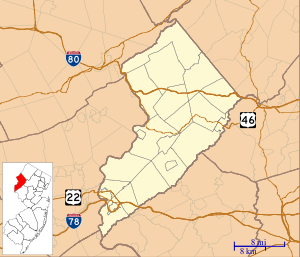
 United States Census Bureau map of ZCTA 07865 Port Murray, New Jersey | |
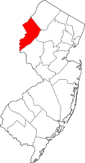
 Port Murray, New Jersey  Port Murray, New Jersey  Port Murray, New Jersey Map of Port Murray in Warren County (Inset: Location of Warren County in New Jersey). | |
| Coordinates: 40°47′37″N 74°54′49″W / 40.793505°N 74.913547°WCoordinates: 40°47′37″N 74°54′49″W / 40.793505°N 74.913547°W[1][2] | |
| Country |
|
| State |
|
| County | Warren |
| Township | Mansfield |
| Area[1] | |
| • Total | 0.168 sq mi (0.435 km2) |
| • Land | 0.167 sq mi (0.433 km2) |
| • Water | 0.001 sq mi (0.002 km2) 0.57% |
| Elevation[3] | 633 ft (193 m) |
| Population (2010 Census)[4] | |
| • Total | 129 |
| • Density | 772.2/sq mi (298.1/km2) |
| Time zone | Eastern (EST) (UTC-5) |
| • Summer (DST) | EDT (UTC-4) |
| ZIP code | 07865[5] |
| Area code(s) | 908 |
| FIPS code | 3460450[1][6][7] |
| GNIS feature ID | 02584020[1][8] |
Port Murray is an unincorporated community and census-designated place (CDP) located within Mansfield Township in Warren County, New Jersey, United States, that was created as part of the 2010 United States Census.[9][10][11][12] As of the 2010 Census, the CDP's population was 129.[4]
The area is served as United States Postal Service ZIP code 07865.[5] The community was named for its location on the Morris Canal and after Colonel James Boyles Murray, the third president of the Morris Canal and Banking Company.[13]
Geography
According to the United States Census Bureau, the CDP had a total area of 0.168 square miles (0.435 km2), including 0.167 square miles (0.433 km2) of land and 0.001 square miles (0.002 km2) of water (0.57%).[1][2]
Demographics
Census 2000
As of the 2000 United States Census, the population for ZIP Code Tabulation Area 07865 was 2,010.[14]
Census 2010
The 2010 United States Census counted 129 people, 57 households, and 38.99 families residing in the CDP. The population density was 772.2 per square mile (298.1/km2). The CDP contained 63 housing units at an average density of 377.1 per square mile (145.6/km2). The racial makeup of the CDP was 97.67% (126) White, 1.55% (2) Black or African American, 0.00% (0) Native American, 0.00% (0) Asian, 0.00% (0) Pacific Islander, 0.00% (0) from other races, and 0.78% (1) from two or more races. Hispanics or Latinos of any race were 1.55% (2) of the population.[4]
Out of a total of 57 households, 21.1% had children under the age of 18 living with them, 56.1% were married couples living together, 5.3% had a female householder with no husband present, and 31.6% were non-families. 22.8% of all households were made up of individuals, and 5.3% had someone living alone who was 65 years of age or older. The average household size was 2.26 and the average family size was 2.64.[4]
In the CDP, 14.7% of the population were under the age of 18, 7.0% from 18 to 24, 23.3% from 25 to 44, 35.7% from 45 to 64, and 19.4% who were 65 years of age or older. The median age was 48.1 years. For every 100 females the census counted 126.3 males, but for 100 females at least 18 years old, it was 120.0 males.[4]
Transportation
Port Murray had a station on the Morris and Essex Railroad, located 67 miles (108 km) from New York City.[15]
References
- 1 2 3 4 5 Gazetteer of New Jersey Places, United States Census Bureau. Accessed July 21, 2016.
- 1 2 US Gazetteer files: 2010, 2000, and 1990, United States Census Bureau. Accessed September 4, 2014.
- ↑ U.S. Geological Survey Geographic Names Information System: Port Murray Census Designated Place, Geographic Names Information System. Accessed June 3, 2013
- 1 2 3 4 5 DP-1 - Profile of General Population and Housing Characteristics: 2010 Demographic Profile Data for Port Murray CDP, New Jersey, United States Census Bureau. Accessed June 3, 2013.
- 1 2 Look Up a ZIP Code for Port Murray, NJ, United States Postal Service. Accessed June 3, 2013.
- ↑ American FactFinder, United States Census Bureau. Accessed September 4, 2014.
- ↑ A Cure for the Common Codes: New Jersey, Missouri Census Data Center. Accessed June 3, 2013.
- ↑ US Board on Geographic Names, United States Geological Survey. Accessed September 4, 2014.
- ↑ GCT-PH1 - Population, Housing Units, Area, and Density: 2010 - County -- County Subdivision and Place from the 2010 Census Summary File 1 for Warren County, New Jersey, United States Census Bureau. Accessed June 4, 2013.
- ↑ 2006-2010 American Community Survey Geography for New Jersey, United States Census Bureau. Accessed June 4, 2013.
- ↑ New Jersey: 2010 - Population and Housing Unit Counts - 2010 Census of Population and Housing (CPH-2-32), United States Census Bureau, p. III-5, August 2012. Accessed June 4, 2013. "Warren County—Name Changes: Beattystown CDP name corrected from Beatyestown; New CDPs: Allamuchy (formed from part of deleted Allamuchy-Panther Valley CDP), Anderson, Asbury, Blairstown, Brainards, Bridgeville, Broadway, Brookfield, Buttzville, Columbia, Delaware, Delaware Park, Finesville, Great Meadows (formed from part of deleted Great Meadows-Vienna CDP and additional area), Greenwich, Hainesburg, Harmony, Hope, Hutchinson, Johnsonburg, Lopatcong Overlook, Marksboro, Mountain Lake, Mount Hermon, New Village, Panther Valley (formed from part of deleted Allamuchy-Panther Valley CDP), Port Colden, Port Murray, Silver Lake, Stewartsville, Upper Pohatcong, Upper Stewartsville, and Vienna (formed from part of deleted Great Meadows-Vienna and additional area)"
- ↑ Locality Search, State of New Jersey. Accessed April 19, 2015.
- ↑ Goller, Robert R. The Morris Canal: Across New Jersey by Water and Rail, p. 34. Arcadia Publishing, 1999. ISBN 0738500763.
- ↑ DP-1 Profile of General Demographic Characteristics: 2000 more information Census 2000 Summary File 1 (SF 1) 100-Percent Data for ZCTA5 07865, United States Census Bureau. Accessed June 3, 2013.
- ↑ Travelers' Official Guide of the Railways; June 1, 1870: National Railway Publication Company.