Kiyota-ku, Sapporo
| Kiyota 清田区 | |
|---|---|
| Ward | |
| Kiyota Ward | |
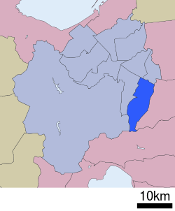 Location of Kiyota-ku in Sapporo | |
| Country | Japan |
| Prefecture | Hokkaidō |
| City | Sapporo |
| Established | November 4, 1997 |
| Area | |
| • Total | 59.87 km2 (23.12 sq mi) |
| Population (2014) | |
| • Total | 115,351 |
| • Density | 1,900/km2 (5,000/sq mi) |
| Estimation as of December 31, 2014 | |
| Time zone | Japan Standard Time (UTC+9) |
| Postal | 004-8613 |
| Address | 1-2-1 Hiraokaichijo, Teine-ku, Sapporo-shi, Hokkaido |
| Website | Kiyota-ku Ward Office |
Kiyota-ku, Sapporo (清田区、札幌) is one of the 10 wards in Sapporo, Hokkaidō, Japan. It is translated as "pure" or "clean" for "清", and "(rice) field" for "田". The ward was split from Toyohira-ku on November 4, 1997.
Overview
According to the jūminhyō (registry of residential addresses and figures) in 2008, 114,730 people are living in Kiyota-ku. The total area of the ward is 59.70 km², which is the 4th largest ward in Sapporo.[1]
The ward is neighboured to four wards in Sapporo (Toyohira-ku, Shiroishi-ku, Atsubetsu-ku, Minami-ku), and two cities (Kitahiroshima, Eniwa) .
History
The central part of Kiyota-ku was originally called as "Ashiribetsu", and in 1944, it was renamed as Kiyota, meaning "beautiful pure (clean) rice field". Rice fields and farms of the apples have widely spread in the area until early Shōwa period, but the area did not exist as one of the wards in Sapporo.[2]
In 1972, Sapporo was listed as one of the cities designated by government ordinance, and several wards were established including Toyohira-ku. On November 4, 1997, Kiyota-ku was split from Toyohira-ku, and the Kiyota-ku Residential Center with a hall for cultural purposes was built in following year.[2]
Education
University
College
High schools
Public
- Hokkaido Sapporo Shinei High School
- Hokkaido Sapporo Hiraoka High School
- Hokkaido Sapporo Kiyota High School (city)
Private
- Hokurei High School
- Hokkaido Korean Primary, Middle and High School (North Korean international school)[3]
Transportation
Kiyota-ku is the only ward of Sapporo in which there is no railway.
- Hokkaido Expressway: Sapporo-minami IC
- Route 36
Sources
- ↑ Kiyota-ku, General Overview
- 1 2 The history of Kiyota-ku
- ↑ "Education" (Archive). City of Sapporo. Retrieved on October 12, 2015. "Hokkaido Korean Primary, Middle and High School Hiraoka 4-jo 2-chome 6-1, Kiyota-ku"
External links
| Wikimedia Commons has media related to Kiyota-ku, Sapporo. |
Coordinates: 42°59′58″N 141°26′38″E / 42.99944°N 141.44389°E