Kirby, Vermont
| Kirby, Vermont | |
|---|---|
| Town | |
|
South Kirby School House | |
 Kirby, Vermont | |
 Kirby, Vermont Location in the United States | |
| Coordinates: 44°31′N 71°56′W / 44.517°N 71.933°WCoordinates: 44°31′N 71°56′W / 44.517°N 71.933°W | |
| Country | United States |
| State | Vermont |
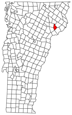
| County | Caledonia |
| Area | |
| • Total | 24.4 sq mi (63.2 km2) |
| • Land | 24.4 sq mi (63.1 km2) |
| • Water | 0.04 sq mi (0.1 km2) |
| Elevation | 1,558 ft (475 m) |
| Population (2010) | |
| • Total | 493 |
| • Density | 20/sq mi (7.8/km2) |
| Time zone | Eastern (EST) (UTC-5) |
| • Summer (DST) | EDT (UTC-4) |
| Area code(s) | 802 |
| FIPS code | 50-37900[1] |
| GNIS feature ID | 1462130[2] |

Kirby is a town in Caledonia County, Vermont, United States. The population was 493 at the 2010 census.[3]
Geography
Kirby is located on the eastern border of Caledonia County in northeastern Vermont. It is bordered by the town of St. Johnsbury to the southwest, Lyndon to the west, Burke to the north, Victory to the northeast, Concord to the southeast, and Waterford to the south. According to the United States Census Bureau, the town has a total area of 24.4 square miles (63.2 km2), of which 24.4 square miles (63.1 km2) is land and 0.04 square miles (0.1 km2), or 0.20%, is water.[3]
U.S. Route 2 passes through the southern corner of the town, connecting St. Johnsbury to the west with Lancaster, New Hampshire, to the east.
The highest point in Kirby is the 2,750-foot (840 m) summit of Kirby Mountain, located along the town boundary with Victory.[4]
Demographics
| Historical population | |||
|---|---|---|---|
| Census | Pop. | %± | |
| 1800 | 20 | — | |
| 1810 | 311 | 1,455.0% | |
| 1820 | 312 | 0.3% | |
| 1830 | 401 | 28.5% | |
| 1840 | 520 | 29.7% | |
| 1850 | 509 | −2.1% | |
| 1860 | 473 | −7.1% | |
| 1870 | 417 | −11.8% | |
| 1880 | 398 | −4.6% | |
| 1890 | 355 | −10.8% | |
| 1900 | 350 | −1.4% | |
| 1910 | 297 | −15.1% | |
| 1920 | 324 | 9.1% | |
| 1930 | 311 | −4.0% | |
| 1940 | 252 | −19.0% | |
| 1950 | 257 | 2.0% | |
| 1960 | 235 | −8.6% | |
| 1970 | 224 | −4.7% | |
| 1980 | 282 | 25.9% | |
| 1990 | 347 | 23.0% | |
| 2000 | 456 | 31.4% | |
| 2010 | 493 | 8.1% | |
| Est. 2014 | 499 | [5] | 1.2% |
| U.S. Decennial Census[6] | |||
As of the census[1] of 2000, there were 456 people, 168 households, and 122 families residing in the town. The population density was 18.7 people per square mile (7.2/km2). There were 207 housing units at an average density of 8.5 per square mile (3.3/km2). The racial makeup of the town was 96.05% White, 0.44% African American, 0.44% from other races, and 3.07% from two or more races. Hispanic or Latino of any race were 1.54% of the population.
There were 168 households out of which 36.9% had children under the age of 18 living with them, 56.0% were married couples living together, 9.5% had a female householder with no husband present, and 26.8% were non-families. 19.0% of all households were made up of individuals and 4.8% had someone living alone who was 65 years of age or older. The average household size was 2.71 and the average family size was 3.05.
In the town the population was spread out with 28.9% under the age of 18, 5.5% from 18 to 24, 28.3% from 25 to 44, 28.5% from 45 to 64, and 8.8% who were 65 years of age or older. The median age was 37 years. For every 100 females there were 99.1 males. For every 100 females age 18 and over, there were 98.8 males.
The median income for a household in the town was $37,917, and the median income for a family was $43,333. Males had a median income of $27,778 versus $22,500 for females. The per capita income for the town was $16,675. About 15.2% of families and 15.3% of the population were below the poverty line, including 22.0% of those under age 18 and 12.8% of those age 65 or over.
References
- 1 2 "American FactFinder". United States Census Bureau. Retrieved 2008-01-31.
- ↑ "US Board on Geographic Names". United States Geological Survey. 2007-10-25. Retrieved 2008-01-31.
- 1 2 "Geographic Identifiers: 2010 Demographic Profile Data (G001): Kirby town, Caledonia County, Vermont". U.S. Census Bureau, American Factfinder. Retrieved February 6, 2013.
- ↑ U.S. Geological Survey Burke Mountain, VT 7.5-minute quadrangle, 1988.
- ↑ "Annual Estimates of the Resident Population for Incorporated Places: April 1, 2010 to July 1, 2014". Retrieved June 4, 2015.
- ↑ "U.S. Decennial Census". United States Census Bureau. Retrieved May 16, 2015.
Municipalities and communities of Caledonia County, Vermont, United States | ||
|---|---|---|
| Towns | 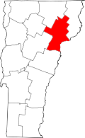 | |
| Villages | ||
| CDPs | ||
| Other community | ||