Waterford, Vermont
| Waterford, Vermont | |
|---|---|
| Town | |
|
Waterford seen across Moore Reservoir | |
 Waterford, Vermont | |
 Waterford, Vermont Location in the United States | |
| Coordinates: 44°22′N 71°57′W / 44.367°N 71.950°WCoordinates: 44°22′N 71°57′W / 44.367°N 71.950°W | |
| Country | United States |
| State | Vermont |
| County | Caledonia |
| Chartered | November 8, 1780,[1] |
| Area | |
| • Total | 39.7 sq mi (102.9 km2) |
| • Land | 38.3 sq mi (99.2 km2) |
| • Water | 1.4 sq mi (3.7 km2) |
| Elevation | 1,306 ft (398 m) |
| Population (2010) | |
| • Total | 1,280 |
| • Density | 33/sq mi (12.9/km2) |
| Time zone | Eastern (EST) (UTC-5) |
| • Summer (DST) | EDT (UTC-4) |
| ZIP code | 05819 |
| Area code(s) | 802 |
| FIPS code | 50-77125[2] |
| GNIS feature ID | 1462245[3] |

Waterford is a town in Caledonia County, Vermont, United States. The population was 1,280 at the 2010 census.[4]
History
The town was formed by the Vermont charter on November 8, 1780,[1] and was originally called Littleton, but the name was changed to Waterford in 1797.[5] The town may have been named after Waterford, Ireland, or for the ford that ran across the Connecticut River in that area.[1]
Geography
Waterford is located in eastern Caledonia County along the Connecticut River, the eastern border of Vermont. The town is bordered by Barnet to the west, St. Johnsbury to the northwest, Kirby to the north, and Concord, Vermont, to the east. The town of Littleton, New Hampshire, is to the south, across the Connecticut River.
According to the United States Census Bureau, the town of Waterford has a total area of 39.7 square miles (102.9 km2), of which 38.3 square miles (99.2 km2) is land and 1.4 square miles (3.7 km2), or 3.59%, is water.[4]
The town is crossed by Interstate 93 and Interstate 91. The northern terminus of I-93, at I-91, is in the western corner of the town, just south of St. Johnsbury. Exit 1 on I-93 serves the northern part of Waterford. Vermont Route 18 is a two-lane highway that parallels I-93.
The highest point in Waterford is the 2,017-foot (615 m) summit of Fuller Hill, near the town's eastern border.[6]
Demographics
| Historical population | |||
|---|---|---|---|
| Census | Pop. | %± | |
| 1790 | 63 | — | |
| 1800 | 565 | 796.8% | |
| 1810 | 1,289 | 128.1% | |
| 1820 | 1,247 | −3.3% | |
| 1830 | 1,358 | 8.9% | |
| 1840 | 1,388 | 2.2% | |
| 1850 | 1,412 | 1.7% | |
| 1860 | 1,171 | −17.1% | |
| 1870 | 879 | −24.9% | |
| 1880 | 815 | −7.3% | |
| 1890 | 734 | −9.9% | |
| 1900 | 705 | −4.0% | |
| 1910 | 629 | −10.8% | |
| 1920 | 574 | −8.7% | |
| 1930 | 712 | 24.0% | |
| 1940 | 498 | −30.1% | |
| 1950 | 468 | −6.0% | |
| 1960 | 460 | −1.7% | |
| 1970 | 586 | 27.4% | |
| 1980 | 882 | 50.5% | |
| 1990 | 1,190 | 34.9% | |
| 2000 | 1,104 | −7.2% | |
| 2010 | 1,280 | 15.9% | |
| Est. 2014 | 1,280 | [7] | 0.0% |
| U.S. Decennial Census[8] | |||
As of the census[2] of 2000, there were 1,104 people, 424 households, and 340 families residing in the town. The population density was 28.9 people per square mile (11.2/km2). There were 477 housing units at an average density of 12.5 per square mile (4.8/km2). The racial makeup of the town was 98.55% White, 0.27% Asian, and 1.18% from two or more races. Hispanic or Latino of any race were 0.27% of the population.
There were 424 households out of which 32.1% had children under the age of 18 living with them, 71.7% were married couples living together, 5.4% had a female householder with no husband present, and 19.8% were non-families. 15.8% of all households were made up of individuals and 6.1% had someone living alone who was 65 years of age or older. The average household size was 2.60 and the average family size was 2.88.
In the town the population was spread out with 24.6% under the age of 18, 4.3% from 18 to 24, 25.7% from 25 to 44, 31.4% from 45 to 64, and 13.9% who were 65 years of age or older. The median age was 42 years. For every 100 females there were 104.4 males. For every 100 females age 18 and over, there were 100.5 males.
Arts and culture
The area known as "White Village" features homes from the 1700s, a church, post office and bed and breakfast.[9]
Economy
Personal income
The median income for a household in the town was $50,197, and the median income for a family was $52,105. Males had a median income of $32,100 versus $23,839 for females. The per capita income for the town was $21,762. About 2.3% of families and 4.2% of the population were below the poverty line, including 3.3% of those under age 18 and 6.3% of those age 65 or over.
Waterford has the highest per capita income of any town or city in the Northeast Kingdom. It ranks 74 out of 282 census areas in Vermont.[10]
Education
Waterford Public Schools are part of the Essex-Caledonia Supervisory Union. The district serves students in prekindergarten to eighth grade.[11]
Notable people
- Amos K. Hadley, Speaker of the New York State Assembly.[12]
- Jonathan Ross, Chief Justice of the Vermont Supreme Court and a United States Senator from Vermont.[13]
In popular culture
The film State and Main is about a film production; it is set in Waterford, although it was actually filmed in Massachusetts.
References
- 1 2 3 "About Waterford, Vermont". Virtual Vermont. Retrieved December 30, 2012.
- 1 2 "American FactFinder". United States Census Bureau. Retrieved 2008-01-31.
- ↑ "US Board on Geographic Names". United States Geological Survey. 2007-10-25. Retrieved 2008-01-31.
- 1 2 "Geographic Identifiers: 2010 Demographic Profile Data (G001): Waterford town, Caledonia County, Vermont". U.S. Census Bureau, American Factfinder. Retrieved February 6, 2013.
- ↑ Land Grants for Towns of Vermont Starting with W -- Waterford
- ↑ U.S. Geological Survey Concord, VT 7.5-minute quadrangle, 1967.
- ↑ "Annual Estimates of the Resident Population for Incorporated Places: April 1, 2010 to July 1, 2014". Retrieved June 4, 2015.
- ↑ "U.S. Decennial Census". United States Census Bureau. Retrieved May 16, 2015.
- ↑ "Waterford, Vermont 05848". Vermont Living Magazine. Retrieved December 30, 2012.
- ↑ Vermont locations by per capita income
- ↑ "Essex-Caledonia Supervisory Union, Homepage".
- ↑ "A Political Sage: Amos K. Hadley an Old Warrior at 85". The Eagle (Bryan, TX). March 12, 1898. p. 2.
- ↑ "ROSS, Jonathan, (1826 - 1905)". Biographical Directory of the United States Congress. Retrieved December 30, 2012.
External links
| Wikimedia Commons has media related to Waterford, Vermont. |
- Official Town of Waterford, VT Website
- Waterford Volunteer Fire Department
- City-Data.com
- ePodunk: Profile for Waterford, Vermont, VT
- Waterford, Vermont, History
- Waterford School
Municipalities and communities of Caledonia County, Vermont, United States | ||
|---|---|---|
| Towns | 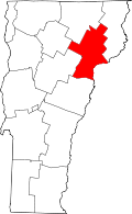 | |
| Villages | ||
| CDPs | ||
| Other community | ||