McIndoe Falls, Vermont
McIndoe Falls[1] is an unincorporated community within the town of Barnet, Vermont, in the United States. It is located in the southeastern corner of Barnet, along the Connecticut River, the state boundary with New Hampshire. A dam on the Connecticut River at the village forms the McIndoes Reservoir, which extends upstream to the village of Barnet.
U.S. Route 5 passes north-south through the village. Interstate 91 bypasses the village to the west, with the nearest access being Exit 18 (Barnet), 3 miles (5 km) to the north. McIndoes Falls Road leads east from the center of the village across the Connecticut River to the town of Monroe, New Hampshire. The next river crossing upstream is 2 miles (3 km) to the north near Barnet village, and the next crossing downstream is 8 miles (13 km) south where U.S. Route 302 crosses between Wells River, Vermont, and Woodsville, New Hampshire.
McIndoe Falls has a separate ZIP code (05050) from the rest of Barnet.
References
Coordinates: 44°15′41″N 72°3′47″W / 44.26139°N 72.06306°W
Municipalities and communities of Caledonia County, Vermont, United States | ||
|---|---|---|
| Towns | 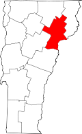 | |
| Villages | ||
| CDPs | ||
| Other community | ||