Hudson, Ontario
| Hudson | |
|---|---|
| Township (single-tier) | |
| Township of Hudson | |
|
Township hall | |
 Hudson | |
| Coordinates: 47°32′14″N 79°49′27″W / 47.53722°N 79.82417°WCoordinates: 47°32′14″N 79°49′27″W / 47.53722°N 79.82417°W | |
| Country |
|
| Province |
|
| District | Timiskaming |
| Incorporated | 1904 |
| Surveyed | 1887 |
| First settled | 1897 |
| Area | |
| • Total | 90.64 km2 (35.00 sq mi) |
| Elevation | 245 m (804 ft) |
| Population (2011) | |
| • Total | 476 |
| Time zone | EST (UTC-5) |
| • Summer (DST) | EDT (UTC-4) |
| Postal code FSA | P0J |
| Area code(s) | 705, 249 |
| Website |
www |

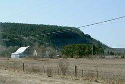
Hudson is a township municipality[1] incorporating the congruent geographic township[2] in Timiskaming District in northeastern Ontario, Canada.[3][4] Hudson is located directly west of the city of Temiskaming Shores[5] and has only one named settlement, the community of Hillview.[6]
Demographics
The township had a population count of 476 in the Canada 2011 Census,[7] an increase of 3.0% from the revised figure of 462 recorded in the Canada 2006 Census.[8]
History
Hudson was surveyed in 1887. However, the first settlers did not arrive until 1897, and the township was incorporated in 1904. The first Census of Canada to take place after settlement, in 1901, recorded the population as 46.[9]
Transportation
Ontario Highway 65 passes through the township on its way from Temiskaming Shores towards Matachewan.[5]
See also
References
- ↑ "Hudson". Geographical Names Data Base. Natural Resources Canada. Retrieved 2011-08-16.
- ↑ "Hudson". Geographical Names Data Base. Natural Resources Canada. Retrieved 2011-08-16.
- ↑ "Hudson". Atlas of Canada. Natural Resources Canada. 2010-02-04. Retrieved 2011-08-16. Shows township limits.
- ↑ Restructured municipalities - Ontario map #4 (Map). Restructuring Maps of Ontario. Ontario Ministry of Municipal Affairs and Housing. 2006. Retrieved 2011-08-16.
- 1 2 Map 12 (PDF) (Map). 1 : 1,600,000. Official road map of Ontario. Ministry of Transportation of Ontario. 2010-01-01. Retrieved 2011-08-16.
- ↑ "Hillview". Geographical Names Data Base. Natural Resources Canada. Retrieved 2011-08-16.
- ↑ 2011 Census Profile
- ↑ "Data errors in the 2006 population and dwelling counts".
- ↑ "History". Township of Hudson. 2003. Retrieved 2011-08-16. Excerpted from Hawirko, Norman R; Arnott, Margaret. "I've got to stop here until I'm called for".
External links
 |
Kerns | Harley | | |
| Unorganized West Timiskaming | |
Temiskaming Shores | ||
| ||||
| | ||||
| Unorganized West Timiskaming |
| City | 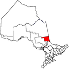 | |
|---|---|---|
| Towns | ||
| Townships | ||
| Village | ||
| Indian Reserves | ||
| Unorganized areas | ||
| Local services boards | ||
| ||