King-Lebel
| King-Lebel | |
|---|---|
| designated place | |
|
King Kirkland | |
| Coordinates: 48°09′45″N 79°57′30″W / 48.16250°N 79.95833°WCoordinates: 48°09′45″N 79°57′30″W / 48.16250°N 79.95833°W | |
| Country |
|
| Province |
|
| District | Timiskaming District |
| Government | |
| • Type | local services board |
| • MP | Charlie Angus |
| • MPP | John Vanthof |
| Area | |
| • Total | 83.92 km2 (32.40 sq mi) |
| Population (2006) | |
| • Total | 351 |
| • Density | 4.2/km2 (11/sq mi) |
| Canada 2006 Census | |
| Time zone | Eastern (EST) (UTC-5) |
| Area code(s) | 705 |

King-Lebel is a designated place in the Canadian province of Ontario, located in the Timiskaming District. The community, located between the town of Kirkland Lake and the municipal township of Gauthier, consists of the unincorporated township of Lebel, whose primary settlement is the community of King Kirkland.
Services in the township are provided by a local services board.
King-Lebel had a population of 351 in the Canada 2006 Census.[1] The community is considered part of Timiskaming, Unorganized, West Part.
References
 |
Kirkland Lake | | ||
| Kirkland Lake | |
Gauthier | ||
| ||||
| | ||||
| City | 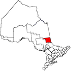 | |
|---|---|---|
| Towns | ||
| Townships | ||
| Village | ||
| Indian Reserves | ||
| Unorganized areas | ||
| Local services boards | ||
| ||
This article is issued from Wikipedia - version of the 11/20/2016. The text is available under the Creative Commons Attribution/Share Alike but additional terms may apply for the media files.