McGarry, Ontario
| McGarry | |
|---|---|
| Township | |
| Township of McGarry | |
|
Virginiatown | |
 McGarry | |
| Coordinates: 48°08′47″N 79°34′14″W / 48.14639°N 79.57056°WCoordinates: 48°08′47″N 79°34′14″W / 48.14639°N 79.57056°W[1] | |
| Country |
|
| Province |
|
| District | Timiskaming |
| Government | |
| • Type | Township |
| • Reeve | Clermont Lapointe |
| • Federal riding | Timmins—James Bay |
| • Prov. riding | Timiskaming—Cochrane |
| Area[2] | |
| • Land | 86.72 km2 (33.48 sq mi) |
| Elevation[3] | 327 m (1,073 ft) |
| Population (2011)[2] | |
| • Total | 595 |
| • Density | 6.9/km2 (18/sq mi) |
| Time zone | EST (UTC-5) |
| • Summer (DST) | EDT (UTC-4) |
| Postal code | P0K 1X0 |
| Area code(s) | 705, 249 |
| Website |
www |

McGarry is an incorporated township in Timiskaming District in Northeastern Ontario, Canada.[1]
The township includes the communities of Virginiatown and Kearns. It is situated on the border with Quebec to the east, along Highway 66 between Kirkland Lake and Rouyn-Noranda. The northern border of the township forms part of the border between Timiskaming District and Cochrane District.
J.T. Kearns (for whom the village was named) staked a claim in 1907, which became the Chesterfield Gold Mines (1938-1952). A 854-meter shaft connected 20 levels, and its 500-ton stamp mill produced a total of 458,880 ounces of gold. Virginiatown and North Virginiatown were built to house the Kerr Addison workers. Kerr Addison Gold mines started in 1936, and employed 1,456 people by 1959. Annual production was 500,000 ounces of gold from 1957 to 1961, and in 1960, produced the most gold in the Western Hemisphere. The 10,000,000th ounce of gold was produced in 1982. However, production reduced to 47,211 ounces in 1984 from a workforce of 329. The renamed Kerr Mine produced 15,350 ounces in 1993, and 22,000 ounces in 1994.[4]
Demographics
| Historical population | ||
|---|---|---|
| Year | Pop. | ±% |
| 1991 | 1,139 | — |
| 1996 | 1,015 | −10.9% |
| 2001 | 787 | −22.5% |
| 2006 | 674 | −14.4% |
| 2011 | 595 | −11.7% |
| Source: [5] | ||
Private dwellings, excluding seasonal cottages: 284 (total: 360)
Mother tongue:[6]
- English as first language: 30.5%
- French as first language: 63%
- English and French as first language: 1.5%
- Other as first language: 5%

See also
References
- 1 2 "McGarry". Geographical Names Data Base. Natural Resources Canada. Retrieved 2014-05-19.
- 1 2 2011 Census Profile
- ↑ Elevation taken from Google Earth at geographical coordinates, accessed 2014-05-20.
- ↑ Barnes, Michael (1995). Gold in Ontario. Erin: The Boston Mills Press. pp. 33–37. ISBN 155046146X.
- ↑ Statistics Canada: 1996, 2001, 2006, 2011 census
- ↑ "2006 Community Profile".
External links
- Official website
- Community profile (2008)
- Image of McGarry Township Building, circa 1953, from vtownhistory.org
- Historic Photos of Virginiatown & Kearns
 |
Unorganized East Timiskaming | | ||
| Larder Lake | |
| ||
| ||||
| | ||||
| Unorganized West Timiskaming |
| City | 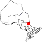 | |
|---|---|---|
| Towns | ||
| Townships | ||
| Village | ||
| Indian Reserves | ||
| Unorganized areas | ||
| Local services boards | ||
| ||