Latchford, Ontario
| Latchford | |
|---|---|
| Town (single-tier) | |
| Town of Latchford | |
|
Bridge over the Montreal River with Latchford in the background. | |
| Motto: The Best Little Town by a Dam Site! | |
 Latchford | |
| Coordinates: 47°19′44″N 79°48′37″W / 47.32889°N 79.81028°WCoordinates: 47°19′44″N 79°48′37″W / 47.32889°N 79.81028°W | |
| Country |
|
| Province |
|
| District | Timiskaming |
| Settled | 1902 |
| Incorporated | June 15, 1907 |
| Government | |
| • Mayor | George Lefebvre |
| • Federal riding | Nipissing—Timiskaming |
| • Prov. riding | Timiskaming—Cochrane |
| Area[1] | |
| • Land | 153.35 km2 (59.21 sq mi) |
| Elevation | 289 m (948 ft) |
| Population (2011)[1] | |
| • Total | 387 |
| • Density | 2.5/km2 (6/sq mi) |
| Time zone | EST (UTC-5) |
| • Summer (DST) | EDT (UTC-4) |
| Postal Code | P0J 1N0 |
| Area code(s) | 705, 249 |
| Website |
www |

Latchford is a Single-tier municipality town in Timiskaming District in Northeastern Ontario, Canada.[2] It is located on Bay Lake on the Montreal River near the town of Cobalt and the municipality of Temagami, and is 20 kilometres (13 miles) from the city of Temiskaming Shores. The population of the town in the Canada 2011 Census was 387.[1] The town's slogan is "The Best Little Town by a Dam Site!"
History
Latchford was first settled in 1902 when the decision to build the Temiskaming and Northern Ontario Railway (now the Ontario Northland Railway) was struck. It was decided the railway would cross the Montreal River at the location of what is today Latchford, and a bridge was finished in 1904. Hence, the settlement was known first as Montreal River Station. It was renamed Latchford in 1905 in honour of the provincial commissioner of public works, Francis Robert Latchford, and was incorporated as a town on July 15, 1907. A dam that provided hydroelectric power as well as a vehicle crossing over the river was built in 1910, and Ontario Highway 11 including a bridge over the river was built finished through the town in 1927. Silver mining, forestry, and later tourism, drove Latchford’s economy throughout the 20th century.[3][4]
In 2006, the boundaries of the town were expanded to include the South Part of geographic Gillies Limit Township.[5] today part of the town of Latchford;[6]
A plaque was erected in 2009 commemorating the founding of the town.[3][7]
Transportation
Latchford has good road links because of Ontario Highway 11, which is part of the Trans-Canada Highway as it passes through the town. Ontario Northland offers a twice-daily bus service north towards Cochrane and south towards North Bay.
Bridges
The Sgt. Aubrey Cosens VC Memorial Bridge, which carries Ontario Highway 11, is the town's most recognized symbol. It was named after a World War II recipient of the Victoria Cross from Latchford. The bridge failed on a cold day in 2003, but was repaired and is again in service. Latchford is also home to the world's shortest covered bridge.
Recreation
W.J.B. Greenwood Provincial Park is in Latchford south of the town centre.[8]
Demographics
Population trend:[9]
- Population in 2011: 387
- Population in 2006: 370 [10]
- Population in 2001: 363 (or 368 when adjusted to 2006 boundaries)
- Population in 1996: 338
- Population in 1991: 345
Private dwellings occupied by usual residents: 152 (total dwellings: 223)
Mother tongue:[11]
- English as first language: 78.2%
- French as first language: 12.6%
- English and French as first language: 2.3%
- Other as first language: 6.9%
References
- 1 2 3 2011 Census Profile
- ↑ "Latchford". Geographical Names Data Base. Natural Resources Canada. Retrieved 2010-07-21.
- 1 2 "Founding of Latchford commemorated with provincial plaque". Ontario Heritage Trust. 2009-07-15. Retrieved 2011-09-09.
- ↑ "The House of Memories (1931)". Town of Latchford. Retrieved 2011-09-09.
- ↑ "Gillies Limit (South)" (PDF). Geology Ontario - Historic Claim Maps. Ontario Ministry of Northern Development, Mines and Forestry. Retrieved 2011-09-09.
- ↑ Restructured municipalities - Ontario map #4 (Map). Restructuring Maps of Ontario. Ontario Ministry of Municipal Affairs and Housing. 2006. Retrieved 2011-09-09.
- ↑ "Founding of Latchford". Ontario Heritage Trust. Retrieved 2011-09-09.
- ↑ "W.J.B. Greenwood". Ontario Parks. 2002-11-12. Retrieved 2011-09-09.
- ↑ Statistics Canada: 1996, 2001, 2006, 2011 census
- ↑ "Adjusted 2006 population explanation".
- ↑ "2006 Community Profile".
Other map sources:
- Map 12 (PDF) (Map). 1 : 1,600,000. Official road map of Ontario. Ministry of Transportation of Ontario. 2010-01-01. Retrieved 2011-09-09.
- "Topographic Map sheet 31M5". Atlas of Canada. Natural Resources Canada. 2010-02-04. Retrieved 2010-07-21.
External links
 |
Coleman | | ||
| Unorganized West Timiskaming | |
Unorganized West Timiskaming | ||
| ||||
| | ||||
| Temagami |
| City | 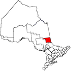 | |
|---|---|---|
| Towns | ||
| Townships | ||
| Village | ||
| Indian Reserves | ||
| Unorganized areas | ||
| Local services boards | ||
| ||