Ginter Park
|
Ginter Park Historic District | |
|
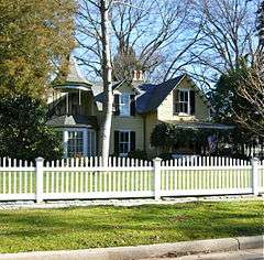
A house within the Ginter Park Historic District | |
  | |
| Location | Roughly bounded by North Ave., Moss Side and Hawthorne and Chamberlayne Aves., Brookland Park Blvd., and Brook Rd., Richmond, Virginia |
|---|---|
| Coordinates | 37°34′50″N 77°26′50″W / 37.58056°N 77.44722°WCoordinates: 37°34′50″N 77°26′50″W / 37.58056°N 77.44722°W |
| Area | 290 acres (120 ha) |
| Architectural style | Colonial Revival, Builder's Vernacular |
| NRHP Reference # | [1] |
| VLR # | 127-0201 |
| Significant dates | |
| Added to NRHP | September 22, 1986 |
| Designated VLR | June 17, 1986, December 17, 2009[2] |
Ginter Park is a suburb neighborhood of Richmond, Virginia built on land owned and developed by Lewis Ginter. The neighborhood's first well known resident was newspaperman Joseph Bryan, who lived in Laburnum, first built in 1883 and later rebuilt . In 1895, many acres of land north of Richmond were purchased by Ginter in order to develop into neighborhoods. Ginter Park and other neighborhoods were developed from this initial land purchase. In Ginter Park are Union Theological Seminary & Presbyterian School of Christian Education and as well as Pollard Park.
Nearby are Children's Hospital of Richmond,[3] Armstrong High School (Richmond, Virginia),
While borders are not exact, nearby neighborhoods that are part of North Side include Barton Heights, Highland Park, Sherwood Park and Bellevue.
The Ginter Park Historic District was listed on the National Register of Historic Places in 1986.[1] It encompasses 291 contributing buildings and 179 contributing structures.[4]
References
- 1 2 National Park Service (2009-03-13). "National Register Information System". National Register of Historic Places. National Park Service.
- ↑ "Virginia Landmarks Register". Virginia Department of Historic Resources. Retrieved 19 March 2013.
- ↑ Children's Hospital of Richmond (VA)
- ↑ Douglas Harnsberger and Anne Thorn (February 1986). "National Register of Historic Places Inventory/Nomination: Ginter Park Historic District" (PDF). Virginia Department of Historic Resources. and Accompanying photo and Accompanying map
External links
- Richmond Neighborhoods: Ginter Park Terrace
- Historic Ginter Park
- Ginter Park - Richmond (VA) website
 |
Bellevue | | ||
| Laburnum Park; Sherwood Park | |
|||
| ||||
| | ||||
| Ginter Park Terrace; Brookland Park |

