Clayville, New York
| Clayville, New York | |
|---|---|
| Village | |
 Location in Oneida County and the state of New York. | |
| Coordinates: 42°58′29″N 75°15′0″W / 42.97472°N 75.25000°WCoordinates: 42°58′29″N 75°15′0″W / 42.97472°N 75.25000°W | |
| Country | United States |
| State | New York |
| County | Oneida |
| Area | |
| • Total | 0.5 sq mi (1.2 km2) |
| • Land | 0.5 sq mi (1.2 km2) |
| • Water | 0.0 sq mi (0.0 km2) |
| Elevation | 961 ft (293 m) |
| Population (2010) | |
| • Total | 350 |
| Time zone | Eastern (EST) (UTC-5) |
| • Summer (DST) | EDT (UTC-4) |
| ZIP code | 13322 |
| Area code(s) | 315 |
| FIPS code | 36-16111 |
| GNIS feature ID | 0946810 |
Clayville is a village in Oneida County, New York, USA. The population was 350 at the 2010 census.
The Village of Clayville (formerly called Paris Furnace) is inside the Town of Paris.
History
Clayville was incorporated in 1887. Clayville was named in honor of Henry Clay. Iron foundries and machine shops were an important activity here by the 1850s.
Geography
Clayville is located at 42°58′29″N 75°15′0″W / 42.97472°N 75.25000°W (42.974818, -75.250047).[1]
According to the United States Census Bureau, the village has a total area of 0.5 square miles (1.3 km2), of which, 0.5 square miles (1.3 km2) of it is land and 2.13% is water.
Demographics
| Historical population | |||
|---|---|---|---|
| Census | Pop. | %± | |
| 1870 | 944 | — | |
| 1880 | 847 | −10.3% | |
| 1890 | 843 | −0.5% | |
| 1900 | 568 | −32.6% | |
| 1910 | 649 | 14.3% | |
| 1920 | 990 | 52.5% | |
| 1930 | 801 | −19.1% | |
| 1940 | 711 | −11.2% | |
| 1950 | 719 | 1.1% | |
| 1960 | 686 | −4.6% | |
| 1970 | 535 | −22.0% | |
| 1980 | 478 | −10.7% | |
| 1990 | 463 | −3.1% | |
| 2000 | 445 | −3.9% | |
| 2010 | 350 | −21.3% | |
| Est. 2015 | 341 | [2] | −2.6% |
As of the census[4] of 2000, there were 445 people, 168 households, and 109 families residing in the village. The population density was 970.7 people per square mile (373.5/km²). There were 200 housing units at an average density of 436.3 per square mile (167.9/km²). The racial makeup of the village was 98.43% White, 0.45% African American, 0.22% Pacific Islander, and 0.90% from two or more races. Hispanic or Latino of any race were 0.22% of the population.
There were 168 households out of which 38.1% had children under the age of 18 living with them, 47.6% were married couples living together, 11.3% had a female householder with no husband present, and 35.1% were non-families. 29.8% of all households were made up of individuals and 11.3% had someone living alone who was 65 years of age or older. The average household size was 2.65 and the average family size was 3.37.
In the village the population was spread out with 29.9% under the age of 18, 8.5% from 18 to 24, 30.3% from 25 to 44, 20.7% from 45 to 64, and 10.6% who were 65 years of age or older. The median age was 34 years. For every 100 females there were 96.9 males. For every 100 females age 18 and over, there were 100.0 males.
The median income for a household in the village was $32,054, and the median income for a family was $39,500. Males had a median income of $26,528 versus $18,250 for females. The per capita income for the village was $14,935. About 9.8% of families and 12.5% of the population were below the poverty line, including 17.6% of those under age 18 and 10.9% of those age 65 or over.
References
- ↑ "US Gazetteer files: 2010, 2000, and 1990". United States Census Bureau. 2011-02-12. Retrieved 2011-04-23.
- ↑ "Annual Estimates of the Resident Population for Incorporated Places: April 1, 2010 to July 1, 2015". Retrieved July 2, 2016.
- ↑ "Census of Population and Housing". Census.gov. Archived from the original on May 11, 2015. Retrieved June 4, 2015.
- ↑ "American FactFinder". United States Census Bureau. Archived from the original on 2013-09-11. Retrieved 2008-01-31.
Municipalities and communities of Oneida County, New York, United States | ||
|---|---|---|
| Cities | 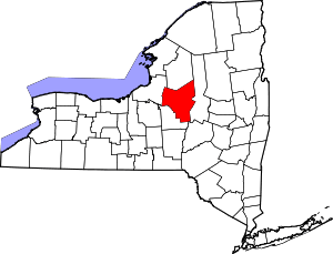 | |
| Towns | ||
| Villages | ||
| CDPs | ||
| Hamlets | ||