Deerfield, New York
| Deerfield, New York | |
|---|---|
| Town | |
 Location in Oneida County and the state of New York. | |
| Coordinates: 43°10′28″N 75°9′42″W / 43.17444°N 75.16167°WCoordinates: 43°10′28″N 75°9′42″W / 43.17444°N 75.16167°W | |
| Country | United States |
| State | New York |
| County | Oneida |
| Government | |
| • Type | Town Council |
| • Town Supervisor | Scott Mahardy (D) |
| • Town Council |
Members' List
|
| Area | |
| • Total | 33.1 sq mi (85.6 km2) |
| • Land | 32.9 sq mi (85.3 km2) |
| • Water | 0.1 sq mi (0.3 km2) |
| Elevation | 1,014 ft (309 m) |
| Population (2010) | |
| • Total | 4,273 |
| • Density | 130/sq mi (50/km2) |
| Time zone | Eastern (EST) (UTC-5) |
| • Summer (DST) | EDT (UTC-4) |
| ZIP code | 13502 |
| Area code(s) | 315 |
| FIPS code | 36-19928 |
| GNIS feature ID | 0978891 |
| Website | Town of Deerfield Home Page |
Deerfield is a town in Oneida County, New York, United States. The population was 4,273 at the 2010 census.
The Town of Deerfield is on the eastern border of the county and northeast of the City of Utica.
History
Deerfield was formed from the Town of Schuyler in 1798.
In 1920, the population of Deerfield was 706.
Geography
According to the United States Census Bureau, the town, which lies immediately north of the city of Utica, has a total area of 33.1 square miles (86 km2), of which, 32.9 square miles (85 km2) of it is land and 0.1 square miles (0.26 km2) of it (0.39%) is water.
The east town line is the border of Herkimer County, New York. The New York State Thruway and the Erie Canal pass south of the town. The Mohawk River used to form the southern border of the town but has since been annexed into Utica.
Demographics
| Historical population | |||
|---|---|---|---|
| Census | Pop. | %± | |
| 1800 | 1,048 | — | |
| 1810 | 1,232 | 17.6% | |
| 1820 | 2,346 | 90.4% | |
| 1830 | 4,182 | 78.3% | |
| 1840 | 3,120 | −25.4% | |
| 1850 | 2,287 | −26.7% | |
| 1860 | 2,249 | −1.7% | |
| 1870 | 2,045 | −9.1% | |
| 1880 | 2,082 | 1.8% | |
| 1890 | 1,954 | −6.1% | |
| 1900 | 1,756 | −10.1% | |
| 1910 | 1,660 | −5.5% | |
| 1920 | 706 | −57.5% | |
| 1930 | 983 | 39.2% | |
| 1940 | 1,147 | 16.7% | |
| 1950 | 1,621 | 41.3% | |
| 1960 | 3,554 | 119.2% | |
| 1970 | 4,104 | 15.5% | |
| 1980 | 3,934 | −4.1% | |
| 1990 | 3,942 | 0.2% | |
| 2000 | 3,909 | −0.8% | |
| 2010 | 4,273 | 9.3% | |
| Est. 2014 | 4,272 | [1] | 0.0% |
As of the census[3] of 2000, there were 3,906 people, 1,449 households, and 1,146 families residing in the town. The population density was 118.6 people per square mile (45.8/km²). There were 1,512 housing units at an average density of 45.9 per square mile (17.7/km²). The racial makeup of the town was 98.75% White, 0.59% African American, 0.05% Native American, 0.28% Asian, 0.03% from other races, and 0.31% from two or more races. Hispanic or Latino of any race were 0.72% of the population.
There were 1,449 households out of which 35.0% had children under the age of 18 living with them, 68.9% were married couples living together, 7.2% had a female householder with no husband present, and 20.9% were non-families. 17.8% of all households were made up of individuals and 9.0% had someone living alone who was 65 years of age or older. The average household size was 2.70 and the average family size was 3.06.
In the town the population was spread out with 25.5% under the age of 18, 5.5% from 18 to 24, 27.0% from 25 to 44, 26.1% from 45 to 64, and 15.9% who were 65 years of age or older. The median age was 40 years. For every 100 females there were 99.3 males. For every 100 females age 18 and over, there were 97.7 males.
The median income for a household in the town was $47,197, and the median income for a family was $53,631. Males had a median income of $37,540 versus $24,441 for females. The per capita income for the town was $20,676. About 2.0% of families and 3.8% of the population were below the poverty line, including 0.5% of those under age 18 and 8.1% of those age 65 or over.
Communities and locations in Deerfield
- Deerfield – The hamlet of Deerfield is a northern suburb of the City of Utica. The community is located on Route 5 by the Mohawk River and Erie Canal.
- Deerfield Heights – Another suburb of Utica, north of Deerfield.
- Dewey Corners – A location south of Dewey Corners on Route 8.
- North Gage – A hamlet in the northwest part of the town.
- Walker Corners – A location east of North Gage, located on Route 8.
Notable people
- John Atkinson (1835–1897), born in Deerfield, noted Methodist clergyman and author[4]
- Hanmer Robbins, Wisconsin State Assemblyman
- Michael S. Zarnock, published author/columnist and two-time Guinness World Record Holder, born April 21, 1958 in Utica; moved to Deerfield in 1998.
References
- ↑ "Annual Estimates of the Resident Population for Incorporated Places: April 1, 2010 to July 1, 2014". Retrieved June 4, 2015.
- ↑ "Census of Population and Housing". Census.gov. Retrieved June 4, 2015.
- ↑ "American FactFinder". United States Census Bureau. Retrieved 2008-01-31.
- ↑ Who Was Who in America, Historical Volume, 1607-1896. Chicago: Marquis Who's Who. 1963.
External links
Municipalities and communities of Oneida County, New York, United States | ||
|---|---|---|
| Cities | 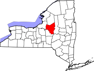 | |
| Towns | ||
| Villages | ||
| CDPs | ||
| Hamlets | ||