Trenton, New York
| Trenton, New York | |
|---|---|
| Town | |
 Location in Oneida County and the state of New York. | |
| Coordinates: 43°15′19″N 75°11′26″W / 43.25528°N 75.19056°WCoordinates: 43°15′19″N 75°11′26″W / 43.25528°N 75.19056°W | |
| Country | United States |
| State | New York |
| County | Oneida |
| Government | |
| • Type | Town Council |
| • Town Supervisor | Joseph E. Smith(R) |
| • Town Council |
Members' List
|
| Area | |
| • Total | 43.7 sq mi (113.2 km2) |
| • Land | 43.3 sq mi (112.2 km2) |
| • Water | 0.4 sq mi (1.0 km2) |
| Elevation | 801 ft (244 m) |
| Population (2010) | |
| • Total | 4,498 |
| • Density | 100/sq mi (40/km2) |
| Time zone | Eastern (EST) (UTC-5) |
| • Summer (DST) | EDT (UTC-4) |
| FIPS code | 36-75280 |
| GNIS feature ID | 0979556 |
Trenton is a town in Oneida County, New York, in the United States. The population was 4,498 at the 2010 census.
History
The first settlement was developed in 1793 by Gerrit Boon in Barneveldt, as an agent of the Holland Land Company. Boon went back to Holland after a few years. His successor was Adam Gerard Mappa a Dutch typesetter. At the end of his life Mappa's friend Francis Adrian Vanderkemp moved to Barneveld.
The town was formed in 1797 from the Town of Schuyler (in Herkimer County, New York). The name may have been selected because some local soldiers fought at the Battle of Trenton. The town includes areas form the Holland and Servis Patents.
The Wethersfield Stone Schoolhouse was listed on the National Register of Historic Places in 2005.[1]
Geography
According to the United States Census Bureau, the town has a total area of 43.7 square miles (113 km2), of which, 43.3 square miles (112 km2) of it is land and 0.4 square miles (1.0 km2) of it (0.89%) is water.
The West Canada Creek forms the eastern town line, the border of Herkimer County.
The town lent its name to the "Trenton Group," a limestone bed that extends to Minnesota.
The Wethersfield Stone Schoolhouse was listed on the National Register of Historic Places in 2005.[1]
Demographics
| Historical population | |||
|---|---|---|---|
| Census | Pop. | %± | |
| 1800 | 624 | — | |
| 1810 | 1,548 | 148.1% | |
| 1820 | 2,617 | 69.1% | |
| 1830 | 3,221 | 23.1% | |
| 1840 | 3,178 | −1.3% | |
| 1850 | 3,540 | 11.4% | |
| 1860 | 3,504 | −1.0% | |
| 1870 | 3,156 | −9.9% | |
| 1880 | 3,097 | −1.9% | |
| 1890 | 2,709 | −12.5% | |
| 1900 | 2,628 | −3.0% | |
| 1910 | 2,402 | −8.6% | |
| 1920 | 2,389 | −0.5% | |
| 1930 | 2,262 | −5.3% | |
| 1940 | 2,295 | 1.5% | |
| 1950 | 2,522 | 9.9% | |
| 1960 | 3,417 | 35.5% | |
| 1970 | 4,429 | 29.6% | |
| 1980 | 4,683 | 5.7% | |
| 1990 | 4,682 | 0.0% | |
| 2000 | 4,670 | −0.3% | |
| 2010 | 4,498 | −3.7% | |
| Est. 2014 | 4,470 | [2] | −0.6% |
As of the census[4] of 2000, there were 4,670 people, 1,776 households, and 1,287 families residing in the town. The population density was 107.8 people per square mile (41.6/km²). There were 1,932 housing units at an average density of 44.6 per square mile (17.2/km²). The racial makeup of the town was 98.07% White, 0.39% African American, 0.06% Native American, 0.54% Asian, 0.17% from other races, and 0.77% from two or more races. Hispanic or Latino of any race were 0.34% of the population.
There were 1,776 households out of which 35.6% had children under the age of 18 living with them, 58.5% were married couples living together, 9.0% had a female householder with no husband present, and 27.5% were non-families. 22.9% of all households were made up of individuals and 8.6% had someone living alone who was 65 years of age or older. The average household size was 2.61 and the average family size was 3.07.
In the town the population was spread out with 27.0% under the age of 18, 6.2% from 18 to 24, 27.6% from 25 to 44, 26.7% from 45 to 64, and 12.5% who were 65 years of age or older. The median age was 39 years. For every 100 females there were 99.1 males. For every 100 females age 18 and over, there were 99.4 males.
The median income for a household in the town was $49,559, and the median income for a family was $56,377. Males had a median income of $32,523 versus $28,516 for females. The per capita income for the town was $23,139. About 2.6% of families and 5.9% of the population were below the poverty line, including 7.4% of those under age 18 and 3.5% of those age 65 or over.
Communities and locations in Trenton
- Barneveld – The Village of Barneveld is in the east central part of the town, west of Trenton Falls.
- Barneveld Station – A location south of Barneveld on New York State Route 12 (NY 12).
- Hinckley – A hamlet located on NY 365 near the Hinckley Reservoir on the north bank of West Canada Creek.
- Holland Patent – The Village of Holland Patent is in the southwest part of the town on NY 365.
- Mapledale – A location south of Barneveld.
- Prospect – The Village of Prospect is in the northeast corner of the town.
- South Trenton – Located off NY 12 near the southern town border with Deerfield.
- Steuben Valley – A hamlet at the west town line.
- Trenton Falls – A waterfall and hamlet at the east town line on West Canada Creek.
- Trenton Falls Station – A location west of Trenton Falls.
References
- 1 2 National Park Service (2009-03-13). "National Register Information System". National Register of Historic Places. National Park Service.
- ↑ "Annual Estimates of the Resident Population for Incorporated Places: April 1, 2010 to July 1, 2014". Retrieved June 4, 2015.
- ↑ "Census of Population and Housing". Census.gov. Retrieved June 4, 2015.
- ↑ "American FactFinder". United States Census Bureau. Retrieved 2008-01-31.
External links
Municipalities and communities of Oneida County, New York, United States | ||
|---|---|---|
| Cities | 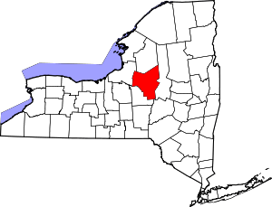 | |
| Towns | ||
| Villages | ||
| CDPs | ||
| Hamlets | ||