Sherrill, New York
| Sherrill | |
|---|---|
| City | |
| Nickname(s): "The Silver City" | |
 Location within Oneida County and New York | |
 Sherrill Location within the state of New York | |
| Coordinates: 43°4′15″N 75°35′57″W / 43.07083°N 75.59917°WCoordinates: 43°4′15″N 75°35′57″W / 43.07083°N 75.59917°W | |
| Country | United States |
| State | New York |
| County | Oneida |
| Government | |
| • Type | Council-Manager |
| • Mayor | William Vineall |
| • City Manager | Michael Sayles |
| • City Commission |
Members' List
|
| Area | |
| • Total | 2.0 sq mi (5.2 km2) |
| • Land | 2.0 sq mi (5.2 km2) |
| • Water | 0.0 sq mi (0.0 km2) |
| Elevation | 499 ft (152 m) |
| Population (2010) | |
| • Total | 3,071 |
| Time zone | Eastern (EST) (UTC-5) |
| • Summer (DST) | EDT (UTC-4) |
| ZIP code | 13461 |
| Area code(s) | 315 |
| FIPS code | 36-66993 |
| GNIS feature ID | 0965089 |
| Website | City of Sherrill, New York |
Sherrill is a city in Oneida County, New York, United States. With a population of 3,071 (2010 census), it is the least populous city in the state. Sherrill is located at the western end of the Town of Vernon on Route 5. Sherrill is referred to as The Silver City.[1]
History
Sherrill was founded in 1916 through a special act of the state legislature. It is unique among cities in New York, because its city charter provides that, for many purposes, it is to be treated as if it were still a village located within the town of Vernon. While other cities in New York are not subject to a town's jurisdiction the Vernon town government continues to have jurisdiction over the territory of the city.[2][3]
In 1997, the Oneida tribe purchased land within the city, eventually initiating a dispute about whether they had to pay taxes.[4]
Geography
Sherrill is located at 43°04′15″N 75°35′57″W / 43.070808°N 75.599124°W,[5] adjacent to the border of Madison County, New York. According to the United States Census Bureau, the city has a total area of 2.0 square miles (5.2 km2), all land.
New York State Route 5 passes through the north side of the city.
Demographics
| Historical population | |||
|---|---|---|---|
| Census | Pop. | %± | |
| 1920 | 1,761 | — | |
| 1930 | 2,150 | 22.1% | |
| 1940 | 2,184 | 1.6% | |
| 1950 | 2,236 | 2.4% | |
| 1960 | 2,922 | 30.7% | |
| 1970 | 2,986 | 2.2% | |
| 1980 | 2,830 | −5.2% | |
| 1990 | 2,864 | 1.2% | |
| 2000 | 3,147 | 9.9% | |
| 2010 | 3,071 | −2.4% | |
| Est. 2015 | 3,066 | [6] | −0.2% |
As of the census[8] of 2000, there were 3,147 people, 1,262 households, and 879 families residing in the city. The population density was 1,554.6 people per square mile (601.5/km2). There were 1,309 housing units at an average density of 646.6 per square mile (250.2/km2). The racial makeup of the city was 98.00% White, 0.22% African American, 0.60% Native American, 0.60% Asian, 0.03% from other races, and 0.54% from two or more races. Hispanic or Latino of any race were 0.83% of the population.
There were 1,262 households out of which 33.6% had children under the age of 18 living with them, 59.3% were married couples living together, 8.1% had a female householder with no husband present, and 30.3% were non-families. 27.4% of all households were made up of individuals and 15.9% had someone living alone who was 65 years of age or older. The average household size was 2.48 and the average family size was 3.03.
In the city the population was spread out with 26.2% under the age of 18, 5.8% from 18 to 24, 25.0% from 25 to 44, 25.9% from 45 to 64, and 17.1% who were 65 years of age or older. The median age was 41 years. For every 100 females there were 86.8 males. For every 100 females age 18 and over, there were 81.8 males.
The median income for a household in the city was $48,919, and the median income for a family was $60,573. Males had a median income of $41,179 versus $26,500 for females. The per capita income for the city was $22,311. About 0.8% of families and 2.2% of the population were below the poverty line, including 2.6% of those under age 18 and 3.9% of those age 65 or over.
References
- ↑ "Sherrill New York homepage". City of Sherrill. Retrieved 2009-04-05.
- ↑ "City Charter". City of Sherrill. p. Title I, Section 3, final sentence. Archived from the original on 2009-05-02. Retrieved 2009-04-05.
- ↑ [[["l"]] "[*]"] Check
|url=value (help). - ↑ Tax dispute with the Oneida.
- ↑ "US Gazetteer files: 2010, 2000, and 1990". United States Census Bureau. 2011-02-12. Retrieved 2011-04-23.
- ↑ "Annual Estimates of the Resident Population for Incorporated Places: April 1, 2010 to July 1, 2015". Retrieved July 2, 2016.
- ↑ "Census of Population and Housing". Census.gov. Retrieved June 4, 2015.
- ↑ "American FactFinder". United States Census Bureau. Retrieved 2008-01-31.
External links
Municipalities and communities of Oneida County, New York, United States | ||
|---|---|---|
| Cities | 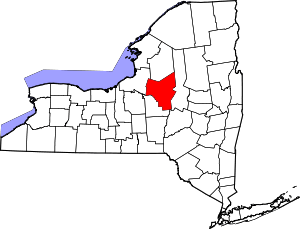 | |
| Towns | ||
| Villages | ||
| CDPs | ||
| Hamlets | ||