Whitesboro, New York
| Whitesboro, New York | ||
|---|---|---|
| Village | ||
|
Commercial buildings in Whitesboro | ||
| ||
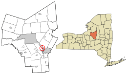 Location in Oneida County and the state of New York. | ||
| Coordinates: 43°7′N 75°18′W / 43.117°N 75.300°WCoordinates: 43°7′N 75°18′W / 43.117°N 75.300°W | ||
| Country | United States | |
| State | New York | |
| County | Oneida | |
| Area | ||
| • Total | 1.1 sq mi (2.8 km2) | |
| • Land | 1.1 sq mi (2.8 km2) | |
| • Water | 0.0 sq mi (0.0 km2) | |
| Elevation | 423 ft (129 m) | |
| Population (2010) | ||
| • Total | 3,772 | |
| Time zone | Eastern (EST) (UTC-5) | |
| • Summer (DST) | EDT (UTC-4) | |
| ZIP code | 13492 | |
| Area code(s) | 315 | |
| FIPS code | 36-81710[1] | |
| GNIS feature ID | 0971160[2] | |

.jpeg)
Whitesboro is a village in Oneida County, New York, United States. The population was 3,772 at the 2010 census. The village is named after Hugh White, an early settler who had been adopted into the Oneida tribe and built the first permanent settlement there in 1784-85.[3]
The Village of Whitesboro is inside the Town of Whitestown.
History
The village was first settled circa 1784. The village was incorporated in 1813.
The older part of the village was bordered by the Erie Canal and the village's Main Street. When the canal was filled in the first half of the 20th century, Oriskany Boulevard was built over the filled-in canal. The streets that connect the two roads form the oldest part of the village.
Ice skating was once popular on the Erie Canal, and once covered with ice, the residents used the Flagg Street Playground in the winter to ice skate. The fire department in the 1950s-1980s would spray water on a large area of the several acre playground, and most of the village would come out and skate. A large portion of the village would participate. In the early 1980s, the skating was stopped for insurance reasons.
The Whitestown Town Hall was listed on the National Register of Historic Places in 1973.[4]
City seal controversy
The Whitesboro seal, originating in the early 1900s, displays founder Hugh White wrestling an Oneida Native American. The seal has been controversial because it has been interpreted as a settler choking the Native American; city officials contend it depicts a friendly wrestling match that White won, gaining the respect of the Oneida.[5] The current version of the seal was created in 1970, after a lawsuit by a Native American group: the version used before the suit showed the settler's hands on the Native American's neck instead of his shoulders.[6]
The seal attracted more controversy in 2016 when village residents voted 157 to 55 to keep the seal as-is rather than explore alternative images.[7] On January 21, 2016, Patrick O'Connor, the mayor of Whitesboro, called Jessica Williams, a correspondent for The Daily Show, and told her that the town would change the seal.[8]
Geography
Whitesboro is located at 43°7′N 75°18′W / 43.117°N 75.300°W (43.124, -75.296).[9]
According to the United States Census Bureau, the village has a total area of 1.1 square miles (2.8 km2), all land. The Sauquoit Creek runs through the village.
Demographics
| Historical population | |||
|---|---|---|---|
| Census | Pop. | %± | |
| 1870 | 964 | — | |
| 1880 | 1,370 | 42.1% | |
| 1890 | 1,663 | 21.4% | |
| 1900 | 1,958 | 17.7% | |
| 1910 | 2,375 | 21.3% | |
| 1920 | 3,038 | 27.9% | |
| 1930 | 3,375 | 11.1% | |
| 1940 | 3,532 | 4.7% | |
| 1950 | 3,902 | 10.5% | |
| 1960 | 4,784 | 22.6% | |
| 1970 | 4,805 | 0.4% | |
| 1980 | 4,460 | −7.2% | |
| 1990 | 4,195 | −5.9% | |
| 2000 | 3,943 | −6.0% | |
| 2010 | 3,772 | −4.3% | |
| Est. 2015 | 3,694 | [10] | −2.1% |
As of the census[1] of 2000, there were 3,943 people, 1,778 households, and 992 families residing in the village. The population density was 3,675.4 people per square mile (1,422.8/km²). There were 1,921 housing units at an average density of 1,790.6 per square mile (693.2/km²). The racial makeup of the village was 97.69% White, 0.53% African American, 0.03% Native American, 0.33% Asian, 0.53% from other races, and 0.89% from two or more races. Hispanic or Latino of any race were 1.47% of the population.
There were 1,778 households out of which 27.3% had children under the age of 18 living with them, 36.9% were married couples living together, 15.0% had a female householder with no husband present, and 44.2% were non-families. 39.0% of all households were made up of individuals and 18.7% had someone living alone who were 65 years of age or older. The average household size was 2.21 and the average family size was 2.98.
In the village the population was spread out with 23.3% under the age of 18, 7.8% from 18 to 24, 31.7% from 25 to 44, 20.3% from 45 to 64, and 17.0% who were 65 years of age or older. The median age was 37 years. For every 100 females there were 86.7 males. For every 100 females age 18 and over, there were 81.2 males.
The median income for a household in the village was $31,947, and the median income for a family was $42,741. Males had a median income of $29,408 versus $25,865 for females. The per capita income for the village was $17,386.
Notable people
- Robert Esche, professional ice hockey goaltender, currently with the Ak Bars Kazan and formerly with the NHL's Philadelphia Flyers
- William A. Moseley, former US Congressman
- Mark Mowers, professional ice hockey winger
- Mark Lemke, former Major League baseball player with the Atlanta Braves
- William Whipple Warren, 19th-century historian of the Ojibwe and Minnesota Territory legislator, attended school at the Oneida Institute
- Philo White, former Wisconsin state senator, U.S. diplomat
References
- 1 2 "American FactFinder". United States Census Bureau. Retrieved 2008-01-31.
- ↑ "US Board on Geographic Names". United States Geological Survey. 2007-10-25. Retrieved 2008-01-31.
- ↑ Transactions of the Oneida Historical Society at Utica, 1881–1884, p.73 et seq. (1885)
- ↑ National Park Service (2009-03-13). "National Register Information System". National Register of Historic Places. National Park Service.
- ↑ Santora, Marc (January 12, 2016). "Residents in Whitesboro, N.Y., vote to keep a much-criticized village emblem". The New York Times.
- ↑ Potts, Courtney (January 4, 2009). "Whitesboro seal 'takes a little explaining'". Observer-Dispatch.
- ↑ Santora, Marc (January 12, 2016). "Residents in Whitesboro, N.Y., Vote to Keep a Much-Criticized Village Emblem". The New York Times.
- ↑ Nunez, Michael (22 January 2016). "Whitesboro Will Finally Change Its Racist Town Seal, Says The Daily Show". Gizmodo. Retrieved 22 January 2016.
- ↑ "US Gazetteer files: 2010, 2000, and 1990". United States Census Bureau. 2011-02-12. Retrieved 2011-04-23.
- ↑ "Annual Estimates of the Resident Population for Incorporated Places: April 1, 2010 to July 1, 2015". Retrieved July 2, 2016.
- ↑ "Census of Population and Housing". Census.gov. Retrieved June 4, 2015.
External links
Municipalities and communities of Oneida County, New York, United States | ||
|---|---|---|
| Cities | 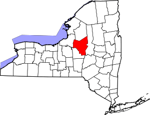 | |
| Towns | ||
| Villages | ||
| CDPs | ||
| Hamlets | ||