Centenary Motorway
| Centenary Motorway Queensland | |
|---|---|
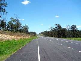 | |
| Motorway extension near Ripley, Queensland | |
| General information | |
| Type | Motorway |
| Length | 43 km (27 mi) |
| Route number(s) |
|
| Major junctions | |
| North end |
|
| South end |
|
| Location(s) | |
| Major suburbs / towns |
Darra Sinnamon Park |
| Highway system | |
|
Highways in Australia National Highway • Freeways in Australia Highways in Queensland | |
| |
The M5 (Centenary Motorway) is a 43-kilometre (27 mi) motorway in the western suburbs of Brisbane, Australia.
It starts as a two-lane arterial road at Yamanto, travelling to Springfield, where it becomes a two-lane highway and travels across the M2 Logan Motorway at Ellen Grove (formerly Metroad 4 / M4) and ends at Kenmore where it changes its name to the M5 Western Freeway. It features eight interchanges, the major ones being with the M7 Ipswich Motorway (formerly Metroad 2 / M2) in Darra and another at Sinnamon Park. The Centenary Freeway links traffic from the west to the north of Brisbane.
In October 2012, it was announced that the planned bikeway from Springfield to the existing bikeway along the Motorway would not proceed. Instead the existing two lane road would be expanded by two lanes.[1]
Recent Motorway designation
Almost the entire length of road is of freeway/motorway standard and has now been designated as such. Those sections not of freeway standard are being upgraded and re-designated over time. As of October 2006 the blue hexagonal Metroad 5 signage is getting progressively replaced with M5 signage. Officially the M5 starts/ends at the Sumner Road Interchange and not at the M7/M5 Interchange. This will change when the M7/M5 Interchange is upgraded.
The M5 has been identified to receive a major upgrade in the South East Queensland Infrastructure Plan and Program. Additional lanes will be added to accommodate Transit Lane.
Extension
The motorway was extended to Yamanto and opened in late June 2009.[2] The extension cost $366 million and was opened by Anna Bligh. Five bridges along the new section were named after local people, places, events and football teams, including botanist Lloyd Bird and the Box Flat Mine disaster.[2]
Interchanges
The interchange with the Logan Motorway is crossed by a viaduct for the two track railway crossing of the Springfield railway line.[3] The crossing is more than 800 metres long and has been designed so that its piers do not obstruct planned upgrades of both roads.[3]
| LGA | Location | km | mi | Destinations | Notes |
|---|---|---|---|---|---|
| Brisbane | Indooroopilly | 0 | 0.0 | Northern motorway terminus: continues as Western Freeway; northbound exit only to Moggill Road | |
| Indooroopilly–Fig Tree Pocket–Chapel Hill–Kenmore quadripoint | 2 | 1.2 | Fig Tree Pocket Road – Fig Tree Pocket | Parclo interchange | |
| Brisbane River | 4 | 2.5 | Centenary Bridge | ||
| Brisbane | Jindalee | 4.5 | 2.8 | Sinnamon Road | Northbound entrance and southbound exit |
| 4.7– 5 | 2.9– 3.1 | Seventeen Mile Rocks Road | No northbound entrance | ||
| Mount Ommaney–Sinnamon Park boundary | 6 | 3.7 | Dandenong Road west / Glen Ross Road east | Roundabout interchange | |
| Jamboree Heights–Sumner–Darra tripoint | 7 | 4.3 | Sumners Road | ||
| Darra | 8 | 5.0 | No northbound exit to M7 westbound; no southbound entrance from M7 eastbound | ||
| Richlands | 9.5 | 5.9 | Southbound exit and northbound entrance | ||
| 10 | 6.2 | Northbound exit and southbound entrance | |||
| Forest Lake | 13 | 8.1 | No southbound exit to M2 north-westbound; no northbound entrance from M2 south-eastbound | ||
| Ipswich | Springfield–Springfield Lakes boundary | 20 | 12 | Springfield Parkway west / Springfield Lakes Boulevard east | |
| Springfield Lakes | 21 | 13 | Springfield–Greenbank Arterial – Greenbank, Springfield Central | Southbound exit only | |
| Springfield Central–Augustine Heights boundary | 22 | 14 | Southern motoway terminus: continues as Centenary Highway | ||
See also
References
- ↑ Tony Moore (10 October 2012). "Bikeway axed for Centenary Motorway widening". Brisbane Times. Fairfax Media. Retrieved 21 June 2013.
- 1 2 Tony Moore (28 June 2009). "New Centenary Highway opens tomorrow". Brisbane Times. Fairfax Media. Retrieved 21 June 2013.
- 1 2 Pacheco, Pedro; Filipe Magalhaes (2015). Multi-Span Large Bridges: International Conference on Multi-Span Large Bridges, 1-3 July 2015, Porto, Portugal. CRC Press. p. 480. ISBN 9781315687193. Retrieved 16 October 2016.
Coordinates: 27°38′54.77″S 152°55′59.76″E / 27.6485472°S 152.9332667°E