Moggill Road
| Moggill Road Queensland | |
|---|---|
 | |
| Moggill Road flooding in Chapel Hill on 12 January 2011 | |
| General information | |
| Type | Road |
| Length | 27 km (17 mi) |
| Major junctions | |
| Moggill Ferry, Moggill | |
| High Street, Toowong | |
| |
Moggill Road is a major road in Brisbane, Queensland, Australia. It commences at High Street at Toowong and terminates at the Moggill Ferry in Moggill. It is part of State Route 33. The road carried an average of 39,305 vehicles per day between July and December 2014.[1]
It passes through the Brisbane suburbs of Toowong, Taringa, Indooroopilly, Chapel Hill, Kenmore, Pullenvale, Pinjarra Hills, Bellbowrie and Moggill.
It stretches 27 km (17 mi). $14 million worth of road works started in 2010, $32 million in 2009, following a further $27 million completed in 2008.
Flooding
During the 2010–2011 Queensland floods, Moggill Road flooded in a number of places, including:
- around the intersctions with Market Street and Witton Road, Chapel Hill[2]
- around Pullen Pullen Creek at Pinjarra Hills and Bellowrie[3]
The flooding causes the suburbs of Bellbowrie, Moggill and Karana Downs to be cut off, leading to shortages of food and medical supplies.[4]
Gallery
 Moggill Road, Taringa, 1907
 Moggill Road, Taringa, ca.1920
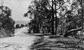 Moggill Road, Indooroopilly, 1921
 Moggill Road in Taringa, 2005
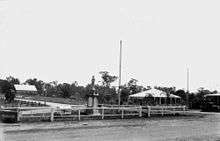 Moggill Road and Brookfield Road, Kenmore, 1925
See also
References
- ↑ Kristian Silva (18 March 2015). "Brisbane traffic increasing, report shows". Brisbane Times. Fairfax Media. Retrieved 18 March 2015.
- ↑ "Chapel Hill" (PDF). Flood Flag Maps. Brisbane City Council. Retrieved 31 August 2013.
- ↑ "Bellbowrie" (PDF). Flood Flag Maps. Brisbane City Council. Retrieved 31 August 2013.
- ↑ Baumgart, Sean (14 January 2011). "'You have not been forgotten': Bligh". Brisbane Times. Retrieved 31 August 2013.