Cape Ann Light Station
|
Twin Lights Historic District–Cape Ann Light Station | |
  | |
| Nearest city | Rockport, Massachusetts |
|---|---|
| Coordinates | 42°38′12.444″N 70°34′29.752″W / 42.63679000°N 70.57493111°WCoordinates: 42°38′12.444″N 70°34′29.752″W / 42.63679000°N 70.57493111°W |
| Area | 50 acres (20 ha) |
| Built | 1860 |
| MPS | Lighthouses of Massachusetts TR (AD) |
| NRHP Reference # | 71000355[1] |
| Significant dates | |
| Added to NRHP | October 07, 1971 |
| Designated NHLD | January 3, 2001 |
The Cape Ann Light Station on Thacher Island, off Cape Ann in Rockport, Massachusetts is nationally significant as the last light station to be established under colonial rule and the first station in the United States to mark a navigational hazard rather than a harbor entrance.[2] The current pair of lighthouses were built in 1861. They were both equipped with first order Fresnel lenses, which stood approximately 10 feet (3.0 m) high and weighed several tons (tonnes).
After being decommissioned in the early 1980s, the lens from the south tower was moved to the U.S. Coast Guard Museum at the United States Coast Guard Academy in New London, Connecticut. In 2013 a joint effort by the Cape Ann Museum and the Thacher Island Association brought the lens back to Cape Ann. The first order lens is now on display at the Cape Ann Museum in Gloucester, Massachusetts.
When these lights were built, there was no way to produce a flashing light and, occasionally mariners would confuse one light for another with disastrous results. The only way to create a distinction was to build more than one light. There were two lights at Plymouth and three at Nauset Beach. Gradually as it became possible to create flashes with a revolving lens system, the multiple lights were discontinued, so that while the south light is an active, Coast Guard maintained light, the north tower was discontinued in 1932. It was relighted as a Private Aid to Navigation in 1989. Both lights are now owned by the Town of Rockport and managed by the Thacher Island Association.
The station was added to the National Register of Historic Places as Twin Lights Historic District—Cape Ann Light Station on October 7, 1971, reference number 71000355. In 2001 they became the 9th light station to be recognized as a National Historic Landmark.[2][3]
Cape Ann Light
.jpg) South Tower of the Cape Ann Twin Lighthouses, ca. 1869 | |
| Location | Cape Ann, Massachusetts |
|---|---|
| Year first constructed | 1771 |
| Year first lit | 1861 (current structure) |
| Automated | 1979 |
| Foundation | Granite (surface rock) |
| Construction | Cut granite |
| Tower shape | Conical |
| Markings / pattern | Natural, unpainted granite |
| Height | 124 feet (38 m) |
| Focal height | 166 feet (51 m) |
| Original lens | 1st order Fresnel lens |
| Current lens | VRB-25 |
| Range | 17 nautical miles (31 km; 20 mi) |
| Characteristic | Fl R 5s |
| Fog signal | HORN: 2 every 60s |
| Admiralty number | J0276 |
| ARLHS number | USA-105 |
| USCG number | 1-295[3][4][5] |
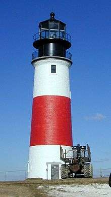
Cape Ann Light is the southern lighthouse that comprise the station.
Thacher Island North Light
 The northern lighthouse is to the right in this 2009 photo. | |
| Location | Cape Ann, Massachusetts |
|---|---|
| Coordinates | 42°38′21″N 70°34′29.2″W / 42.63917°N 70.574778°W |
| Year first constructed | 1771 |
| Year first lit | 1861 (current structure) |
| Automated | 1988 |
| Deactivated | 1932-1988 |
| Foundation | Granite (surface rock) |
| Construction | Cut granite |
| Tower shape | Conical |
| Markings / pattern | Natural, unpainted granite |
| Height | 124 feet (38 m) |
| Focal height | 162 feet (49 m) |
| Original lens | 1st order Fresnel lens |
| Current lens | 200 millimetres (7.9 in) |
| Characteristic | F Y |
| Fog signal | none |
| USCG number | 1-305[4][5] |

Thacher Island North Light is the northern most lighthouse that comprise the station.
Nomenclature
| Wikimedia Commons has media related to Cape Ann Light Station. |
- The south light's official name in the US Coast Guard Light List is Cape Ann Light, number 1-295.[5]
- The north light's official name is Thacher Island North Light, number 1-305.
- The National Historic Landmark listing name is Twin Lights Historic District—Cape Ann Light Station.
- The lights are known locally as the Twin Lights or Thacher Island Lights.
See also
References
- ↑ National Park Service (2009-03-13). "National Register Information System". National Register of Historic Places. National Park Service.
- 1 2 "Cape Ann Light Station". National Historic Landmark summary listing. National Park Service. Archived from the original on 2008-05-02. Retrieved 2008-08-04.
- 1 2 Rowlett, Russ (2009-09-06). "Lighthouses of the United States: Northern Massachusetts". The Lighthouse Directory. University of North Carolina at Chapel Hill.
- 1 2 "Historic Light Station Information and Photography: Massachusetts". United States Coast Guard Historian's Office. 2009-09-06.
- 1 2 3 Light List, Volume I, Atlantic Coast, St. Croix River, Maine to Shrewsbury River, New Jersey (PDF). Light List. United States Coast Guard. 2009. p. 4.
| Topics |  | ||||||||||||||||||||||||||||||
|---|---|---|---|---|---|---|---|---|---|---|---|---|---|---|---|---|---|---|---|---|---|---|---|---|---|---|---|---|---|---|---|
| Lists by county | |||||||||||||||||||||||||||||||
| Lists by city |
| ||||||||||||||||||||||||||||||
| Other lists | |||||||||||||||||||||||||||||||
| |||||||||||||||||||||||||||||||