| [3] |
Name on the Register |
Image |
Date listed[4] |
Location |
City or town |
Description |
|---|
| 1 |
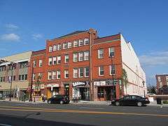
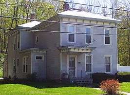
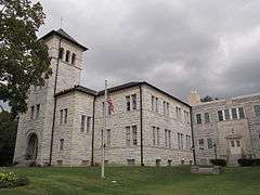
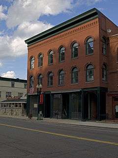
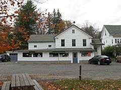
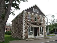
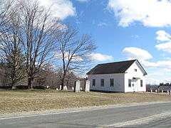
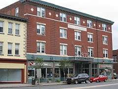
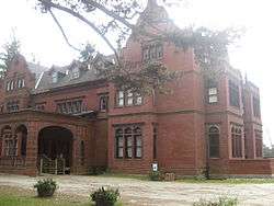
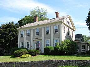
Allen Hotel |
|
000000001983-09-01-0000September 1, 1983
(#83000566) |
Wendell Ave.
42°26′55″N 73°15′09″W / 42.448611°N 73.2525°W / 42.448611; -73.2525 (Allen Hotel) |
Pittsfield |
|
| 2 |
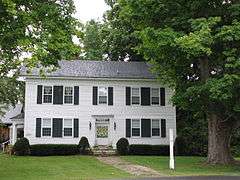
William Russell Allen House |
|
000000001980-05-07-0000May 7, 1980
(#80000427) |
359 East St.
42°26′52″N 73°14′49″W / 42.447778°N 73.246944°W / 42.447778; -73.246944 (William Russell Allen House) |
Pittsfield |
|
| 3 |
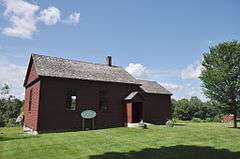
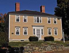
Anthony House |
|
000000001985-01-03-0000January 3, 1985
(#85000021) |
67 East Rd.
42°36′55″N 73°06′10″W / 42.615278°N 73.102778°W / 42.615278; -73.102778 (Anthony House) |
Adams |
Birthplace of suffragette Susan B. Anthony; now a museum.
|
| 4 |
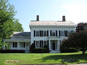
Armory Block |
|
000000001982-04-01-0000April 1, 1982
(#82004944) |
39-45 Park St.
42°37′20″N 73°07′14″W / 42.622222°N 73.120556°W / 42.622222; -73.120556 (Armory Block) |
Adams |
|
| 5 |
Armstrong House |
|
000000001985-10-25-0000October 25, 1985
(#85003394) |
60 Brooklyn St.
42°42′26″N 73°06′47″W / 42.707222°N 73.113056°W / 42.707222; -73.113056 (Armstrong House) |
North Adams |
part of the North Adams Multiple Resource Area (MRA)
|
| 6 |
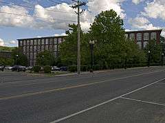
Arnold Print Works |
|
000000001985-10-25-0000October 25, 1985
(#85003379) |
87 Marshall St.
42°42′05″N 73°06′59″W / 42.701389°N 73.116389°W / 42.701389; -73.116389 (Arnold Print Works) |
North Adams |
now the Massachusetts Museum of Contemporary Art (MASS MoCA); part of the North Adams MRA
|
| 7 |
Colonel John Ashley House |
|
000000001975-02-10-0000February 10, 1975
(#75001915) |
117 Cooper Hill Rd.
42°03′34″N 73°21′23″W / 42.059444°N 73.356389°W / 42.059444; -73.356389 (Colonel John Ashley House) |
Sheffield |
Historic house museum operated by The Trustees of Reservations. The 1773 Sheffield Declaration was drafted in the house. In 1781 Elizabeth "Mum Bett" Freeman won her freedom in a case which led to the end of slavery in Massachusetts
|
| 8 |
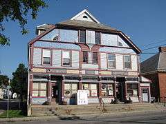
P. J. Barrett Block |
|
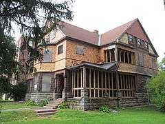
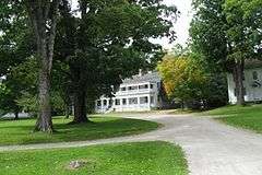
000000001982-04-01-0000April 1, 1982
(#82004945) |
70-76 Park St.
42°37′24″N 73°07′15″W / 42.623333°N 73.120833°W / 42.623333; -73.120833 (P. J. Barrett Block) |
Adams |
|
| 9 |
Beaver Mill |
|
000000001973-05-11-0000May 11, 1973
(#73000292) |
Beaver St.
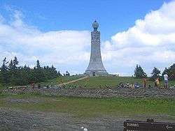
42°42′12″N 73°05′55″W / 42.703333°N 73.098611°W / 42.703333; -73.098611 (Beaver Mill) |
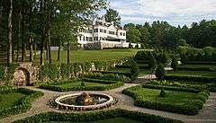
North Adams |
|
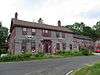
| 10 |
Becket Center Historic District |
|
000000001982-08-11-0000August 11, 1982
(#82004952) |
MA 8, Hamilton and YMCA Rds.
42°17′03″N 73°04′08″W / 42.284167°N 73.068889°W / 42.284167; -73.068889 (Becket Center Historic District) |
Becket |
|
| 11 |
Berkshire Mill No. 1 |
|
000000001982-04-01-0000April 1, 1982
(#82004946) |
Hoosac St.
42°37′31″N 73°07′06″W / 42.625386°N 73.118404°W / 42.625386; -73.118404 (Berkshire Mill No. 1) |
Adams |
|
| 12 |
Berkshire Life Insurance Company Building |
|
000000001986-02-27-0000February 27, 1986
(#86000276) |
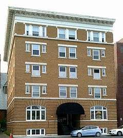
5-7 North St.
42°26′56″N 73°15′18″W / 42.448889°N 73.255°W / 42.448889; -73.255 (Berkshire Life Insurance Company Building) |
Pittsfield |
|
| 13 |
Rev. Adonijah Bidwell House |
|
000000001982-08-26-0000August 26, 1982
(#82004954) |
Royal Hemlocks and Art School Rds.
42°12′27″N 73°13′09″W / 42.2075°N 73.219167°W / 42.2075; -73.219167 (Rev. Adonijah Bidwell House) |
Monterey |
|
| 14 |
Blackinton Historic District |
|
000000001985-10-25-0000October 25, 1985
(#85003384) |
Roughly Massachusetts Ave. between Ashton and Doanes Aves. and Church Hill and Boston & Maine RR
42°41′26″N 73°06′08″W / 42.690556°N 73.102222°W / 42.690556; -73.102222 (Blackinton Historic District) |
North Adams |
part of the North Adams MRA
|
| 15 |
The Boardman |
|
000000001985-10-25-0000October 25, 1985
(#85003403) |
39-53 Montana St.
42°41′33″N 73°06′23″W / 42.6925°N 73.106389°W / 42.6925; -73.106389 (The Boardman) |
North Adams |
part of the North Adams MRA
|
| 16 |
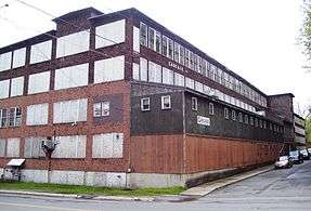
Boston Finishing Works |
Upload image |
000000002016-10-04-0000October 4, 2016
(#16000690) |
160 Water St.
42°42′23″N 73°12′02″W / 42.706435°N 73.200665°W / 42.706435; -73.200665 (Boston Finishing Works) |
Williamstown |
|
| 16 |
Capt. John Brewer House |
|
000000001984-03-29-0000March 29, 1984
(#84002083) |
Main Rd.
42°10′40″N 73°12′29″W / 42.177778°N 73.208056°W / 42.177778; -73.208056 (Capt. John Brewer House) |
Monterey |
|
| 17 |
Charles Browne House |
|
000000001985-10-25-0000October 25, 1985
(#85003413) |
932 S. Church St.
42°40′43″N 73°05′52″W / 42.678611°N 73.097778°W / 42.678611; -73.097778 (Charles Browne House) |
North Adams |
part of the North Adams MRA
|
| 18 |
Chesterwood |
|
000000001966-10-15-0000October 15, 1966
(#66000652) |
3 Williamsville Rd.
42°17′08″N 73°21′18″W / 42.285556°N 73.355°W / 42.285556; -73.355 (Chesterwood) |
Stockbridge |
Home of Daniel Chester French
|
| 19 |
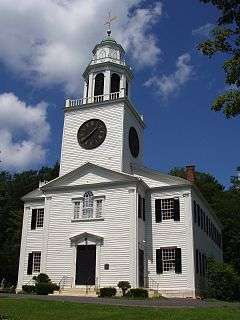
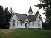
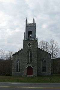
Church on the Hill |
|
000000001982-09-30-0000September 30, 1982
(#82001894) |
55 Main St.
42°21′49″N 73°17′01″W / 42.363611°N 73.283611°W / 42.363611; -73.283611 (Church on the Hill) |
Lenox |
|
| 20 |
Church Street-Cady Hill Historic District |
|
000000001983-03-10-0000March 10, 1983
(#83000567) |
Roughly E. Main St. from Church to Pleasant St., and Church St. from Summer St. to Elmwood Ave.; also roughly bounded by E. Main and Holbrook Sts., Wall and Meadow Sts., Elmwood Ave., and Perry, South, and Ashland Sts.
42°41′48″N 73°06′26″W / 42.696667°N 73.107222°W / 42.696667; -73.107222 (Church Street-Cady Hill Historic District) |
North Adams |
Listed on the National Register as "Church Street Historic District" but renamed and expanded on 000000001985-10-25-0000October 25, 1985; second set of boundaries represents the increase
|
| 21 |
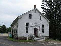
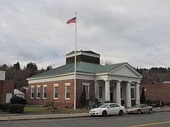
Citizens Hall |
|
000000001972-06-19-0000June 19, 1972
(#72000126) |
13 Willard Hill Rd.
42°18′58″N 73°19′52″W / 42.316111°N 73.331111°W / 42.316111; -73.331111 (Citizens Hall) |
Interlaken |
|
| 22 |
H. W. Clark Biscuit Company |
|
000000002009-04-22-0000April 22, 2009
(#09000235) |
179-191 Ashland St.
42°41′38″N 73°06′32″W / 42.693811°N 73.108856°W / 42.693811; -73.108856 (H. W. Clark Biscuit Company) |
North Adams |
part of the North Adams MRA
|
| 23 |
Clark-Eames House |
|
000000001986-09-12-0000September 12, 1986
(#86002139) |
230 Middlefield Rd.
42°20′36″N 73°04′31″W / 42.343333°N 73.075278°W / 42.343333; -73.075278 (Clark-Eames House) |
Washington |
part of the Washington MRA
|
| 24 |
Clinton African Methodist Episcopal Zion Church |
|
000000002008-05-29-0000May 29, 2008
(#08000464) |
9 Elm Ct.
42°11′48″N 73°21′46″W / 42.196686°N 73.362883°W / 42.196686; -73.362883 (Clinton African Methodist Episcopal Zion Church) |
Great Barrington |
|
| 25 |
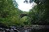
Coleman Bridge |
|
000000002000-02-18-0000February 18, 2000
(#00000112) |
Windsor Bush Rd. over Phelps Brook
42°31′56″N 72°59′36″W / 42.532222°N 72.993333°W / 42.532222; -72.993333 (Coleman Bridge) |
Windsor |
|
| 26 |
Congregational Church of West Stockbridge |
|
000000001996-07-30-0000July 30, 1996
(#96000899) |
45 Main St.
42°19′57″N 73°22′01″W / 42.332500°N 73.366944°W / 42.332500; -73.366944 (Congregational Church of West Stockbridge) |
West Stockbridge |
|
| 27 |
Crane and Company |
|
000000001983-07-01-0000July 1, 1983
(#83004376) |
Off Main St.
42°28′10″N 73°10′42″W / 42.469444°N 73.178333°W / 42.469444; -73.178333 (Crane and Company) |
Dalton |
Listing encompasses what is now the Crane Company museum.
|
| 28 |
Cranesville Historic District |
|
000000002005-11-09-0000November 9, 2005
(#05001208) |
North and south of Main St., west of Park Ave.
42°28′21″N 73°10′38″W / 42.4725°N 73.177222°W / 42.4725; -73.177222 (Cranesville Historic District) |
Dalton |
|
| 29 |
Crowley House |
|
000000001985-10-25-0000October 25, 1985
(#85003414) |
365 W. Main St.
42°41′59″N 73°07′40″W / 42.699722°N 73.127778°W / 42.699722; -73.127778 (Crowley House) |
North Adams |
part of the North Adams MRA
|
| 30 |
Dalton Grange Hall No. 23 |
|
000000001983-11-10-0000November 10, 1983
(#83003924) |
South St. and Grange Hall Rd.
42°27′38″N 73°10′58″W / 42.460556°N 73.182778°W / 42.460556; -73.182778 (Dalton Grange Hall No. 23) |
Dalton |
Demolished.[5]
|
| 31 |
W.E.B. Du Bois Boyhood Homesite |
|
000000001976-05-11-0000May 11, 1976
(#76000947) |
MA 23
42°10′42″N 73°23′30″W / 42.178333°N 73.391667°W / 42.178333; -73.391667 (W.E.B. Du Bois Boyhood Homesite) |
Great Barrington |
Site of house where W.E.B. Du Bois, African American intellectual and activist, grew up.
|
| 32 |
Dwight-Henderson House |
|
000000001976-03-26-0000March 26, 1976
(#76000237) |
Main St.
42°11′29″N 73°21′56″W / 42.191389°N 73.365556°W / 42.191389; -73.365556 (Dwight-Henderson House) |
Great Barrington |
Home of colonial militia general Joseph Dwight.
|
| 33 |
Philip Eames House |
|
000000001986-09-12-0000September 12, 1986
(#86002140) |
88 Stone House Rd.
42°22′18″N 73°07′09″W / 42.371667°N 73.119167°W / 42.371667; -73.119167 (Philip Eames House) |
Washington |
part of the Washington MRA
|
| 34 |
East Lawn Cemetery and Sherman Burbank Memorial Chapel |
|
000000002000-09-14-0000September 14, 2000
(#00001086) |
605 Main St.
42°42′27″N 73°11′47″W / 42.7075°N 73.196389°W / 42.7075; -73.196389 (East Lawn Cemetery and Sherman Burbank Memorial Chapel) |
Williamstown |
|
| 35 |
East Main Street Cemetery |
|
000000002000-06-02-0000June 2, 2000
(#00000567) |
E. Main St.
42°28′24″N 73°09′05″W / 42.473333°N 73.151389°W / 42.473333; -73.151389 (East Main Street Cemetery) |
Dalton |
|
| 36 |
Eaton, Crane & Pike Company Factory |
|
000000001990-08-03-0000August 3, 1990
(#90001166) |
75 S. Church St.
42°26′47″N 73°15′38″W / 42.446389°N 73.260556°W / 42.446389; -73.260556 (Eaton, Crane & Pike Company Factory) |
Pittsfield |
|
| 37 |
Elm Court |
|
000000001985-12-30-0000December 30, 1985
(#85003184) |
Stockbridge St.
42°20′19″N 73°17′31″W / 42.338611°N 73.291944°W / 42.338611; -73.291944 (Elm Court) |
Lenox and Stockbridge |
|
| 38 |
Elm-Maple-South Streets Historic District |
|
000000002004-09-08-0000September 8, 2004
(#04000932) |
2 Depot St., 2-14 Elm St., 1-2 Laurel Ln., 1-4 Maple St., 1-11 South St.
42°16′46″N 73°18′47″W / 42.279444°N 73.313056°W / 42.279444; -73.313056 (Elm-Maple-South Streets Historic District) |
Stockbridge |
|
| 39 |
Fairview Cemetery |
|
000000002000-05-11-0000May 11, 2000
(#00000483) |
Curtis Ave.
42°28′37″N 73°10′21″W / 42.476944°N 73.1725°W / 42.476944; -73.1725 (Fairview Cemetery) |
Dalton |
|
| 40 |
Farnams Village Historic District |
|
000000002000-04-27-0000April 27, 2000
(#99000866) |
Farnams Rd., Lanesborough Rd., and Cheshire Rd.
42°32′44″N 73°11′31″W / 42.545556°N 73.191944°W / 42.545556; -73.191944 (Farnams Village Historic District) |
Cheshire |
|
| 41 |
Fitch-Hoose House |
|
000000002010-06-24-0000June 24, 2010
(#10000390) |
6 Gulf Rd.
42°28′52″N 73°10′32″W / 42.481111°N 73.175556°W / 42.481111; -73.175556 (Fitch-Hoose House) |
Dalton |
|
| 42 |
Five Corners Historic District |
|
000000001993-01-07-0000January 7, 1993
(#92001717) |
Junction of Cold Spring, Green River, New Ashford, Hancock, and Sloan Rds., and the surrounding area
42°39′35″N 73°14′33″W / 42.659722°N 73.2425°W / 42.659722; -73.2425 (Five Corners Historic District) |
Williamstown |
|
| 43 |
Freeman's Grove Historic District |
|
000000001985-10-25-0000October 25, 1985
(#85003388) |
Roughly bounded by Liberty St., Eagle St., Bracewell Ave., and Houghton St.
42°41′41″N 73°06′40″W / 42.694722°N 73.111111°W / 42.694722; -73.111111 (Freeman's Grove Historic District) |
North Adams |
part of the North Adams MRA
|
| 44 |
Freight Yard Historic District |
|
000000001972-06-13-0000June 13, 1972
(#72000131) |
West of the Hadley Overpass and southwest of the Hoosac River
42°41′18″N 73°06′54″W / 42.688333°N 73.115°W / 42.688333; -73.115 (Freight Yard Historic District) |
North Adams |
Part of the Western Gateway Heritage State Park
|
| 45 |
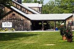
Frelinghuysen Morris House and Studio |
Upload image |
000000002016-05-31-0000May 31, 2016
(#16000304) |
92 Hawthorne St. and 159 West St.
42°20′56″N 73°17′59″W / 42.348784°N 73.299639°W / 42.348784; -73.299639 (Frelinghuysen Morris House and Studio) |
Stockbridge |
|
| 46 |
Glendale Power House |
|
000000001982-06-24-0000June 24, 1982
(#82004957) |
MA 183
42°16′50″N 73°21′11″W / 42.280556°N 73.353056°W / 42.280556; -73.353056 (Glendale Power House) |
Stockbridge |
|
| 47 |
Golden Hill Bridge |
|
000000001994-02-09-0000February 9, 1994
(#93001592) |
Golden Hill Rd. over the Housatonic R.
42°19′18″N 73°14′33″W / 42.321667°N 73.2425°W / 42.321667; -73.2425 (Golden Hill Bridge) |
Lee |
|
| 48 |
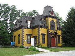
Goodwood |
|
000000001982-04-15-0000April 15, 1982
(#82004955) |
311 Summit Rd.
42°23′49″N 73°21′22″W / 42.396944°N 73.356111°W / 42.396944; -73.356111 (Goodwood) |
Richmond |
|
| 49 |
Hall's Tavern |
|
000000001983-03-10-0000March 10, 1983
(#83000568) |
31 North St.
42°33′46″N 73°09′58″W / 42.562778°N 73.166111°W / 42.562778; -73.166111 (Hall's Tavern) |
Cheshire |
|
| 50 |
Hancock Shaker Village |
|
000000001968-11-24-0000November 24, 1968
(#68000037) |
5 mi (8.0 km) south of Pittsfield on U.S. Route 20, the Hancock Turnpike
42°26′03″N 73°22′27″W / 42.434167°N 73.374167°W / 42.434167; -73.374167 (Hancock Shaker Village) |
Hancock and Pittsfield |
|
| 51 |
Hancock Town Hall |
|
000000001975-09-26-0000September 26, 1975
(#73001956) |
MA 43
42°32′53″N 73°18′39″W / 42.548056°N 73.310833°W / 42.548056; -73.310833 (Hancock Town Hall) |
Hancock |
|
| 52 |
Samuel Harrison House |
|
000000002006-03-22-0000March 22, 2006
(#06000147) |
80 Third St.
42°27′02″N 73°14′46″W / 42.450636°N 73.2461°W / 42.450636; -73.2461 (Samuel Harrison House) |
Pittsfield |
|
| 53 |
Hathaway Tenement |
|
000000001985-10-25-0000October 25, 1985
(#85003415) |
311-321 River St.
42°42′13″N 73°07′12″W / 42.703611°N 73.12°W / 42.703611; -73.12 (Hathaway Tenement) |
North Adams |
part of the North Adams MRA
|
| 54 |
Hillside Cemetery |
|
000000002001-07-19-0000July 19, 2001
(#01000722) |
West Main St.
42°42′00″N 73°07′24″W / 42.700042°N 73.1232°W / 42.700042; -73.1232 (Hillside Cemetery) |
North Adams |
part of the North Adams MRA
|
| 55 |
Hoosac Street School |
|
000000001988-02-10-0000February 10, 1988
(#87002547) |
20 Hoosac St.
42°37′31″N 73°06′53″W / 42.625278°N 73.114722°W / 42.625278; -73.114722 (Hoosac Street School) |
Adams |
|
| 56 |
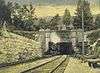
Hoosac Tunnel |
|
000000001973-11-02-0000November 2, 1973
(#73000294) |
From North Adams on the west to the Deerfield River on the east
42°40′30″N 73°02′43″W / 42.675°N 73.045278°W / 42.675; -73.045278 (Hoosac Tunnel) |
North Adams |
|
| 57 |
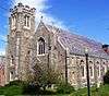
Housatonic Congregational Church |
|
000000002002-04-18-0000April 18, 2002
(#02000377) |
1089 Main St.
42°15′29″N 73°21′56″W / 42.258056°N 73.365556°W / 42.258056; -73.365556 (Housatonic Congregational Church) |
Great Barrington |
|
| 58 |
Frank Howard Building |
|
000000002012-08-14-0000August 14, 2012
(#12000499) |
124-132 Fenn St., 67-71 Federal St.
42°26′59″N 73°15′07″W / 42.449737°N 73.251956°W / 42.449737; -73.251956 (Frank Howard Building) |
Pittsfield |
|
| 59 |
Hyde House |
|
000000001976-11-21-0000November 21, 1976
(#76000239) |
144 W. Park St.
42°18′13″N 73°15′12″W / 42.303611°N 73.253333°W / 42.303611; -73.253333 (Hyde House) |
Lee |
|
| 60 |
Hyde School |
|
000000002004-06-04-0000June 4, 2004
(#04000566) |
100 High St.
42°18′24″N 73°14′53″W / 42.3066°N 73.247975°W / 42.3066; -73.247975 (Hyde School) |
Lee |
|
| 61 |
Jacob's Pillow Dance Festival |
|
000000002001-02-05-0000February 5, 2001
(#00001458) |
George Carter Rd.
42°15′52″N 73°07′05″W / 42.264444°N 73.118056°W / 42.264444; -73.118056 (Jacob's Pillow Dance Festival) |
Becket |
Declared a National Historic Landmark on 000000002003-05-27-0000May 27, 2003
|
| 62 |
Johnson Manufacturing Company |
|
000000001985-10-25-0000October 25, 1985
(#85003418) |
65 Brown St.
42°42′08″N 73°07′18″W / 42.702222°N 73.121667°W / 42.702222; -73.121667 (Johnson Manufacturing Company) |
North Adams |
part of the North Adams MRA
|
| 63 |
Johnson School |
|
000000001985-10-25-0000October 25, 1985
(#85003416) |
School St.
42°42′18″N 73°07′08″W / 42.705°N 73.118889°W / 42.705; -73.118889 (Johnson School) |
North Adams |
part of the North Adams MRA
|
| 64 |
Jones Block |
|
000000001982-04-01-0000April 1, 1982
(#82004947) |
49-53 Park St.
42°37′20″N 73°07′12″W / 42.622353°N 73.119982°W / 42.622353; -73.119982 (Jones Block) |
Adams |
|
| 65 |
Kenmore |
|
000000001996-03-28-0000March 28, 1996
(#96000326) |
Junction of MA 41 and MA 295
42°23′37″N 73°21′54″W / 42.393611°N 73.365°W / 42.393611; -73.365 (Kenmore) |
Richmond |
|
| 66 |
Lee Lower Main Street Historic District |
|
000000001976-03-26-0000March 26, 1976
(#09000090) |
Roughly the area surrounding Main and Park Sts.
42°18′17″N 73°14′56″W / 42.304753°N 73.248814°W / 42.304753; -73.248814 (Lee Lower Main Street Historic District) |
Lee |
|
| 67 |
Lee Station |
|
000000002010-12-27-0000December 27, 2010
(#10001067) |
109 Railroad St.
42°18′25″N 73°15′06″W / 42.306944°N 73.251667°W / 42.306944; -73.251667 (Lee Station) |
Lee |
|
| 68 |
Lenox Academy |
|
000000001982-09-30-0000September 30, 1982
(#82001895) |
75 Main St.
42°21′32″N 73°17′05″W / 42.358889°N 73.284722°W / 42.358889; -73.284722 (Lenox Academy) |
Lenox |
|
| 69 |
Lenox High School |
|
000000002004-08-25-0000August 25, 2004
(#04000903) |
109 Housatonic St.
42°21′23″N 73°17′13″W / 42.356389°N 73.286944°W / 42.356389; -73.286944 (Lenox High School) |
Lenox |
|
| 70 |
Lenox Library |
|
000000001973-04-03-0000April 3, 1973
(#73000291) |
18 Main St.
42°21′27″N 73°17′06″W / 42.3575°N 73.285°W / 42.3575; -73.285 (Lenox Library) |
Lenox |
|
| 71 |
Lenox Railroad Station |
|
000000001989-06-16-0000June 16, 1989
(#89000225) |
Housatonic St. and Willow Creek Rd.
42°21′01″N 73°14′44″W / 42.350278°N 73.245556°W / 42.350278; -73.245556 (Lenox Railroad Station) |
Lenox |
|
| 72 |
Lower Historic District |
|
000000001986-09-12-0000September 12, 1986
(#86002141) |
Washington Mountain Rd.
42°20′24″N 73°07′04″W / 42.34°N 73.117778°W / 42.34; -73.117778 (Lower Historic District) |
Washington |
part of the Washington MRA
|
| 73 |
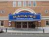
Mahaiwe Block |
|
000000002008-09-12-0000September 12, 2008
(#08000898) |
6-14 Castle St. and 314-322 Main St.
42°11′38″N 73°21′46″W / 42.193823°N 73.362864°W / 42.193823; -73.362864 (Mahaiwe Block) |
Great Barrington |
|
| 74 |
Main Street Cemetery |
|
000000002000-05-18-0000May 18, 2000
(#00000502) |
Main St.
42°28′27″N 73°10′31″W / 42.474167°N 73.175278°W / 42.474167; -73.175278 (Main Street Cemetery) |
Dalton |
|
| 75 |
Main Street Historic District |
|
000000002002-01-17-0000January 17, 2002
(#01001466) |
1-57 Main St., 1-2 Pine St., 2 Sergeant St.
42°16′55″N 73°19′22″W / 42.281944°N 73.322778°W / 42.281944; -73.322778 (Main Street Historic District) |
Stockbridge |
|
| 76 |
Maple Street Cemetery |
|
000000002004-06-02-0000June 2, 2004
(#04000536) |
Maple St.
42°37′35″N 73°07′29″W / 42.626389°N 73.124722°W / 42.626389; -73.124722 (Maple Street Cemetery) |
Adams |
|
| 77 |
Mausert Block |
|
000000001982-04-01-0000April 1, 1982
(#82004948) |
19-27 Park St.
42°37′17″N 73°07′14″W / 42.621389°N 73.120556°W / 42.621389; -73.120556 (Mausert Block) |
Adams |
|
| 78 |
Herman Melville House |
|
000000001966-10-15-0000October 15, 1966
(#66000126) |
Holmes Rd.
42°24′56″N 73°15′04″W / 42.415556°N 73.251111°W / 42.415556; -73.251111 (Herman Melville House) |
Pittsfield |
|
| 79 |
Merrell Tavern |
|
000000001972-02-23-0000February 23, 1972
(#72000136) |
MA 102
42°16′36″N 73°16′59″W / 42.276667°N 73.283056°W / 42.276667; -73.283056 (Merrell Tavern) |
South Lee |
|
| 80 |
Methodist Episcopal Society of Tyringham |
|
000000002000-08-30-0000August 30, 2000
(#00000986) |
128-130 Main Rd.
42°14′38″N 73°12′10″W / 42.243889°N 73.202778°W / 42.243889; -73.202778 (Methodist Episcopal Society of Tyringham) |
Tyringham |
|
| 81 |
Middlefield-Becket Stone Arch Railroad Bridge District |
|
000000001980-04-11-0000April 11, 1980
(#80000502) |
Middlefield vicinity
42°18′44″N 73°01′10″W / 42.3122°N 73.0194°W / 42.3122; -73.0194 (Middlefield-Becket Stone Arch Railroad Bridge District) |
Becket |
Extends into Chester and Middlefield.
|
| 82 |
Mill River Historic District |
|
000000001994-05-17-0000May 17, 1994
(#94000423) |
Roughly bounded by Main St. and River Church, Southfield, Clayton, School, and Hayes Hill Rds., Town of New Marlborough
42°06′49″N 73°16′06″W / 42.113611°N 73.268333°W / 42.113611; -73.268333 (Mill River Historic District) |
Mill River |
|
| 83 |
Mill Village Historic District |
|
000000001983-10-06-0000October 6, 1983
(#83003926) |
Cole Ave., Mill, Arnold, and Elm Sts.
42°43′00″N 73°11′25″W / 42.716667°N 73.190278°W / 42.716667; -73.190278 (Mill Village Historic District) |
Williamstown |
|
| 84 |
Mission House |
|
000000001968-11-24-0000November 24, 1968
(#68000038) |
Main St.
42°16′59″N 73°18′56″W / 42.283156°N 73.315681°W / 42.283156; -73.315681 (Mission House) |
Stockbridge |
|
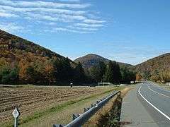
| 85 |
Mohawk Trail |
|
000000001973-04-03-0000April 3, 1973
(#73000283) |
Along the bank of the Cold River
42°38′15″N 72°57′13″W / 42.6375°N 72.953611°W / 42.6375; -72.953611 (Mohawk Trail) |
Florida and Savoy |
|
| 86 |
Montville Baptist Church |
|
000000002006-10-12-0000October 12, 2006
(#06000936) |
5 Hammertown Rd.
42°07′07″N 73°07′29″W / 42.118703°N 73.124853°W / 42.118703; -73.124853 (Montville Baptist Church) |
Sandisfield |
Now the Sandisfield Arts Center
|
| 87 |
Monument Mills |
|
000000001983-11-29-0000November 29, 1983
(#83003927) |
Park and Front Sts.
42°15′19″N 73°21′52″W / 42.255278°N 73.364444°W / 42.255278; -73.364444 (Monument Mills) |
Great Barrington |
|
| 88 |
Monument Square-Eagle Street Historic District |
|
000000001972-06-19-0000June 19, 1972
(#72000132) |
Monument Square and environs, at the eastern end of Main St.; also roughly bounded by Holden, Center, and Union Sts., East Middle School, Summer, and Main Sts.
42°41′57″N 73°06′37″W / 42.699167°N 73.110278°W / 42.699167; -73.110278 (Monument Square-Eagle Street Historic District) |
North Adams |
Second set of boundaries represents a boundary increase of 000000001988-08-25-0000August 25, 1988
|
| 89 |
Morewood School |
|
000000001984-05-31-0000May 31, 1984
(#84002084) |
30 S. Mountain Rd.
42°25′48″N 73°15′40″W / 42.43°N 73.261111°W / 42.43; -73.261111 (Morewood School) |
Pittsfield |
|
| 90 |
Mount Greylock Summit Historic District |
|
000000001998-04-20-0000April 20, 1998
(#98000349) |
Junction of Notch, Rockwell, and Summit Rds.
42°38′16″N 73°10′06″W / 42.637778°N 73.168333°W / 42.637778; -73.168333 (Mount Greylock Summit Historic District) |
Adams |
|
| 91 |
The Mount |
|
000000001971-11-11-0000November 11, 1971
(#71000900) |
South of Lenox on U.S. Route 7
42°19′53″N 73°16′54″W / 42.331389°N 73.281667°W / 42.331389; -73.281667 (The Mount) |
Lenox |
|
| 92 |
Naumkeag |
|
000000001975-11-03-0000November 3, 1975
(#75000264) |
5 Prospect Hill Rd.
42°17′17″N 73°19′05″W / 42.288056°N 73.318056°W / 42.288056; -73.318056 (Naumkeag) |
Stockbridge |
|
| 93 |
New Boston Inn |
|
000000001988-09-01-0000September 1, 1988
(#88001459) |
Junction of MA 8 and MA 57
42°05′38″N 73°04′40″W / 42.093889°N 73.077778°W / 42.093889; -73.077778 (New Boston Inn) |
Sandisfield |
|
| 94 |
New Marlborough Village |
|
000000001982-09-30-0000September 30, 1982
(#82001896) |
MA 57, New Marlborough, Monterey and Southfield Rds.
42°07′30″N 73°13′38″W / 42.125°N 73.227222°W / 42.125; -73.227222 (New Marlborough Village) |
New Marlborough |
|
| 95 |
Nichols-Sterner House |
|
000000001987-09-17-0000September 17, 1987
(#87001997) |
428 Swamp Rd.
42°24′27″N 73°19′11″W / 42.4075°N 73.319722°W / 42.4075; -73.319722 (Nichols-Sterner House) |
Richmond |
|
| 96 |
Norad Mill |
|
000000001985-10-25-0000October 25, 1985
(#85003417) |
60 Roberts Dr.
42°41′55″N 73°08′20″W / 42.698611°N 73.138889°W / 42.698611; -73.138889 (Norad Mill) |
North Adams |
part of the North Adams MRA
|
| 97 |
Normal School Historic District |
|
000000001985-10-25-0000October 25, 1985
(#85003391) |
Roughly Church and Blackinton Sts.
42°41′27″N 73°06′10″W / 42.690833°N 73.102778°W / 42.690833; -73.102778 (Normal School Historic District) |
North Adams |
Mostly Victorian residences near the Massachusetts College of Liberal Arts; part of the North Adams MRA
|
| 98 |
North Becket Village Historic District |
|
000000001988-07-26-0000July 26, 1988
(#88000229) |
Main, High, and Pleasant Sts.
42°19′57″N 73°04′58″W / 42.3325°N 73.082778°W / 42.3325; -73.082778 (North Becket Village Historic District) |
Becket |
|
| 99 |
North Egremont Historic District |
|
000000001989-01-20-0000January 20, 1989
(#88003126) |
Roughly bounded by Shun Toll Rd., Rt. 71, Hillsdale Rd., and Mill Rd.
42°11′55″N 73°26′25″W / 42.198611°N 73.440278°W / 42.198611; -73.440278 (North Egremont Historic District) |
Egremont |
|
| 100 |
Northeast School |
|
000000002002-08-30-0000August 30, 2002
(#02000902) |
981 Summit Rd.
42°24′00″N 73°19′54″W / 42.4°N 73.331667°W / 42.4; -73.331667 (Northeast School) |
Richmond |
|
| 101 |
Old Central Fire Station |
|
000000001977-11-02-0000November 2, 1977
(#77000177) |
66 Allen St.
42°26′58″N 73°15′09″W / 42.449444°N 73.2525°W / 42.449444; -73.2525 (Old Central Fire Station) |
Pittsfield |
|
| 102 |
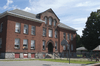
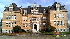
Old Central High School |
|
000000001980-08-06-0000August 6, 1980
(#80000428) |
99 2nd St.[6]
42°27′03″N 73°14′56″W / 42.450833°N 73.248889°W / 42.450833; -73.248889 (Old Central High School) |
Pittsfield |
|
| 103 |
Old Churchyard Cemetery |
|
000000002012-04-16-0000April 16, 2012
(#12000206) |
Adjacent to 918 Jenks Rd.
42°34′51″N 73°07′27″W / 42.580815°N 73.124107°W / 42.580815; -73.124107 (Old Churchyard Cemetery) |
Cheshire |
|
| 104 |
Old Covered Bridge |
|
000000001978-11-24-0000November 24, 1978
(#78000445) |
Covered Bridge Lane
42°07′26″N 73°21′17″W / 42.123889°N 73.354722°W / 42.123889; -73.354722 (Old Covered Bridge) |
Sheffield |
|
| 105 |
Old Curtisville Historic District |
|
000000001976-10-29-0000October 29, 1976
(#76000250) |
North of Stockbridge on MA 183
42°18′57″N 73°19′57″W / 42.315833°N 73.3325°W / 42.315833; -73.3325 (Old Curtisville Historic District) |
Stockbridge |
|
| 106 |
Old Town Hall |
|
000000001972-04-26-0000April 26, 1972
(#72001299) |
32 East St. at the corner of Allen St.
42°26′54″N 73°15′11″W / 42.448333°N 73.253056°W / 42.448333; -73.253056 (Old Town Hall) |
Pittsfield |
|
| 107 |
Benjamin Osborn House |
|
000000001987-10-01-0000October 1, 1987
(#87001758) |
West St., east down abandoned lane
42°07′02″N 73°28′12″W / 42.117222°N 73.47°W / 42.117222; -73.47 (Benjamin Osborn House) |
Mount Washington |
|
| 108 |
Park Square Historic District |
|
000000001975-07-24-0000July 24, 1975
(#75001911) |
At the junction of North, South, East, and West Sts.; also roughly bounded by E. Housatonic, South, North and Fenn Sts. and Wendell Ave.
42°26′54″N 73°15′12″W / 42.448333°N 73.253333°W / 42.448333; -73.253333 (Park Square Historic District) |
Pittsfield |
Second set of boundaries represents a boundary increase of 000000001991-12-23-0000December 23, 1991
|
| 109 |
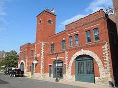
Park Street Firehouse |
|
000000001982-01-28-0000January 28, 1982
(#82004949) |
47 Park St.
42°37′20″N 73°07′12″W / 42.622222°N 73.119936°W / 42.622222; -73.119936 (Park Street Firehouse) |
Adams |
|
| 110 |
Pettibone Farm |
|
000000001991-01-04-0000January 4, 1991
(#90001944) |
Old Cheshire Rd., north of its junction with Nobodys Rd.
42°32′01″N 73°12′01″W / 42.533611°N 73.200278°W / 42.533611; -73.200278 (Pettibone Farm) |
Lanesborough |
|
| 111 |
Phillips Woolen Mill |
|
000000001982-09-30-0000September 30, 1982
(#82001897) |
71 Grove St.
42°36′23″N 73°08′05″W / 42.606389°N 73.134722°W / 42.606389; -73.134722 (Phillips Woolen Mill) |
Adams |
|
| 112 |
Pilgrim Memorial Church and Parish House |
|
000000002005-11-25-0000November 25, 2005
(#05001323) |
249 Wahconah St.
42°27′56″N 73°15′14″W / 42.465556°N 73.253889°W / 42.465556; -73.253889 (Pilgrim Memorial Church and Parish House) |
Pittsfield |
|
| 113 |
Pittsfield & North Adams Passenger Station and Baggage & Express House |
|
000000001982-04-01-0000April 1, 1982
(#82004950) |
10 Pleasant St.
42°37′18″N 73°07′09″W / 42.621798°N 73.119068°W / 42.621798; -73.119068 (Pittsfield & North Adams Passenger Station and Baggage & Express House) |
Adams |
|
| 114 |
Pittsfield Cemetery |
|
000000002007-03-13-0000March 13, 2007
(#07000145) |
203 Wahconah St.
42°28′01″N 73°15′28″W / 42.466936°N 73.257783°W / 42.466936; -73.257783 (Pittsfield Cemetery) |
Pittsfield |
|
| 115 |
Charles Whittlesey Power House |
|
000000001997-08-08-0000August 8, 1997
(#97000820) |
575 South St.
42°25′44″N 73°15′21″W / 42.428889°N 73.255833°W / 42.428889; -73.255833 (Charles Whittlesey Power House) |
Pittsfield |
|
| 116 |
Providence Court |
|
000000001987-11-20-0000November 20, 1987
(#87001107) |
379 East St.
42°26′51″N 73°14′47″W / 42.4475°N 73.246389°W / 42.4475; -73.246389 (Providence Court) |
Pittsfield |
|
| 117 |
Quaker Meetinghouse |
|
000000001976-08-17-0000August 17, 1976
(#76000236) |
Maple Street Cemetery
42°37′38″N 73°07′34″W / 42.627222°N 73.126111°W / 42.627222; -73.126111 (Quaker Meetinghouse) |
Adams |
|
| 118 |
Ramsdell Public Library |
|
000000002014-07-25-0000July 25, 2014
(#14000440) |
1087 Main St.
42°15′29″N 73°21′55″W / 42.2581°N 73.3653°W / 42.2581; -73.3653 (Ramsdell Public Library) |
Great Barrington |
|
| 119 |
Renfrew Mill No. 2 |
|
000000001982-10-14-0000October 14, 1982
(#82000474) |
217 Columbia St.
42°38′15″N 73°06′26″W / 42.6375°N 73.107222°W / 42.6375; -73.107222 (Renfrew Mill No. 2) |
Adams |
|
| 120 |
A.H. Rice Silk Mill |
|
000000002015-03-02-0000March 2, 2015
(#15000047) |
55 Spring St.
42°27′24″N 73°14′30″W / 42.4568°N 73.2417°W / 42.4568; -73.2417 (A.H. Rice Silk Mill) |
Pittsfield |
|
| 121 |
Richmond Furnace Historical and Archeological District |
|
000000001999-08-31-0000August 31, 1999
(#99001044) |
State, Cone Hill, and Furnace Rds.
42°21′21″N 73°22′32″W / 42.355833°N 73.375556°W / 42.355833; -73.375556 (Richmond Furnace Historical and Archeological District) |
Richmond |
|
| 122 |
Rising Paper Mill |
|
000000001975-08-11-0000August 11, 1975
(#75000253) |
North of Great Barrington on MA 183 at Risingdale
42°14′28″N 73°21′28″W / 42.241111°N 73.357778°W / 42.241111; -73.357778 (Rising Paper Mill) |
Great Barrington |
|
| 123 |
Rock Ridge |
|
000000001983-09-16-0000September 16, 1983
(#83000569) |
Tyringham Rd.
42°11′08″N 73°13′19″W / 42.185556°N 73.221944°W / 42.185556; -73.221944 (Rock Ridge) |
Monterey |
|
| 124 |
Philemon Sage House |
|
000000001982-08-31-0000August 31, 1982
(#82001898) |
MA 183
42°03′17″N 73°09′03″W / 42.054722°N 73.150833°W / 42.054722; -73.150833 (Philemon Sage House) |
Sandisfield |
|
| 125 |
Saint Andrew's Chapel |
|
000000001986-09-12-0000September 12, 1986
(#86002142) |
Washington Mountain Rd.
42°21′27″N 73°07′58″W / 42.3575°N 73.132778°W / 42.3575; -73.132778 (Saint Andrew's Chapel) |
Washington |
part of the Washington MRA
|
| 126 |
St. Joseph's School |
|
000000001983-12-22-0000December 22, 1983
(#83003928) |
Eagle St.
42°42′04″N 73°06′33″W / 42.701111°N 73.109167°W / 42.701111; -73.109167 (St. Joseph's School) |
North Adams |
|
| 127 |
St. Luke's Episcopal Church |
|
000000001972-02-23-0000February 23, 1972
(#72000127) |
U.S. 7
42°32′06″N 73°13′48″W / 42.5351°N 73.2299°W / 42.5351; -73.2299 (St. Luke's Episcopal Church) |
Lanesborough |
|
| 128 |
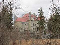
Searles Castle |
|
000000001982-04-15-0000April 15, 1982
(#82004953) |
Main St.
42°11′23″N 73°21′42″W / 42.189722°N 73.361667°W / 42.189722; -73.361667 (Searles Castle) |
Great Barrington |
|
| 129 |
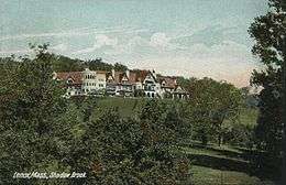
Shadow Brook Farm Historic District |
|
000000001988-03-10-0000March 10, 1988
(#88000202) |
Lenox West Rd., MA 183 near Bucks Ln.
42°20′41″N 73°19′38″W / 42.344722°N 73.327222°W / 42.344722; -73.327222 (Shadow Brook Farm Historic District) |
Stockbridge |
|
| 130 |
Shaker Farm |
|
000000001995-11-06-0000November 6, 1995
(#95001198) |
opposite 1448 Dublin Rd.
42°22′53″N 73°21′13″W / 42.381389°N 73.353611°W / 42.381389; -73.353611 (Shaker Farm) |
Richmond |
|
| 131 |
Sheffield Center Historic District |
|
000000001989-12-01-0000December 1, 1989
(#89002060) |
Roughly US 7/Main St. from Miller Ave. to Salisbury Rd.
42°06′22″N 73°21′09″W / 42.106111°N 73.3525°W / 42.106111; -73.3525 (Sheffield Center Historic District) |
Sheffield |
|
| 132 |
Sheffield Plain Historic District |
|
000000001988-06-23-0000June 23, 1988
(#88000881) |
Roughly 0.5 miles (0.80 km) off U.S. Route 7, south from Cook Rd.
42°07′22″N 73°21′20″W / 42.122778°N 73.355556°W / 42.122778; -73.355556 (Sheffield Plain Historic District) |
Sheffield |
|
| 133 |
Thomas Shepard House |
|
000000001984-05-31-0000May 31, 1984
(#84002085) |
764 East Hill Rd.
42°05′21″N 73°12′02″W / 42.08929°N 73.200682°W / 42.08929; -73.200682 (Thomas Shepard House) |
New Marlborough |
|
| 134 |
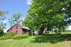
Eber Sherman Farm |
|
000000001983-10-06-0000October 6, 1983
(#83003929) |
1010 State Rd.
42°42′03″N 73°10′10″W / 42.70082°N 73.16938°W / 42.70082; -73.16938 (Eber Sherman Farm) |
North Adams |
|
| 135 |
William B. Sherman Farm |
|
000000001985-10-25-0000October 25, 1985
(#85003419) |
1072 State Rd.
42°42′03″N 73°10′24″W / 42.700833°N 73.173333°W / 42.700833; -73.173333 (William B. Sherman Farm) |
North Adams |
part of the North Adams MRA
|
| 136 |
Sibley-Corcoran House |
|
000000001986-09-12-0000September 12, 1986
(#86002143) |
387 Valley Rd.
42°22′33″N 73°06′46″W / 42.375722°N 73.112639°W / 42.375722; -73.112639 (Sibley-Corcoran House) |
Washington |
part of the Washington MRA
|
| 137 |
Simmons Block |
|
000000001982-04-01-0000April 1, 1982
(#82004951) |
86-90 Park St.
42°37′25″N 73°07′14″W / 42.623611°N 73.120556°W / 42.623611; -73.120556 (Simmons Block) |
Adams |
|
| 138 |
Col. Benjamin Simond House |
|
000000001983-09-01-0000September 1, 1983
(#83000570) |
643 Simonds Rd.
42°43′47″N 73°12′20″W / 42.729722°N 73.205556°W / 42.729722; -73.205556 (Col. Benjamin Simond House) |
Williamstown |
|
| 139 |
Society of the Congregational Church of Great Barrington |
|
000000001992-08-20-0000August 20, 1992
(#92000999) |
241 and 251 Main St.
42°11′43″N 73°21′41″W / 42.195278°N 73.361389°W / 42.195278; -73.361389 (Society of the Congregational Church of Great Barrington) |
Great Barrington |
|
| 140 |
South Center School House |
|
000000001986-09-12-0000September 12, 1986
(#86002144) |
Washington Mountain Rd.
42°21′00″N 73°07′33″W / 42.35°N 73.125833°W / 42.35; -73.125833 (South Center School House) |
Washington |
part of the Washington MRA
|
| 141 |
South Egremont Village Historic District |
|
000000001984-05-31-0000May 31, 1984
(#84002086) |
MA 23-41, Buttonball Lane, Sheffield, and Pinecrest Hill Rds.
42°09′28″N 73°24′38″W / 42.157778°N 73.410556°W / 42.157778; -73.410556 (South Egremont Village Historic District) |
South Egremont |
|
| 142 |
South Lee Historic District |
|
000000001999-02-18-0000February 18, 1999
(#99000237) |
1365-1710 Pleasant-1120-1140 Fairview St.-15-80 Willow St.
42°16′42″N 73°16′33″W / 42.278267°N 73.275908°W / 42.278267; -73.275908 (South Lee Historic District) |
Lee |
|
| 143 |
South Mountain Concert Hall |
|
000000001973-08-14-0000August 14, 1973
(#73001943) |
New South Mountain Rd.
42°25′05″N 73°17′21″W / 42.418056°N 73.289167°W / 42.418056; -73.289167 (South Mountain Concert Hall) |
Pittsfield |
|
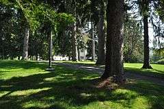
| 144 |
Springside Park |
|
000000002008-06-27-0000June 27, 2008
(#08000553) |
874 North St.
42°28′17″N 73°14′40″W / 42.471478°N 73.244494°W / 42.471478; -73.244494 (Springside Park) |
Pittsfield |
|
| 145 |
Stafford Hill Memorial |
|
000000001986-02-14-0000February 14, 1986
(#86000260) |
Stafford Hill Rd.
42°34′28″N 73°06′59″W / 42.574444°N 73.116389°W / 42.574444; -73.116389 (Stafford Hill Memorial) |
Cheshire |
|
| 146 |
Stockbridge Casino |
|
000000001976-08-27-0000August 27, 1976
(#76000249) |
E. Main St. at Yale Hill Rd.
42°16′56″N 73°18′06″W / 42.282222°N 73.301667°W / 42.282222; -73.301667 (Stockbridge Casino) |
Stockbridge |
|
| 147 |
Summer Street Historic District |
|
000000001985-09-05-0000September 5, 1985
(#85002009) |
Crandall, Center, East, Liberty, Orchard and Summer Sts.
42°37′07″N 73°07′01″W / 42.618611°N 73.116944°W / 42.618611; -73.116944 (Summer Street Historic District) |
Adams |
|
| 148 |
Sykes House |
|
000000001985-10-25-0000October 25, 1985
(#85003420) |
521 W. Main St.
42°41′56″N 73°07′59″W / 42.698889°N 73.133056°W / 42.698889; -73.133056 (Sykes House) |
North Adams |
part of the North Adams MRA
|
| 149 |
Taconic and West Avenues Historic District |
|
000000001998-06-11-0000June 11, 1998
(#98000680) |
Roughly bounded by Main St., Maple, West, and Taconic Aves., and Castle St.
42°11′27″N 73°22′05″W / 42.190833°N 73.368056°W / 42.190833; -73.368056 (Taconic and West Avenues Historic District) |
Great Barrington |
|
| 150 |
Trinity Episcopal Church |
|
000000001996-04-04-0000April 4, 1996
(#96000363) |
102 Walker St.
42°21′16″N 73°16′56″W / 42.354444°N 73.282222°W / 42.354444; -73.282222 (Trinity Episcopal Church) |
Lenox |
|
| 151 |
Tyringham Cemetery |
|
000000002009-09-16-0000September 16, 2009
(#09000716) |
Church Rd.
42°14′34″N 73°12′05″W / 42.242703°N 73.201444°W / 42.242703; -73.201444 (Tyringham Cemetery) |
Tyringham |
|
| 152 |
Tyringham Shaker Settlement Historic District |
|
000000001987-10-15-0000October 15, 1987
(#87001785) |
Jerusalem Rd.
42°14′46″N 73°13′30″W / 42.246111°N 73.225°W / 42.246111; -73.225 (Tyringham Shaker Settlement Historic District) |
Tyringham |
|
| 153 |
Upper Historic District |
|
000000001987-09-02-0000September 2, 1987
(#86002145) |
Roughly between Branch and Frost Rds. on Washington Mountain Rd.
42°21′48″N 73°08′37″W / 42.363333°N 73.143611°W / 42.363333; -73.143611 (Upper Historic District) |
Washington |
part of the Washington MRA
|
| 154 |
Upper North Street Commercial District |
|
000000002002-12-27-0000December 27, 2002
(#02001615) |
220-555 North St., 33 Eagle St.
42°27′14″N 73°15′09″W / 42.453889°N 73.2525°W / 42.453889; -73.2525 (Upper North Street Commercial District) |
Pittsfield |
|
| 155 |
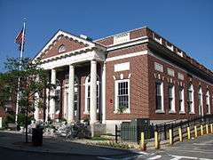
US Post Office-Great Barrington Main |
|
000000001986-01-10-0000January 10, 1986
(#86000163) |
222 Main St.
42°12′N 73°22′W / 42.2°N 73.36°W / 42.2; -73.36 (US Post Office-Great Barrington Main) |
Great Barrington |
|
| 156 |
US Post Office-Williamstown Main |
|
000000001986-07-17-0000July 17, 1986
(#86002243) |
56 Spring St.
42°42′38″N 73°12′14″W / 42.710556°N 73.203889°W / 42.710556; -73.203889 (US Post Office-Williamstown Main) |
Williamstown |
|
| 157 |
Ventfort Hall |
|
000000001993-03-05-0000March 5, 1993
(#93000055) |
120 and 148 Walker St. and 55 Kemble St.
42°21′11″N 73°16′48″W / 42.353056°N 73.28°W / 42.353056; -73.28 (Ventfort Hall) |
Lenox |
|
| 158 |
Villa Virginia |
|
000000001983-11-29-0000November 29, 1983
(#83003930) |
Ice Glen Rd.
42°16′27″N 73°18′41″W / 42.274167°N 73.311389°W / 42.274167; -73.311389 (Villa Virginia) |
Stockbridge |
|
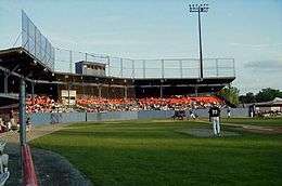
| 159 |
Wahconah Park |
|
000000002005-08-12-0000August 12, 2005
(#05000878) |
143 Wahconah St.
42°27′45″N 73°15′05″W / 42.462592°N 73.251514°W / 42.462592; -73.251514 (Wahconah Park) |
Pittsfield |
|
| 160 |
Wells House |
|
000000001985-10-25-0000October 25, 1985
(#85003393) |
568 W. Main St.
42°41′54″N 73°08′05″W / 42.698333°N 73.134722°W / 42.698333; -73.134722 (Wells House) |
North Adams |
part of the North Adams MRA
|
| 161 |
West Stockbridge Grange No. 246 |
|
000000001999-02-05-0000February 5, 1999
(#99000134) |
5 Swamp Rd.
42°20′09″N 73°22′07″W / 42.335833°N 73.368611°W / 42.335833; -73.368611 (West Stockbridge Grange No. 246) |
West Stockbridge |
|
| 162 |
West Stockbridge Town Hall |
|
000000002009-07-01-0000July 1, 2009
(#09000469) |
9 Main St.
42°20′03″N 73°22′01″W / 42.334167°N 73.367083°W / 42.334167; -73.367083 (West Stockbridge Town Hall) |
West Stockbridge |
|
| 163 |
Westover-Bacon-Potts Farm |
|
000000001990-07-27-0000July 27, 1990
(#90000157) |
MA 41, south of its junction with MA 23
42°08′53″N 73°25′01″W / 42.148056°N 73.416944°W / 42.148056; -73.416944 (Westover-Bacon-Potts Farm) |
Egremont |
|
| 164 |
Wheatleigh |
|
000000001982-04-06-0000April 6, 1982
(#82004956) |
W. Hawthorne Rd.
42°20′27″N 73°18′14″W / 42.340833°N 73.303889°W / 42.340833; -73.303889 (Wheatleigh) |
Stockbridge |
|
| 165 |
Wheeler Family Farmstead |
|
000000002011-09-06-0000September 6, 2011
(#11000614) |
817 S. Main St.
42°10′43″N 73°21′46″W / 42.178611°N 73.362778°W / 42.178611; -73.362778 (Wheeler Family Farmstead) |
Great Barrington |
|
| 166 |
Williamstown Rail Yard and Station Historic District |
|
000000001994-06-03-0000June 3, 1994
(#94000544) |
Junction of Cole Ave. and N. Hoosac Rd.
42°43′11″N 73°11′25″W / 42.719722°N 73.190278°W / 42.719722; -73.190278 (Williamstown Rail Yard and Station Historic District) |
Williamstown |
|
| 167 |
Windsor Print Works |
|
000000001973-05-17-0000May 17, 1973
(#73000296) |
121 Union St.
42°42′02″N 73°06′18″W / 42.700556°N 73.105°W / 42.700556; -73.105 (Windsor Print Works) |
North Adams |
|
| 168 |
Wollison-Shipton Building |
|
000000001982-09-30-0000September 30, 1982
(#82001899) |
142-156 North St.
42°27′02″N 73°15′12″W / 42.450556°N 73.253333°W / 42.450556; -73.253333 (Wollison-Shipton Building) |
Pittsfield |
|
_3.jpg)
.JPG)
_-_house.JPG)


.jpg)

%2C_Pittsfield%2C_Massachusetts.JPG)
.JPG)
_-_general_view.JPG)


_%2C_Egremont_Mass.JPG)