| [3] |
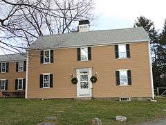
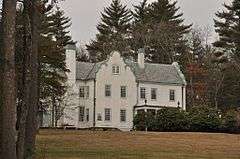
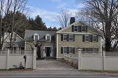
Name on the Register |
Image |
Date listed[4] |
Location |
City or town |
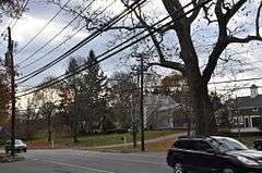
Description |
|---|
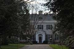
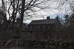
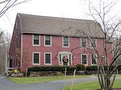
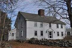
| 1 |
Assington |
|
000000001986-01-03-0000January 3, 1986
(#86000490) |
172 Forest St.
42°13′41″N 71°20′30″W / 42.228056°N 71.341667°W / 42.228056; -71.341667 (Assington) |
|
|
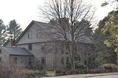
| 2 |
Bullen-Stratton-Cozzen House |
|
000000001986-01-03-0000January 3, 1986
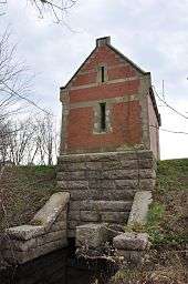
(#86000496) |
52 Brush Hill Rd.
42°15′15″N 71°24′06″W / 42.254167°N 71.401667°W / 42.254167; -71.401667 (Bullen-Stratton-Cozzen House) |
|
|
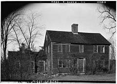
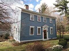
| 3 |
Clark-Northrup House |
|
000000001986-01-03-0000January 3, 1986
(#86000497) |
93 Maple St.
42°14′19″N 71°23′14″W / 42.238611°N 71.387222°W / 42.238611; -71.387222 (Clark-Northrup House) |
|
|
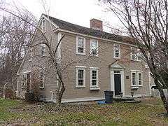
| 4 |
Joseph Cleale House |
|
000000001986-01-03-0000January 3, 1986
(#86000498) |
147 Western Ave.
42°14′21″N 71°24′23″W / 42.239167°N 71.406389°W / 42.239167; -71.406389 (Joseph Cleale House) |
|
|
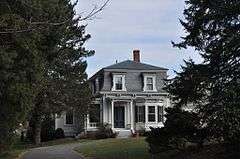
| 5 |
Rev. Edmund Dowse House |
|
000000001986-01-03-0000January 3, 1986
(#86000499) |
25 Farm Rd.
42°14′19″N 71°21′55″W / 42.238611°N 71.365278°W / 42.238611; -71.365278 (Rev. Edmund Dowse House) |
|
|
| 6 |
Edward's Plain-Dowse's Corner Historic District |
|
000000001986-01-03-0000January 3, 1986
(#86000492) |
N. Main St. between Eliot and Everett Sts.
42°15′11″N 71°22′06″W / 42.253056°N 71.368333°W / 42.253056; -71.368333 (Edward's Plain-Dowse's Corner Historic District) |
|
|
| 7 |
Thomas Fleming House |
|
000000001986-01-03-0000January 3, 1986
(#86000500) |
18 Maple St.
42°14′28″N 71°22′29″W / 42.241111°N 71.374722°W / 42.241111; -71.374722 (Thomas Fleming House) |
|
|
| 8 |
Addington Gardner House |
|
000000001990-03-09-0000March 9, 1990
(#90000179) |
128 Hollis St.
42°12′58″N 71°23′55″W / 42.216111°N 71.398611°W / 42.216111; -71.398611 (Addington Gardner House) |
|
|
| 9 |
Eleazer Goulding House |
|
000000001986-01-03-0000January 3, 1986
(#86000501) |
137 Western Ave.
42°14′27″N 71°24′24″W / 42.240833°N 71.406667°W / 42.240833; -71.406667 (Eleazer Goulding House) |
|
|
| 10 |
Charles Holbrook House |
|
000000001986-01-03-0000January 3, 1986
(#86000502) |
137 S. Main St.
42°13′31″N 71°21′47″W / 42.225278°N 71.363056°W / 42.225278; -71.363056 (Charles Holbrook House) |
|
|
| 11 |
Deacon William Leland House |
|
000000001986-01-03-0000January 3, 1986
(#86000503) |
27 Hollis St.
42°12′29″N 71°23′05″W / 42.207962°N 71.384714°W / 42.207962; -71.384714 (Deacon William Leland House) |
|
|
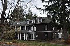
| 12 |
Charles D. Lewis House |
|
000000001986-01-03-0000January 3, 1986
(#86000504) |
81 Hunting Ln.
42°14′58″N 71°23′00″W / 42.249444°N 71.383333°W / 42.249444; -71.383333 (Charles D. Lewis House) |
|
|
| 13 |
Daniel Morse III House |
|
000000001986-01-03-0000January 3, 1986
(#86000505) |
210 Farm Rd.
42°14′05″N 71°20′13″W / 42.234722°N 71.336944°W / 42.234722; -71.336944 (Daniel Morse III House) |
|
|
| 14 |
Morse-Barber House |
|
000000001986-01-03-0000January 3, 1986
(#86000493) |
46 Forest St.
42°13′14″N 71°21′23″W / 42.220556°N 71.356389°W / 42.220556; -71.356389 (Morse-Barber House) |
|
|
| 15 |
Morse-Tay-Leland-Hawes House |
|
000000001986-01-03-0000January 3, 1986
(#86000506) |
266 Western Ave.
42°13′24″N 71°24′03″W / 42.223333°N 71.400833°W / 42.223333; -71.400833 (Morse-Tay-Leland-Hawes House) |
|
|
| 16 |
Asa Sanger House |
|
000000001986-01-03-0000January 3, 1986
(#86000507) |
70 Washington St.
42°14′08″N 71°22′52″W / 42.235556°N 71.381111°W / 42.235556; -71.381111 (Asa Sanger House) |
|
|
| 17 |
Richard Sanger III House |
|
000000001986-01-03-0000January 3, 1986
(#86000508) |
60 Washington St.
42°14′09″N 71°22′48″W / 42.235833°N 71.38°W / 42.235833; -71.38 (Richard Sanger III House) |
|
|
| 18 |
Sawin-Bullen-Bullard House |
|
000000001986-01-03-0000January 3, 1986
(#86000509) |
60 Brush Hill Rd.
42°15′27″N 71°24′15″W / 42.2575°N 71.404167°W / 42.2575; -71.404167 (Sawin-Bullen-Bullard House) |
|
|
| 19 |
Sewall-Ware House |
|
000000001986-01-03-0000January 3, 1986
(#86000494) |
100 S. Main St.
42°13′43″N 71°22′02″W / 42.228611°N 71.367222°W / 42.228611; -71.367222 (Sewall-Ware House) |
|
|
| 20 |
Sherborn Center Historic District |
|
000000001986-01-03-0000January 3, 1986
(#86000495) |
Roughly bounded by Zion's Ln., Conrail railroad tracks, Farm and Sawin Sts., and Washington and N. Main Sts.
42°14′30″N 71°22′16″W / 42.241667°N 71.371111°W / 42.241667; -71.371111 (Sherborn Center Historic District) |
|
|
| 21 |
Sudbury Aqueduct Linear District |
|
000000001990-01-18-0000January 18, 1990
(#89002293) |
Along Sudbury Aqueduct from Farm Pond at Waverly St. (Framingham) to Chestnut Hill Reservoir (Newton)
42°16′09″N 71°22′56″W / 42.269052°N 71.382136°W / 42.269052; -71.382136 (Sudbury Aqueduct Linear District) |
|
Extends from Framingham to Newton.
|
| 22 |
Joseph Twitchell House |
|
000000001986-01-03-0000January 3, 1986
(#86000510) |
32 Pleasant St.
42°13′55″N 71°24′06″W / 42.231944°N 71.401667°W / 42.231944; -71.401667 (Joseph Twitchell House) |
|
|
| 23 |
H. G. Vaughn House |
|
000000001986-01-03-0000January 3, 1986
(#86000511) |
5 Sparhawk Rd.
42°12′24″N 71°22′09″W / 42.206667°N 71.369167°W / 42.206667; -71.369167 (H. G. Vaughn House) |
|
|
| 24 |
Ware's Tavern |
|
000000001986-01-03-0000January 3, 1986
(#86000512) |
113 S. Main St.
42°13′39″N 71°21′58″W / 42.2275°N 71.366111°W / 42.2275; -71.366111 (Ware's Tavern) |
|
|
| 25 |
Woodland Farm-Leland House |
|
000000001986-01-03-0000January 3, 1986
(#86000513) |
104 Woodland St.
42°13′19″N 71°22′54″W / 42.221944°N 71.381667°W / 42.221944; -71.381667 (Woodland Farm-Leland House) |
|
|