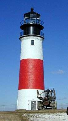
Dumpling Rocks Light
 US Coast Guard photo of the 1889 structure | |
 | |
| Location | Dumpling Rock, Buzzards Bay, Massachusetts |
|---|---|
| Coordinates | 41°32′17.8″N 70°55′17.1″W / 41.538278°N 70.921417°WCoordinates: 41°32′17.8″N 70°55′17.1″W / 41.538278°N 70.921417°W |
| Year first constructed | 1829 (first tower) |
| Year first lit | 1889 (last tower) |
| Automated | 1942 |
| Deactivated | 1942 replaced by skeleton tower (below) |
| Tower shape | Square wood tower attached to house |
| Markings / pattern | Black lantern on white tower and house |
| Original lens | Fourth and fifth order Fresnel lens |
| Characteristic | F W with R sector |
| Fog signal |
Second class Daboli trumpet, 1 every 15s [1] |
|
| |
| Location | Dumpling Rock, Buzzards Bay, Massachusetts |
|---|---|
| Coordinates | 41°32′17.8″N 70°55′17.1″W / 41.538278°N 70.921417°W |
| Year first constructed | 1942 |
| Automated | 1942 |
| Construction | Skeleton tower |
| Markings / pattern | Square Green Daymark |
| Focal height | 52 feet (16 m) |
| Range | 8 nautical miles (15 km; 9.2 mi) |
| Characteristic | Fl G 6s |
| Fog signal | none |
| USCG number |
1-16040 [2] |
Dumpling Rocks Light is a light on a skeleton tower on Dumpling Rock, Buzzards Bay, Massachusetts. It replaced the wooden Dumpling Rock Light, built 1889, which in turn replaced the original stone lighthouse established in 1829.
References
- ↑ "Historic Light Station Information and Photography: Massachusetts". United States Coast Guard Historian's Office. 2009-09-01.
- ↑ United States Coast Guard (2009). Light List, Volume I, Atlantic Coast, St. Croix River, Maine to Shrewsbury River, New Jersey. p. 143.
This article is issued from Wikipedia - version of the 11/8/2013. The text is available under the Creative Commons Attribution/Share Alike but additional terms may apply for the media files.