| [3] |
Name on the Register |
Image |
Date listed[4] |
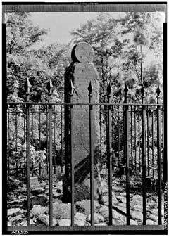
Location |
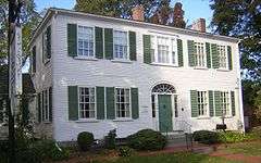
City or town |
Description |
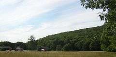
|---|
| 1 |
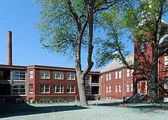
John Adams School |
|
000000001985-12-05-0000December 5, 1985
(#85003068) |
16 Church St.
42°13′47″N 70°56′46″W / 42.2297°N 70.9461°W / 42.2297; -70.9461 (John Adams School) |
Weymouth |
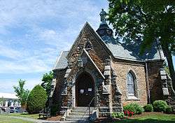
|
| 2 |
All Souls Church |
|
000000002015-07-07-0000July 7, 2015
(#15000389) |
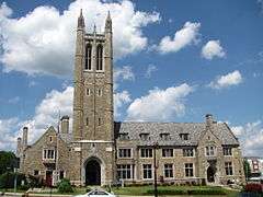
196 Elm St.
42°13′23″N 71°00′02″W / 42.2231°N 71.0006°W / 42.2231; -71.0006 (All Souls Church) |
Braintree |
|
| 3 |
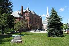
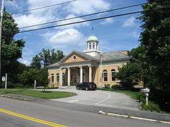
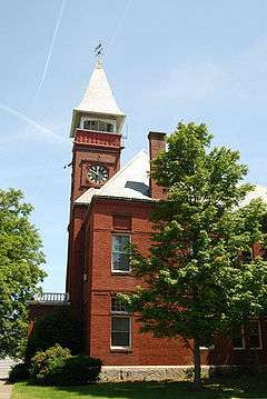
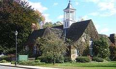
Ames Schoolhouse |
|
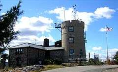
000000001983-03-31-0000March 31, 1983
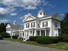
(#83004284) |
450 Washington St.
42°14′43″N 71°10′29″W / 42.2453°N 71.1747°W / 42.2453; -71.1747 (Ames Schoolhouse) |
Dedham |
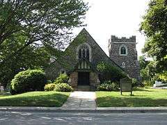
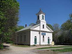
|
| 4 |
Angle Tree Stone |
|
000000001976-01-01-0000January 1, 1976
(#76000228) |
West of North Attleborough off High St.
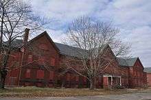
41°59′06″N 71°21′54″W / 41.985°N 71.365°W / 41.985; -71.365 (Angle Tree Stone) |
Plainville |
|
| 5 |
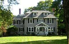
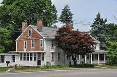
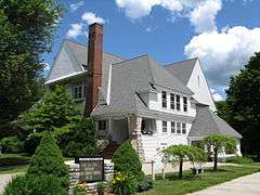
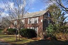
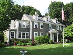
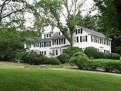
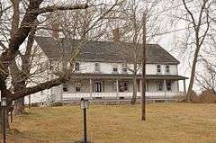
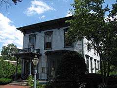
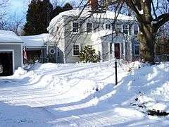
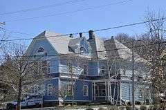
Jonathan Belcher House |
|
000000001976-04-30-0000April 30, 1976
(#76000291) |
360 N. Main St.
42°10′09″N 71°02′46″W / 42.1692°N 71.0461°W / 42.1692; -71.0461 (Jonathan Belcher House) |
Randolph |
|
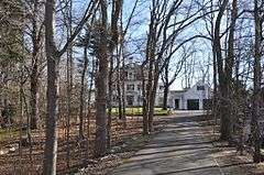
| 6 |
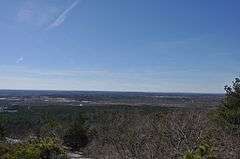
Blue Hills Reservation Parkways-Metropolitan Park System of Greater Boston |
|
000000002003-08-11-0000August 11, 2003
(#03000746) |
Parts of Blue Hill Rd., Chickatawbut Rd., Hillside St., Uniquity Rd., Wampatuck Rd., and Green St.
42°13′34″N 71°04′20″W / 42.2261°N 71.0722°W / 42.2261; -71.0722 (Blue Hills Reservation Parkways-Metropolitan Park System of Greater Boston) |
Braintree and Canton |
Extends into Milton and Quincy; part of the Metropolitan Park System of Greater Boston Multiple Property Submission (MPS)
|
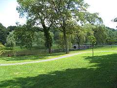
| 7 |
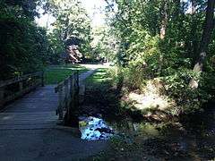
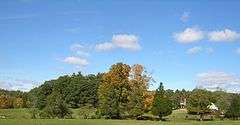
Borderland Historic District |
|
000000001997-06-16-0000June 16, 1997
(#97000497) |
Massapoag Street
42°04′02″N 71°09′24″W / 42.0671°N 71.1567°W / 42.0671; -71.1567 (Borderland Historic District) |
Sharon |
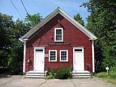
Coextensive with Borderland State Park, extending into Easton in Bristol County.
|
| 8 |
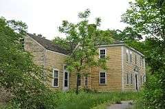
Seth Boyden House |
|
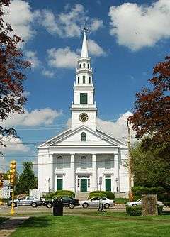
000000001983-11-10-0000November 10, 1983
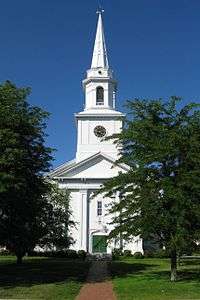
(#83004092) |
135 Oak St.
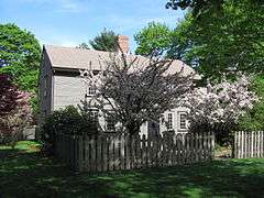
42°04′22″N 71°13′05″W / 42.0728°N 71.2181°W / 42.0728; -71.2181 (Seth Boyden House) |
Foxborough |
|
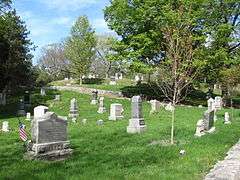
| 9 |
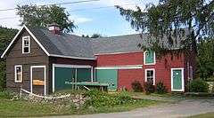
Brookwood Farm |
|
000000001980-09-25-0000September 25, 1980
(#80000655) |
Off Blue Hill River Rd.
42°12′34″N 71°06′41″W / 42.2094°N 71.1114°W / 42.2094; -71.1114 (Brookwood Farm) |
Canton |
Extends into Milton
|
| 10 |
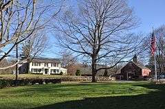
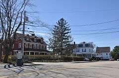
Canton Corner Historic District |
|
000000002009-09-09-0000September 9, 2009
(#09000697) |
Roughly Washington St. from Pecunit St. to southwest of Dedham St., and Pleasant St. from Washington St. to Reservoir Rd.
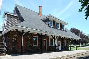
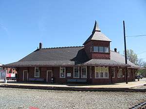
42°10′26″N 71°08′10″W / 42.1738°N 71.1361°W / 42.1738; -71.1361 (Canton Corner Historic District) |
Canton |
|
| 11 |
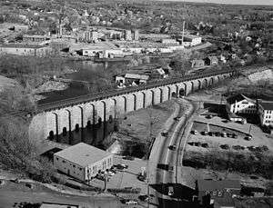
Canton Viaduct |
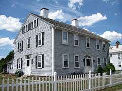
|
000000001984-09-20-0000September 20, 1984
(#84002870) |
At the intersection of Neponset St. and Walpole St.
42°09′32″N 71°09′14″W / 42.1589°N 71.1539°W / 42.1589; -71.1539 (Canton Viaduct) |
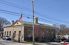
Canton |
Built in 1835
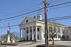
|
| 12 |
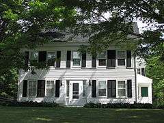
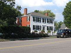
Ezra Carpenter House |
|
000000001985-01-03-0000January 3, 1985
(#85000029) |
168 South St.
42°03′07″N 71°15′17″W / 42.0519°N 71.2547°W / 42.0519; -71.2547 (Ezra Carpenter House) |
Foxborough |
|
| 13 |
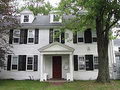
Otis Cary House |
|
000000001986-03-13-0000March 13, 1986
(#86000379) |
242 South St.
42°02′42″N 71°15′36″W / 42.045°N 71.26°W / 42.045; -71.26 (Otis Cary House) |
Foxborough |
|
| 14 |
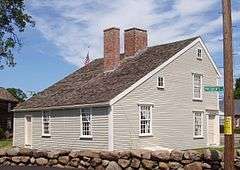
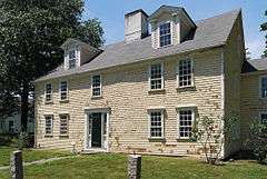
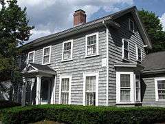
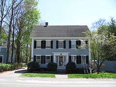
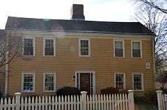
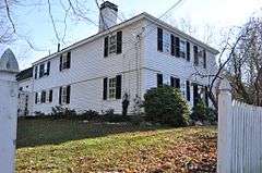
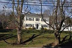
Benjamin Caryl House |
|
000000002000-06-02-0000June 2, 2000
(#00000569) |
107 Dedham St.
42°14′53″N 71°16′17″W / 42.2481°N 71.2714°W / 42.2481; -71.2714 (Benjamin Caryl House) |
Dover |
|
| 15 |
Central Square Historic District |
|
000000001992-02-13-0000February 13, 1992
(#92000040) |
Roughly Broad St. from Middle to Putnam Sts. and Middle from Charles to Center Sts.
42°13′00″N 70°56′12″W / 42.2167°N 70.9367°W / 42.2167; -70.9367 (Central Square Historic District) |
Weymouth |
|
| 16 |
Lucius Clapp Memorial |
|
000000001992-08-18-0000August 18, 1992
(#92000998) |
6 Park St.
42°07′27″N 71°06′05″W / 42.1242°N 71.1014°W / 42.1242; -71.1014 (Lucius Clapp Memorial) |
Stoughton |
|
| 17 |
Cobb's Tavern |
|
000000001974-08-07-0000August 7, 1974
(#74000383) |
41 Bay Rd.
42°08′14″N 71°08′58″W / 42.1372°N 71.1494°W / 42.1372; -71.1494 (Cobb's Tavern) |
Sharon |
|
| 18 |
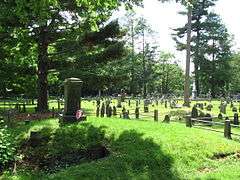
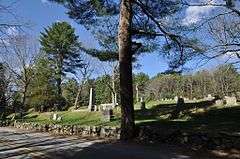
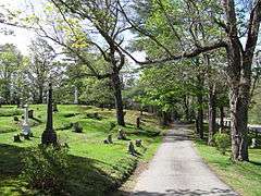
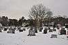
Cohasset Central Cemetery |
|
000000002002-12-27-0000December 27, 2002
(#02001612) |
N. Main St. and Joy Place
42°14′45″N 70°48′26″W / 42.2458°N 70.8072°W / 42.2458; -70.8072 (Cohasset Central Cemetery) |
Cohasset |
|
| 19 |
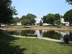
Cohasset Common Historic District |
|
000000001996-02-28-0000February 28, 1996
(#96000058) |
Bounded by Highland Ave., N. Main St., William B. Long, Jr., Rd. and Robert E. Jason Rd.
42°14′32″N 70°48′10″W / 42.2422°N 70.8028°W / 42.2422; -70.8028 (Cohasset Common Historic District) |
Cohasset |
|
| 20 |
Colburn School – High Street Historic District |
|
000000002000-06-09-0000June 9, 2000
(#00000641) |
369–649, 390–680 High St.
42°13′48″N 71°13′17″W / 42.23°N 71.2214°W / 42.23; -71.2214 (Colburn School – High Street Historic District) |
Westwood |
|
| 21 |
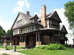
Fred Holland Day House |
|
000000001977-04-18-0000April 18, 1977
(#77000191) |
93 Day St.
42°11′35″N 71°12′13″W / 42.1931°N 71.2036°W / 42.1931; -71.2036 (Fred Holland Day House) |
Norwood |
|
| 22 |
Dean Junior College Historic District |
|
000000001975-04-23-0000April 23, 1975
(#75000285) |
Dean College campus
42°05′07″N 71°23′56″W / 42.0853°N 71.3989°W / 42.0853; -71.3989 (Dean Junior College Historic District) |
Franklin |
|
| 23 |
Dedham Village Historic District |
|
000000002006-09-06-0000September 6, 2006
(#06000785) |
Roughly bounded by High, Court, Washington, and School Sts., Village Ave., and Chestnut St.
42°14′54″N 71°10′49″W / 42.2483°N 71.1803°W / 42.2483; -71.1803 (Dedham Village Historic District) |
Dedham |
|
| 24 |
Dwight-Derby House |
|
000000002002-01-17-0000January 17, 2002
(#01001465) |
7 Frairy St.
42°11′16″N 71°18′30″W / 42.1878°N 71.3083°W / 42.1878; -71.3083 (Dwight-Derby House) |
Medfield |
|
| 25 |
Eaton-Moulton Mill |
|
000000001976-05-16-0000May 16, 1976
(#76000294) |
35 Walnut St.[5]
42°19′32″N 71°15′17″W / 42.3256°N 71.2547°W / 42.3256; -71.2547 (Eaton-Moulton Mill) |
Wellesley |
|
| 26 |
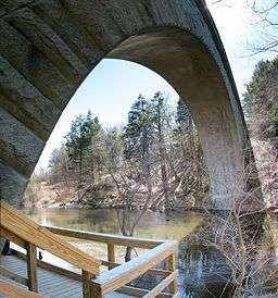
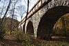
Echo Bridge |
|
000000001980-04-09-0000April 9, 1980
(#80000638) |
Spans the Charles River
42°18′53″N 71°13′39″W / 42.3147°N 71.2275°W / 42.3147; -71.2275 (Echo Bridge) |
Needham |
Extends into Newton in Middlesex County.
|
| 27 |
Ellice School |
|
000000002010-09-24-0000September 24, 2010
(#10000785) |
185 Pleasant St.
42°08′44″N 71°21′29″W / 42.1456°N 71.3581°W / 42.1456; -71.3581 (Ellice School) |
Millis |
|
| 28 |
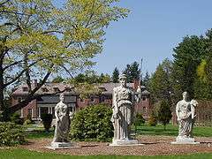
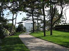
Elm Bank |
|
000000001987-07-10-0000July 10, 1987
(#86003565) |
Bounded by the carriage path to the south and by the Charles River to all other sides, off 900 Washington St.
42°16′34″N 71°18′09″W / 42.2761°N 71.3025°W / 42.2761; -71.3025 (Elm Bank) |
Dover |
|
| 29 |
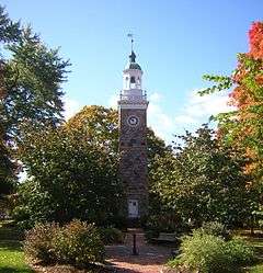
Elm Park and Isaac Sprague Memorial Tower |
|
000000002007-06-05-0000June 5, 2007
(#07000511) |
305 Washington St.
42°18′42″N 71°16′31″W / 42.3116°N 71.2752°W / 42.3116; -71.2752 (Elm Park and Isaac Sprague Memorial Tower) |
Wellesley |
|
| 30 |
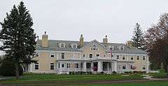
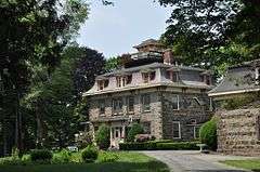
Endicott Estate |
|
000000002002-03-06-0000March 6, 2002
(#02000128) |
656 East St.
42°14′29″N 71°09′48″W / 42.2414°N 71.1633°W / 42.2414; -71.1633 (Endicott Estate) |
Dedham |
|
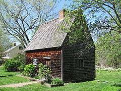
| 31 |
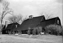
Fairbanks House |
|
000000001966-10-15-0000October 15, 1966
(#66000367) |
Eastern Ave. and East St.
42°14′35″N 71°10′05″W / 42.2431°N 71.1681°W / 42.2431; -71.1681 (Fairbanks House) |
Dedham |
|
| 32 |
Fairview Cemetery |
|
000000002009-09-16-0000September 16, 2009
(#09000717) |
45 Fairview Ave., Boston
42°14′45″N 71°08′18″W / 42.245897°N 71.138464°W / 42.245897; -71.138464 (Fairview Cemetery) |
Dedham |
Mostly in Hyde Park, Boston.
|
| 33 |
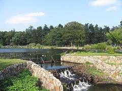
D.W. Field Park |
|
000000002000-11-24-0000November 24, 2000
(#00001341) |
Between Pond St. in Avon and Pleasant St. in Brockton
42°06′17″N 71°02′47″W / 42.104722°N 71.046389°W / 42.104722; -71.046389 (D.W. Field Park) |
Avon |
Extends into Brockton in Plymouth County
|
| 34 |
First Baptist Church of Medfield |
|
000000002003-09-11-0000September 11, 2003
(#03000921) |
438 Main St.
42°11′13″N 71°18′15″W / 42.1869°N 71.3042°W / 42.1869; -71.3042 (First Baptist Church of Medfield) |
Medfield |
|
| 35 |
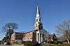
First Parish Unitarian Church |
|
000000001974-04-18-0000April 18, 1974
(#74000376) |
North St.
42°11′14″N 71°18′25″W / 42.1872°N 71.3069°W / 42.1872; -71.3069 (First Parish Unitarian Church) |
Medfield |
|
| 36 |
Fisher School-High Street Historic District |
|
000000002000-06-30-0000June 30, 2000
(#00000687) |
748-850 and 751-823 High St.
42°13′24″N 71°13′25″W / 42.2233°N 71.2236°W / 42.2233; -71.2236 (Fisher School-High Street Historic District) |
Westwood |
|
| 37 |
Fogg Building |
|
000000001983-03-10-0000March 10, 1983
(#83000594) |
100-110 Pleasant St. and 6-10 Columbian St.
42°10′28″N 70°57′07″W / 42.1744°N 70.9519°W / 42.1744; -70.9519 (Fogg Building) |
Weymouth |
|
| 38 |
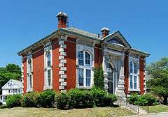
Fogg Library |
|
000000001981-06-11-0000June 11, 1981
(#81000113) |
1 Columbian St.
42°10′28″N 70°57′04″W / 42.1744°N 70.9511°W / 42.1744; -70.9511 (Fogg Library) |
Weymouth |
|
| 39 |
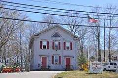
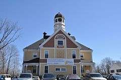
Foxboro Grange Hall |
|
000000001983-04-21-0000April 21, 1983
(#83000595) |
11-15 Bird St.
42°03′56″N 71°15′02″W / 42.0656°N 71.2506°W / 42.0656; -71.2506 (Foxboro Grange Hall) |
Foxborough |
|
| 40 |
Foxborough Pumping Station |
|
000000002005-12-06-0000December 6, 2005
(#05001362) |
25 Pumping Station Rd.
42°04′40″N 71°14′18″W / 42.0778°N 71.2383°W / 42.0778; -71.2383 (Foxborough Pumping Station) |
Foxborough |
|
| 41 |
Foxborough State Hospital |
|
000000001994-07-19-0000July 19, 1994
(#94000695) |
Junction of Chestnut and Main Sts.
42°04′41″N 71°15′30″W / 42.0781°N 71.2583°W / 42.0781; -71.2583 (Foxborough State Hospital) |
Foxborough |
part of the Massachusetts State Hospitals And State Schools MPS
|
| 42 |
Franklin Common Historic District |
|
000000002005-03-31-0000March 31, 2005
(#05000218) |
Main, High, Union, and Pleasant Sts. and Church Sq.
42°05′19″N 71°24′05″W / 42.0886°N 71.4014°W / 42.0886; -71.4014 (Franklin Common Historic District) |
Franklin |
|
| 43 |
Front Street Historic District |
|
000000002011-01-10-0000January 10, 2011
(#10001121) |
Roughly bounded by Front, Summer, Kingman, Congress, and Washington Sts.
42°12′39″N 70°57′43″W / 42.2108°N 70.9619°W / 42.2108; -70.9619 (Front Street Historic District) |
Weymouth |
|
| 44 |
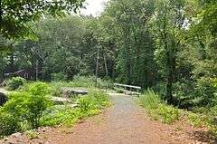
Fuller Brook Park |
|
000000002013-05-29-0000May 29, 2013
(#11000307) |
Dover Rd. to Maugus Ave.
42°18′39″N 71°16′26″W / 42.310791°N 71.273988°W / 42.310791; -71.273988 (Fuller Brook Park) |
Wellesley |
Linear park following Fuller Brook
|
| 45 |
Amos Fuller House |
|
000000001983-03-31-0000March 31, 1983
(#83000596) |
220 Nehoiden St.
42°17′07″N 71°14′31″W / 42.2853°N 71.2419°W / 42.2853; -71.2419 (Amos Fuller House) |
Needham |
|
| 46 |
Robert Fuller House |
|
000000001987-09-08-0000September 8, 1987
(#87001476) |
3 Burrill Ln.
42°17′37″N 71°15′27″W / 42.2936°N 71.2575°W / 42.2936; -71.2575 (Robert Fuller House) |
Needham |
|
| 47 |
Gills Farm Archeological District |
Upload image |
000000001983-10-24-0000October 24, 1983
(#83004093) |
Address Restricted
|
Randolph |
A Middle Archaic prehistoric site.
|
| 48 |
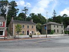
Government Island Historic District |
|
000000001994-05-12-0000May 12, 1994
(#94000424) |
Border St.
42°14′17″N 70°47′21″W / 42.2381°N 70.7892°W / 42.2381; -70.7892 (Government Island Historic District) |
Cohasset |
Former site of the mainland station of the Minot's Ledge Light, now a city-owned wharf and park.
|
| 49 |
Green Hill Site |
|
000000001980-09-25-0000September 25, 1980
(#80000651) |
near the Neponset River
|
Canton |
A sizable prehistoric site encompassing Middle and Late Archaic remains. Part of the Blue Hills and Neponset River Reservations Multiple Resource Area (MRA).
|
| 50 |
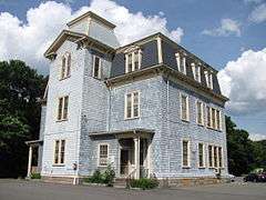
Emery Grover Building |
|
000000001987-08-20-0000August 20, 1987
(#87001393) |
1330 Highland Ave.
42°16′59″N 71°14′10″W / 42.2831°N 71.2361°W / 42.2831; -71.2361 (Emery Grover Building) |
Needham |
|
| 51 |
Josephine M. Hagerty House |
|
000000001997-06-04-0000June 4, 1997
(#97000529) |
357 Atlantic Ave.
42°15′31″N 70°48′09″W / 42.2586°N 70.8024°W / 42.2586; -70.8024 (Josephine M. Hagerty House) |
Cohasset |
|
| 52 |
Holbrook Square Historic District |
|
000000002006-05-10-0000May 10, 2006
(#06000359) |
Roughly N. Franklin St. from Union St. to Linfield St.
42°09′20″N 71°00′35″W / 42.1556°N 71.0097°W / 42.1556; -71.0097 (Holbrook Square Historic District) |
Holbrook |
|
| 53 |
Hunnewell Estates Historic District |
|
000000001988-04-14-0000April 14, 1988
(#88000438) |
Washington St. and Pond Rd.
42°16′59″N 71°18′40″W / 42.2831°N 71.3111°W / 42.2831; -71.3111 (Hunnewell Estates Historic District) |
Wellesley |
H. H. Hunnewell, H. H. Hunnewell Estate
|
| 54 |
Inness-Fitts House and Studio/Barn |
|
000000002002-03-15-0000March 15, 2002
(#02000153) |
406 Main St.
42°11′16″N 71°18′07″W / 42.1878°N 71.3019°W / 42.1878; -71.3019 (Inness-Fitts House and Studio/Barn) |
Medfield |
|
| 55 |
Intermediate Building |
|
000000001981-08-27-0000August 27, 1981
(#81000112) |
324 Washington St.
42°18′38″N 71°16′30″W / 42.3106°N 71.275°W / 42.3106; -71.275 (Intermediate Building) |
Wellesley Hills |
|
| 56 |
Jefferson School |
|
000000001981-05-12-0000May 12, 1981
(#81000114) |
200 Middle St.
42°13′00″N 70°56′15″W / 42.2167°N 70.9375°W / 42.2167; -70.9375 (Jefferson School) |
Weymouth |
|
| 57 |
Kingsbury-Whitaker House |
|
000000001990-07-12-0000July 12, 1990
(#90001080) |
53 Glendoon St.
42°16′54″N 71°14′25″W / 42.2817°N 71.2403°W / 42.2817; -71.2403 (Kingsbury-Whitaker House) |
Needham |
|
| 58 |
Deacon Willard Lewis House |
|
000000001975-10-29-0000October 29, 1975
(#75000297) |
33 West St.
42°08′42″N 71°15′19″W / 42.145°N 71.2553°W / 42.145; -71.2553 (Deacon Willard Lewis House) |
Walpole |
|
| 59 |
Joshua Lewis House |
|
000000001982-04-01-0000April 1, 1982
(#82002749) |
178 South St.
42°15′51″N 71°12′35″W / 42.2642°N 71.2097°W / 42.2642; -71.2097 (Joshua Lewis House) |
Needham |
|
| 60 |
Caleb Lothrop House |
|
000000001976-05-03-0000May 3, 1976
(#76000269) |
14 Summer St.
42°14′12″N 70°47′49″W / 42.2366°N 70.7969°W / 42.2366; -70.7969 (Caleb Lothrop House) |
Cohasset |
|
| 61 |
McIntosh Corner Historic District |
|
000000001989-01-05-0000January 5, 1989
(#88003127) |
Roughly Great Plain and Central Aves.
42°16′52″N 71°15′17″W / 42.2811°N 71.2547°W / 42.2811; -71.2547 (McIntosh Corner Historic District) |
Needham |
|
| 62 |
Medfield State Hospital |
|
000000001994-01-21-0000January 21, 1994
(#93001481) |
45 Hospital Rd.
42°12′48″N 71°20′10″W / 42.2133°N 71.3361°W / 42.2133; -71.3361 (Medfield State Hospital) |
Medfield |
part of the Massachusetts State Hospitals And State Schools MPS
|
| 63 |
Medway Village Historic District |
|
000000002008-12-17-0000December 17, 2008
(#08001191) |
Bounded by former New York and Boston railroad right-of-way, Oakland St., and the Charles River
42°08′30″N 71°23′48″W / 42.1418°N 71.3967°W / 42.1418; -71.3967 (Medway Village Historic District) |
Medway |
|
| 64 |
Memorial Hall |
|
000000001983-04-21-0000April 21, 1983
(#83000597) |
22 South St.
42°03′50″N 71°15′02″W / 42.0639°N 71.2506°W / 42.0639; -71.2506 (Memorial Hall) |
Foxborough |
|
| 65 |
Millis Center Historic District |
|
000000002007-09-14-0000September 14, 2007
(#07000944) |
Curve, Daniels, Exchange, Irving, Lavender, Main, and Union Sts.
42°10′03″N 71°21′36″W / 42.1675°N 71.36°W / 42.1675; -71.36 (Millis Center Historic District) |
Millis |
|
| 66 |
Davis Mills House |
|
000000001982-04-01-0000April 1, 1982
(#82004418) |
945 Central Ave.
42°17′17″N 71°15′07″W / 42.2881°N 71.2519°W / 42.2881; -71.2519 (Davis Mills House) |
Needham |
|
| 67 |
Amos Morse House |
|
000000001986-01-09-0000January 9, 1986
(#86000027) |
77 North St.
42°05′04″N 71°15′29″W / 42.0844°N 71.2581°W / 42.0844; -71.2581 (Amos Morse House) |
Foxborough |
|
| 68 |
Needham Street Bridge |
|
000000001986-09-04-0000September 4, 1986
(#86001852) |
Needham St. at the Charles River
42°18′23″N 71°13′03″W / 42.3064°N 71.2175°W / 42.3064; -71.2175 (Needham Street Bridge) |
Needham |
Extends into Newton in Middlesex County; part of the Newton MRA
|
| 69 |
Needham Town Hall Historic District |
|
000000001990-11-15-0000November 15, 1990
(#90001756) |
Great Plain Ave. between Highland Ave. and Chapel St.
42°17′20″N 71°14′26″W / 42.2889°N 71.2406°W / 42.2889; -71.2406 (Needham Town Hall Historic District) |
Needham |
|
| 70 |
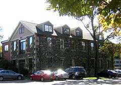
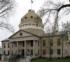
Norfolk County Courthouse |
|
000000001972-11-28-0000November 28, 1972
(#72001312) |
650 High St.
42°14′55″N 71°10′36″W / 42.2486°N 71.1767°W / 42.2486; -71.1767 (Norfolk County Courthouse) |
Dedham |
|
| 71 |
Norfolk Grange Hall |
|
000000001989-05-25-0000May 25, 1989
(#89000438) |
28 Rockwood Rd.
42°07′20″N 71°19′58″W / 42.1222°N 71.3328°W / 42.1222; -71.3328 (Norfolk Grange Hall) |
Norfolk |
|
| 72 |
North Bellingham Cemetery and Oak Hill Cemetery |
|
000000002012-09-25-0000September 25, 2012
(#12000819) |
Hartford Ave.
42°07′01″N 71°27′34″W / 42.116943°N 71.459511°W / 42.116943; -71.459511 (North Bellingham Cemetery and Oak Hill Cemetery) |
Bellingham |
|
| 73 |
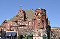
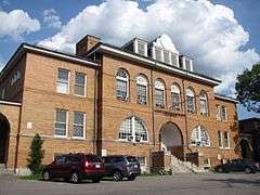
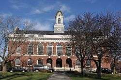
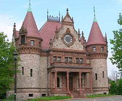
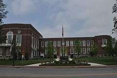
Norwood Memorial Municipal Building |
|
000000001996-10-10-0000October 10, 1996
(#96001086) |
566 Washington St.
42°11′41″N 71°12′02″W / 42.1947°N 71.2006°W / 42.1947; -71.2006 (Norwood Memorial Municipal Building) |
Norwood |
|
| 74 |
Oak Grove Farm |
|
000000002011-05-04-0000May 4, 2011
(#11000247) |
410 Exchange St.
42°10′52″N 71°21′46″W / 42.1811°N 71.3628°W / 42.1811; -71.3628 (Oak Grove Farm) |
Millis |
|
| 75 |
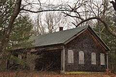
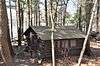
Old Barn |
|
000000001980-09-25-0000September 25, 1980
(#80000660) |
Off Blue Hill River Road
42°12′25″N 71°06′40″W / 42.2069°N 71.1111°W / 42.2069; -71.1111 (Old Barn) |
Canton |
|
| 76 |
Old South Union Church |
|
000000001982-04-01-0000April 1, 1982
(#82004422) |
25 Columbian St.
42°10′30″N 70°57′06″W / 42.175°N 70.9517°W / 42.175; -70.9517 (Old South Union Church) |
Weymouth |
|
| 77 |
Original Congregational Church of Wrentham |
|
000000002014-09-22-0000September 22, 2014
(#14000694) |
1 East & 22 Dedham Sts.
42°04′01″N 71°19′39″W / 42.0669°N 71.3274°W / 42.0669; -71.3274 (Original Congregational Church of Wrentham) |
Wrentham |
|
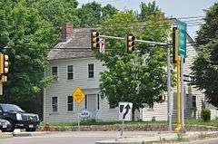
| 78 |
John Partridge House |
|
000000001974-10-15-0000October 15, 1974
(#74000377) |
315 Exchange St.
42°10′34″N 71°21′38″W / 42.1761°N 71.3606°W / 42.1761; -71.3606 (John Partridge House) |
Millis |
|
| 79 |
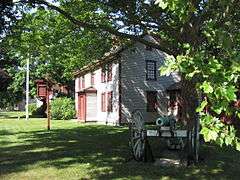
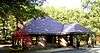
Peak House |
|
000000001975-09-05-0000September 5, 1975
(#75000288) |
347 Main St.
42°11′23″N 71°17′50″W / 42.1897°N 71.2972°W / 42.1897; -71.2972 (Peak House) |
Medfield |
|
| 80 |
Plimpton-Winter House |
|
000000001985-12-05-0000December 5, 1985
(#85003071) |
127 South St.
42°03′53″N 71°19′50″W / 42.0647°N 71.3306°W / 42.0647; -71.3306 (Plimpton-Winter House) |
Wrentham |
|
| 81 |
Pond Street School |
|
000000002010-02-12-0000February 12, 2010
(#10000004) |
235 Pond St.
42°09′45″N 70°57′36″W / 42.1626°N 70.9600°W / 42.1626; -70.9600 (Pond Street School) |
Weymouth |
Also known as the Fulton School, this property has been converted to condominiums.
|
| 82 |
Pondville Cemetery |
|
000000002014-04-15-0000April 15, 2014
(#14000158) |
Everett Street
42°05′06″N 71°17′42″W / 42.0851°N 71.295°W / 42.0851; -71.295 (Pondville Cemetery) |
Norfolk |
|
| 83 |
Ponkapoag Camp of Appalachian Mountain Club |
|
000000001980-09-25-0000September 25, 1980
(#80000657) |
Randolph
42°11′35″N 71°05′14″W / 42.1931°N 71.0872°W / 42.1931; -71.0872 (Ponkapoag Camp of Appalachian Mountain Club) |
Randolph |
part of the Blue Hills and Neponset River Reservations MRA
|
| 84 |
Pratt Historic Building |
|
000000002006-09-07-0000September 7, 2006
(#06000816) |
106 S. Main St.
42°14′19″N 70°47′59″W / 42.2387°N 70.7997°W / 42.2387; -70.7997 (Pratt Historic Building) |
Cohasset |
|
| 85 |
Capt. Josiah Pratt House |
|
000000001983-04-21-0000April 21, 1983
(#83000598) |
141 East St.
42°03′48″N 71°12′03″W / 42.0633°N 71.2008°W / 42.0633; -71.2008 (Capt. Josiah Pratt House) |
Foxborough |
|
| 86 |
Prospect Hill Cemetery |
|
000000002006-03-15-0000March 15, 2006
(#06000129) |
Auburn Rd.
42°09′59″N 71°22′04″W / 42.1664°N 71.3678°W / 42.1664; -71.3678 (Prospect Hill Cemetery) |
Millis |
|
| 87 |
Rabbit Hill Historic District |
|
000000001988-04-01-0000April 1, 1988
(#88000224) |
Roughly bounded by Highland, Main, Franklin, and Milford Sts.
42°08′39″N 71°26′02″W / 42.1442°N 71.4339°W / 42.1442; -71.4339 (Rabbit Hill Historic District) |
Medway |
|
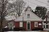
| 88 |
Red Brick School |
|
000000001976-01-01-0000January 1, 1976
(#76000276) |
2 Lincoln St.
42°05′34″N 71°24′00″W / 42.0928°N 71.4°W / 42.0928; -71.4 (Red Brick School) |
Franklin |
|
| 89 |
Redman Farm House |
|
000000001980-09-25-0000September 25, 1980
(#80000664) |
2173 Washington St.
42°11′30″N 71°07′03″W / 42.1917°N 71.1174°W / 42.1917; -71.1174 (Redman Farm House) |
Canton |
Incorrectly listed at the corner of Washington St. and Homans La. Part of the Blue Hills and Neponset River Reservations MRA.
|
| 90 |
Roberts School |
|
000000002007-08-30-0000August 30, 2007
(#07000860) |
320 Union St.
42°09′18″N 71°01′25″W / 42.155°N 71.0236°W / 42.155; -71.0236 (Roberts School) |
Holbrook |
|
| 91 |
Roebuck Tavern |
|
000000001984-05-17-0000May 17, 1984
(#84002878) |
21 Dedham St.
42°04′03″N 71°19′41″W / 42.0675°N 71.3281°W / 42.0675; -71.3281 (Roebuck Tavern) |
Wrentham |
|
| 92 |
Sea Street Historic District |
|
000000002009-08-19-0000August 19, 2009
(#09000646) |
Roughly bounded by Bridge, North, and Neck Sts., Crescent Rd., and Pearl and the rear of Standish Sts.
42°14′35″N 70°56′54″W / 42.2431°N 70.9483°W / 42.2431; -70.9483 (Sea Street Historic District) |
Weymouth |
|
| 93 |
Sharon Historic District |
|
000000001975-08-22-0000August 22, 1975
(#75000296) |
Both sides of N. Main St. from Post Office Sq. to School St.
42°07′28″N 71°10′45″W / 42.1244°N 71.1792°W / 42.1244; -71.1792 (Sharon Historic District) |
Sharon |
|
| 94 |
James Smith House |
|
000000001986-08-21-0000August 21, 1986
(#86001845) |
706 Great Plain Ave.
42°16′49″N 71°13′36″W / 42.2803°N 71.2267°W / 42.2803; -71.2267 (James Smith House) |
Needham |
|
| 95 |
Stetson Hall |
|
000000002011-12-07-0000December 7, 2011
(#11000883) |
6 S. Main St.
42°09′45″N 71°02′29″W / 42.1624°N 71.0414°W / 42.1624; -71.0414 (Stetson Hall) |
Randolph |
|
| 96 |
Stoneholm |
|
000000001980-04-02-0000April 2, 1980
(#80000648) |
188 Ames St.
42°06′55″N 71°09′57″W / 42.1153°N 71.1658°W / 42.1153; -71.1658 (Stoneholm) |
Sharon |
|
| 97 |
Stony Brook Reservation Parkways, Metropolitan Park System of Great Boston MPS |
|
000000002006-01-03-0000January 3, 2006
(#05001509) |
Dedham, Enneking, Turtle Pond Parkways, Smith Field, Reservation, W. Border Rds.
42°15′28″N 71°08′32″W / 42.2578°N 71.1422°W / 42.2578; -71.1422 (Stony Brook Reservation Parkways, Metropolitan Park System of Great Boston MPS) |
Dedham |
Extends into Boston in Suffolk County
|
| 98 |
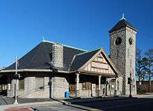
Stoughton Railroad Station |
|
000000001974-01-21-0000January 21, 1974
(#74000384) |
53 Wyman St.
42°07′27″N 71°05′58″W / 42.1242°N 71.0994°W / 42.1242; -71.0994 (Stoughton Railroad Station) |
Stoughton |
|
| 99 |
Stoughtonham Furnace Site |
|
000000001984-08-16-0000August 16, 1984
(#84002881) |
Address Restricted
42°04′56″N 71°12′44″W / 42.0823°N 71.2122°W / 42.0823; -71.2122 (Stoughtonham Furnace Site) |
Sharon, Foxborough |
Site of a Revolutionary War-era foundry
|
| 100 |
Sudbury Aqueduct Linear District |
|
000000001990-01-18-0000January 18, 1990
(#89002293) |
Along the Sudbury Aqueduct from Farm Pond at Waverly St. (Framingham) to Chestnut Hill Reservoir (Newton)
42°17′33″N 71°18′44″W / 42.2925°N 71.3122°W / 42.2925; -71.3122 (Sudbury Aqueduct Linear District) |
Wellesley, Needham |
Extends into Middlesex County. Part of the Water Supply System of Metropolitan Boston MPS.
|
| 101 |
Sullivan's Corner Historic District |
|
000000002012-06-15-0000June 15, 2012
(#12000340) |
Roughly the junction of Main, Needham, & Seekonk Sts.
42°07′14″N 71°18′39″W / 42.120437°N 71.310766°W / 42.120437; -71.310766 (Sullivan's Corner Historic District) |
Norfolk |
|
| 102 |
Thayer Public Library |
|
000000001978-07-21-0000July 21, 1978
(#78000446) |
2 John F. Kennedy Memorial Dr.
42°12′24″N 71°00′18″W / 42.2067°N 71.0049°W / 42.2067; -71.0049 (Thayer Public Library) |
Braintree |
Current library built in 1999.
|
| 103 |
Gen. Sylvanus Thayer House |
|
000000001974-12-03-0000December 3, 1974
(#74000372) |
786 Washington St.
42°12′22″N 71°00′17″W / 42.2061°N 71.0047°W / 42.2061; -71.0047 (Gen. Sylvanus Thayer House) |
Braintree |
|
| 104 |
Tolman-Gay House |
|
000000001982-06-01-0000June 1, 1982
(#82004419) |
1196 Central Ave.
42°16′48″N 71°15′03″W / 42.28°N 71.2508°W / 42.28; -71.2508 (Tolman-Gay House) |
Needham |
|
| 105 |
Townsend House |
|
000000001982-04-01-0000April 1, 1982
(#82004420) |
980 Central Ave.
42°17′28″N 71°14′58″W / 42.2911°N 71.2494°W / 42.2911; -71.2494 (Townsend House) |
Needham |
|
| 106 |
Stephen Turner House |
|
000000001979-05-10-0000May 10, 1979
(#79002682) |
North of Norfolk at 187 Seekonk St.
42°08′45″N 71°18′32″W / 42.1458°N 71.3089°W / 42.1458; -71.3089 (Stephen Turner House) |
Norfolk |
|
| 107 |
Union Station |
|
000000002016-04-05-0000April 5, 2016
(#16000139) |
West St.
42°08′43″N 71°15′29″W / 42.1453°N 71.2581°W / 42.1453; -71.2581 (Union Station) |
Walpole |
|
| 108 |
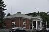
US Post Office-Weymouth Landing |
|
000000001986-05-27-0000May 27, 1986
(#86001186) |
103 Washington St.
42°13′05″N 70°58′02″W / 42.2181°N 70.9672°W / 42.2181; -70.9672 (US Post Office-Weymouth Landing) |
Weymouth |
|
| 109 |
Vine Lake Cemetery |
|
000000002005-04-14-0000April 14, 2005
(#05000277) |
Main St.
42°11′10″N 71°18′56″W / 42.1861°N 71.3156°W / 42.1861; -71.3156 (Vine Lake Cemetery) |
Medfield |
|
| 110 |
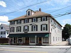
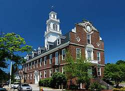
Walpole Town Hall |
|
000000001981-10-08-0000October 8, 1981
(#81000619) |
Main St.
42°08′45″N 71°15′12″W / 42.1458°N 71.2533°W / 42.1458; -71.2533 (Walpole Town Hall) |
Walpole |
|
| 111 |
Warelands |
|
000000001977-11-10-0000November 10, 1977
(#77000190) |
North of Norfolk at 103 Boardman St.
42°07′51″N 71°19′02″W / 42.1308°N 71.3172°W / 42.1308; -71.3172 (Warelands) |
Norfolk |
|
| 112 |
Washington School |
|
000000001986-06-05-0000June 5, 1986
(#86001218) |
8 School St.
42°12′53″N 70°55′19″W / 42.2147°N 70.9219°W / 42.2147; -70.9219 (Washington School) |
Weymouth |
|
| 113 |
Wellesley Congregational Church and Cemetery |
|
000000002014-09-22-0000September 22, 2014
(#14000696) |
2 Central St.
42°17′46″N 71°17′37″W / 42.2961°N 71.2935°W / 42.2961; -71.2935 (Wellesley Congregational Church and Cemetery) |
Wellesley |
|
| 114 |
Wellesley Farms Railroad Station |
|
000000001986-02-14-0000February 14, 1986
(#86000259) |
Croton St. extension
42°19′23″N 71°16′21″W / 42.3231°N 71.2725°W / 42.3231; -71.2725 (Wellesley Farms Railroad Station) |
Wellesley |
|
| 115 |
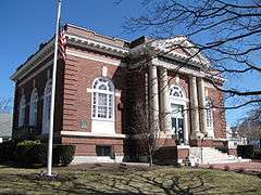
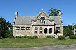
Wellesley Hills Branch Library |
|
000000002007-06-12-0000June 12, 2007
(#07000546) |
210 Washington St.
42°18′53″N 71°16′17″W / 42.3147°N 71.2714°W / 42.3147; -71.2714 (Wellesley Hills Branch Library) |
Wellesley |
|
| 116 |
Wellesley Town Hall |
|
000000001976-04-30-0000April 30, 1976
(#76000295) |
525 Washington St.
42°17′52″N 71°17′32″W / 42.2978°N 71.2922°W / 42.2978; -71.2922 (Wellesley Town Hall) |
Wellesley |
|
| 117 |
Weymouth Civic District |
|
000000001992-03-27-0000March 27, 1992
(#92000146) |
75 Middle St.
42°13′15″N 70°56′23″W / 42.2208°N 70.9397°W / 42.2208; -70.9397 (Weymouth Civic District) |
Weymouth |
|
| 118 |
Weymouth Meeting House Historic District |
|
000000002010-12-13-0000December 13, 2010
(#10001007) |
Church, East, Green, North, and Norton Sts.
42°13′48″N 70°56′38″W / 42.23°N 70.9439°W / 42.23; -70.9439 (Weymouth Meeting House Historic District) |
Weymouth |
|
| 119 |
Israel Whitney House |
|
000000001988-02-25-0000February 25, 1988
(#88000160) |
963 Central Ave.
42°17′16″N 71°15′08″W / 42.2878°N 71.2522°W / 42.2878; -71.2522 (Israel Whitney House) |
Needham |
|
| 120 |
Charles R. Wilber School |
|
000000002010-05-10-0000May 10, 2010
(#10000244) |
75-85 S Main St.
42°07′17″N 71°10′51″W / 42.1215°N 71.1807°W / 42.1215; -71.1807 (Charles R. Wilber School) |
Sharon |
|
| 121 |
Capt. John Wilson House and Bates Ship Chandlery |
|
000000002002-12-27-0000December 27, 2002
(#02001614) |
4 Elm St.
42°14′27″N 70°48′06″W / 42.2408°N 70.8017°W / 42.2408; -70.8017 (Capt. John Wilson House and Bates Ship Chandlery) |
Cohasset |
|
| 122 |
Wrentham State School |
|
000000001994-01-21-0000January 21, 1994
(#93001490) |
Junction of Emerald and North Sts.
42°04′58″N 71°19′08″W / 42.0828°N 71.3189°W / 42.0828; -71.3189 (Wrentham State School) |
Wrentham |
part of the Massachusetts State Hospitals And State Schools MPS |