Bouyon
This article is about the location in France. For the type of music, see Bouyon music.
| Bouyon | ||
|---|---|---|
|
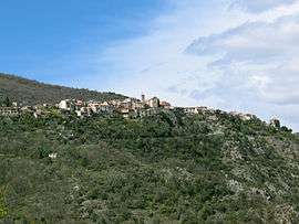
A general view of the village | ||
| ||
 Bouyon | ||
|
Location within Provence-A.-C.d'A. region  Bouyon | ||
| Coordinates: 43°49′31″N 7°07′26″E / 43.8253°N 7.1239°ECoordinates: 43°49′31″N 7°07′26″E / 43.8253°N 7.1239°E | ||
| Country | France | |
| Region | Provence-Alpes-Côte d'Azur | |
| Department | Alpes-Maritimes | |
| Arrondissement | Grasse | |
| Canton | Coursegoules | |
| Government | ||
| • Mayor (2008–2014) | Jean-Pierre Mascarelli | |
| Area1 | 12.29 km2 (4.75 sq mi) | |
| Population (2008)2 | 460 | |
| • Density | 37/km2 (97/sq mi) | |
| Time zone | CET (UTC+1) | |
| • Summer (DST) | CEST (UTC+2) | |
| INSEE/Postal code | 06022 / 06510 | |
| Elevation |
159–1,260 m (522–4,134 ft) (avg. 637 m or 2,090 ft) | |
|
1 French Land Register data, which excludes lakes, ponds, glaciers > 1 km² (0.386 sq mi or 247 acres) and river estuaries. 2 Population without double counting: residents of multiple communes (e.g., students and military personnel) only counted once. | ||

Bouyon (Occitan: Boion) is a commune in the Alpes-Maritimes department in southeastern France.
Situated 30 km (19 mi) northwest of Nice, Bouyon offers magnificent panoramic views of the Alps, and features a traditional château and communal bread oven. Local leisure activities include hiking, mountain-biking, tennis, and fishing, and there is an annual Fête in June and August.
Population
| Historical population | ||
|---|---|---|
| Year | Pop. | ±% |
| 1962 | 288 | — |
| 1968 | 157 | −45.5% |
| 1975 | 202 | +28.7% |
| 1982 | 229 | +13.4% |
| 1990 | 243 | +6.1% |
| 1999 | 352 | +44.9% |
| 2008 | 460 | +30.7% |
See also
References
External links
- Bouyon et ses environs (in French), general information
| Wikimedia Commons has media related to Bouyon. |
This article is issued from Wikipedia - version of the 12/3/2016. The text is available under the Creative Commons Attribution/Share Alike but additional terms may apply for the media files.