Puget-Théniers
| Puget-Théniers | ||
|---|---|---|
|
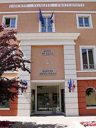
Town hall | ||
| ||
 Puget-Théniers | ||
|
Location within Provence-A.-C.d'A. region  Puget-Théniers | ||
| Coordinates: 43°57′25″N 6°53′39″E / 43.9569°N 6.8942°ECoordinates: 43°57′25″N 6°53′39″E / 43.9569°N 6.8942°E | ||
| Country | France | |
| Region | Provence-Alpes-Côte d'Azur | |
| Department | Alpes-Maritimes | |
| Arrondissement | Nice | |
| Canton | Puget-Théniers | |
| Intercommunality | Vallées d'Azur | |
| Government | ||
| • Mayor (2008–2014) | Robert Velay | |
| Area1 | 21.45 km2 (8.28 sq mi) | |
| Population (2008)2 | 1,818 | |
| • Density | 85/km2 (220/sq mi) | |
| Time zone | CET (UTC+1) | |
| • Summer (DST) | CEST (UTC+2) | |
| INSEE/Postal code | 06099 / 06260 | |
| Elevation |
353–1,436 m (1,158–4,711 ft) (avg. 409 m or 1,342 ft) | |
|
1 French Land Register data, which excludes lakes, ponds, glaciers > 1 km² (0.386 sq mi or 247 acres) and river estuaries. 2 Population without double counting: residents of multiple communes (e.g., students and military personnel) only counted once. | ||
.svg.png)
Puget-Théniers (Italian: Poggetto Tenieri) is a commune in the Alpes-Maritimes department in southeastern France.
Geography
It is situated on in the valley of the Var.
History
It was part of the historic County of Nice until 1860 as Poggetto Tenieri.
Personalities
It is the birthplace of Auguste Blanqui, Jean-Pierre Papon and Aimé Teisseire.
Population
| Historical population | ||
|---|---|---|
| Year | Pop. | ±% |
| 1793 | 800 | — |
| 1800 | 914 | +14.3% |
| 1806 | 1,011 | +10.6% |
| 1822 | 1,053 | +4.2% |
| 1838 | 1,168 | +10.9% |
| 1848 | 1,195 | +2.3% |
| 1858 | 1,077 | −9.9% |
| 1861 | 1,304 | +21.1% |
| 1866 | 1,289 | −1.2% |
| 1872 | 1,222 | −5.2% |
| 1876 | 1,403 | +14.8% |
| 1881 | 1,426 | +1.6% |
| 1886 | 1,215 | −14.8% |
| 1891 | 1,571 | +29.3% |
| 1896 | 1,224 | −22.1% |
| 1901 | 1,337 | +9.2% |
| 1906 | 1,383 | +3.4% |
| 1911 | 1,166 | −15.7% |
| 1921 | 1,252 | +7.4% |
| 1926 | 1,261 | +0.7% |
| 1931 | 1,279 | +1.4% |
| 1936 | 1,271 | −0.6% |
| 1946 | 1,105 | −13.1% |
| 1954 | 1,089 | −1.4% |
| 1962 | 1,415 | +29.9% |
| 1968 | 1,488 | +5.2% |
| 1975 | 1,438 | −3.4% |
| 1982 | 1,446 | +0.6% |
| 1990 | 1,703 | +17.8% |
| 1999 | 1,533 | −10.0% |
See also
References
External links
| Wikimedia Commons has media related to Puget-Théniers. |
- Puget-Théniers Tourist Information
- (English) (French) & (Occitan) Dance and traditional music from Puget-Théniers.
This article is issued from Wikipedia - version of the 9/4/2016. The text is available under the Creative Commons Attribution/Share Alike but additional terms may apply for the media files.