Carros
| Carros | ||
|---|---|---|
|
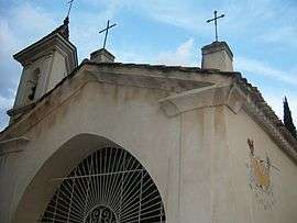
The chapel of Notre Dame des Selves, in Carros | ||
| ||
 Carros | ||
|
Location within Provence-A.-C.d'A. region  Carros | ||
| Coordinates: 43°47′36″N 7°11′18″E / 43.7933°N 7.1883°ECoordinates: 43°47′36″N 7°11′18″E / 43.7933°N 7.1883°E | ||
| Country | France | |
| Region | Provence-Alpes-Côte d'Azur | |
| Department | Alpes-Maritimes | |
| Arrondissement | Grasse | |
| Canton | Carros | |
| Intercommunality | Coteaux d'Azur | |
| Government | ||
| • Mayor (2008–2014) | Antoine Damiani | |
| Area1 | 15.11 km2 (5.83 sq mi) | |
| Population (2008)2 | 11,515 | |
| • Density | 760/km2 (2,000/sq mi) | |
| Time zone | CET (UTC+1) | |
| • Summer (DST) | CEST (UTC+2) | |
| INSEE/Postal code | 06033 / 06510 | |
| Elevation |
63–945 m (207–3,100 ft) (avg. 385 m or 1,263 ft) | |
|
1 French Land Register data, which excludes lakes, ponds, glaciers > 1 km² (0.386 sq mi or 247 acres) and river estuaries. 2 Population without double counting: residents of multiple communes (e.g., students and military personnel) only counted once. | ||

Carros (Occitan: Carròs) is a commune in the Alpes-Maritimes department in southeastern France.
Population
The inhabitants are called Carrossois.
| Historical population | ||
|---|---|---|
| Year | Pop. | ±% |
| 1793 | 404 | — |
| 1800 | 576 | +42.6% |
| 1806 | 607 | +5.4% |
| 1821 | 748 | +23.2% |
| 1831 | 778 | +4.0% |
| 1836 | 811 | +4.2% |
| 1841 | 819 | +1.0% |
| 1846 | 776 | −5.3% |
| 1851 | 854 | +10.1% |
| 1856 | 818 | −4.2% |
| 1861 | 634 | −22.5% |
| 1866 | 656 | +3.5% |
| 1872 | 606 | −7.6% |
| 1876 | 534 | −11.9% |
| 1881 | 525 | −1.7% |
| 1886 | 512 | −2.5% |
| 1891 | 536 | +4.7% |
| 1896 | 560 | +4.5% |
| 1901 | 443 | −20.9% |
| 1906 | 453 | +2.3% |
| 1911 | 453 | +0.0% |
| 1921 | 390 | −13.9% |
| 1926 | 384 | −1.5% |
| 1931 | 403 | +4.9% |
| 1936 | 509 | +26.3% |
| 1946 | 563 | +10.6% |
| 1954 | 662 | +17.6% |
| 1962 | 761 | +15.0% |
| 1968 | 963 | +26.5% |
| 1975 | 4,197 | +335.8% |
| 1982 | 8,457 | +101.5% |
| 1990 | 10,747 | +27.1% |
| 1999 | 10,710 | −0.3% |
| 2008 | 11,515 | +7.5% |
See also
References
| Wikimedia Commons has media related to Carros. |
This article is issued from Wikipedia - version of the 12/3/2016. The text is available under the Creative Commons Attribution/Share Alike but additional terms may apply for the media files.