La Roquette-sur-Siagne
| La Roquette-sur-Siagne | ||
|---|---|---|
|
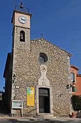
The church of La Roquette-sur-Siagne | ||
| ||
 La Roquette-sur-Siagne | ||
|
Location within Provence-A.-C.d'A. region  La Roquette-sur-Siagne | ||
| Coordinates: 43°34′51″N 6°57′22″E / 43.5808°N 6.9561°ECoordinates: 43°34′51″N 6°57′22″E / 43.5808°N 6.9561°E | ||
| Country | France | |
| Region | Provence-Alpes-Côte d'Azur | |
| Department | Alpes-Maritimes | |
| Arrondissement | Grasse | |
| Canton | Mougins | |
| Intercommunality | Pôle Azur Provence | |
| Government | ||
| • Mayor (2008–2014) | André Roatta | |
| Area1 | 6.31 km2 (2.44 sq mi) | |
| Population (2008)2 | 4,976 | |
| • Density | 790/km2 (2,000/sq mi) | |
| Time zone | CET (UTC+1) | |
| • Summer (DST) | CEST (UTC+2) | |
| INSEE/Postal code | 06108 / 06550 | |
| Elevation |
6–170 m (20–558 ft) (avg. 148 m or 486 ft) | |
|
1 French Land Register data, which excludes lakes, ponds, glaciers > 1 km² (0.386 sq mi or 247 acres) and river estuaries. 2 Population without double counting: residents of multiple communes (e.g., students and military personnel) only counted once. | ||
.svg.png)
La Roquette-sur-Siagne is a commune in the Alpes-Maritimes department in southeastern France.
Population
| Historical population | ||
|---|---|---|
| Year | Pop. | ±% |
| 1962 | 1,241 | — |
| 1968 | 1,670 | +34.6% |
| 1975 | 2,006 | +20.1% |
| 1982 | 2,554 | +27.3% |
| 1990 | 3,642 | +42.6% |
| 1999 | 4,445 | +22.0% |
| 2008 | 4,976 | +11.9% |
Tourism
La Roquette is one of thirteen villages grouped together by the Communauté d'agglomération de Nice-Côte d'Azur tourist department as the Route des Villages Perchés (Route of Perched Villages). The others are: Aspremont, Castagniers, Coaraze, Colomars, Duranus, Èze, Falicon, La Gaude, Levens, Saint-Blaise, Saint-Jeannet and Tourrette-Levens.[1]
See also
References
- ↑ Booklet The route of perched villages, Communaute Nice Côte d'Azur, 2007
| Wikimedia Commons has media related to La Roquette-sur-Siagne. |
This article is issued from Wikipedia - version of the 1/30/2015. The text is available under the Creative Commons Attribution/Share Alike but additional terms may apply for the media files.