Barkers Crossroads, Virginia
| Barkers Crossroads, Virginia | |
|---|---|
| Unincorporated community | |
 Barkers Crossroads  Barkers Crossroads  Barkers Crossroads | |
| Coordinates: 38°45′30″N 77°12′58″W / 38.75833°N 77.21611°WCoordinates: 38°45′30″N 77°12′58″W / 38.75833°N 77.21611°W | |
| Country | United States |
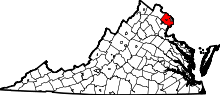
| State | Virginia |
| County | Fairfax |
| Time zone | Eastern (EST) (UTC-5) |
| • Summer (DST) | EDT (UTC-4) |
| GNIS feature ID | 1492516[1] |
Barkers Crossroads is an unincorporated community in Fairfax County, Virginia, United States. Barkers Crossroads developed around the intersection of Hooes and Rolling Roads to between Accotink Creek and Pohick Creek. Today, the community is considered part of the census-designated place of West Springfield.
References
This article is issued from Wikipedia - version of the 9/23/2016. The text is available under the Creative Commons Attribution/Share Alike but additional terms may apply for the media files.