Dunn Loring, Virginia
| Dunn Loring, Virginia | |
|---|---|
| Census-designated place | |
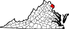
 Location of Dunn Loring in Fairfax County, Virginia | |
 Dunn Loring, Virginia  Dunn Loring, Virginia  Dunn Loring, Virginia Location of Dunn Loring in Fairfax County, Virginia | |
| Coordinates: 38°53′31″N 77°13′52″W / 38.89194°N 77.23111°WCoordinates: 38°53′31″N 77°13′52″W / 38.89194°N 77.23111°W | |
| Country |
|
| State |
|
| County |
|
| Area | |
| • Total | 2.4 sq mi (6.1 km2) |
| • Land | 2.4 sq mi (6.1 km2) |
| • Water | 0.0 sq mi (0.0 km2) |
| Elevation | 436 ft (133 m) |
| Population (2010) | |
| • Total | 8,803 |
| • Density | 3,741/sq mi (1,444.6/km2) |
| Time zone | Eastern (EST) (UTC-5) |
| • Summer (DST) | EDT (UTC-4) |
| ZIP code | 22027 |
| Area code(s) | 703 |
| FIPS code | 51-23984[1] |
| GNIS feature ID | 1495484[2] |
Dunn Loring is a census-designated place (CDP) in Fairfax County, Virginia, United States. The population was 8,803 at the 2010 census.[3]
History
Dunn Loring, the earliest platted subdivision in Fairfax County and possibly the Commonwealth of Virginia, was founded in 1886. General William McKee Dunn and his wife Elizabeth Lanier Dunn purchased about 600 acres (2.4 km2) located on the Washington, Ohio and Western Railroad, now the Washington and Old Dominion Regional Trail, from L. B. Clarke and his wife on June 8, 1886. On September 22, 1886, the land was transferred to the Loring Land and Improvement Company, composed of General Dunn, then a retired Army brigadier general and former Judge Advocate General; George B. Loring, a former congressman and Commissioner of Agriculture; and George H. LeFetra, a Washington temperance hotel proprietor. The Town of Dunn Loring was advertised for residential sales in 1887. The Loring Land and Improvement Company built a railroad station and a post office, but shortly thereafter General Dunn died, and the development stagnated. During the Spanish–American War, the founding of Camp Russell A. Alger brought growth and prosperity to Dunn Loring, and among the troops trained at Camp Alger was the celebrated author-poet Carl Sandburg, after whom the present Sandburg Street was named. In 1912, Fairfax Shield McCandlish bought out the interests of the developers, consolidated parcels, and subdivided the land into its current platting. Following World War II, the area began to develop as part of Metropolitan Washington, D.C.[4]
Geography
Dunn Loring is located in northeastern Fairfax County at 38°53′31″N 77°13′52″W / 38.89194°N 77.23111°W (38.891982, −77.231150).[5] It is bordered to the west by the town of Vienna, to the north by Tysons Corner, to the east by the Capital Beltway, and to the south by Interstate 66. Dunn Loring is 14 miles (23 km) west of downtown Washington, D.C.
According to the U.S. Census Bureau, the CDP has a total area of 2.4 square miles (6.1 km2), all of it land.[3] Several perennial streams of Accotink Creek's Long Branch stream run through the subdivision.[6]
Demographics
As of the census[1] of 2000, there were 7,861 people, 2,668 households, and 2,038 families residing in the CDP. The population density was 3,855.9 people per square mile (1,487.8/km²). There were 2,711 housing units at an average density of 1,329.8/sq mi (513.1/km²). The racial makeup of the CDP was 74.14% White, 3.00% African American, 0.29% Native American, 15.24% Asian, 0.01% Pacific Islander, 4.13% from other races, and 3.18% from two or more races. Hispanic or Latino of any race were 9.87% of the population.
There were 2,668 households out of which 35.6% had children under the age of 18 living with them, 66.8% were married couples living together, 6.0% had a female householder with no husband present, and 23.6% were non-families. 14.9% of all households were made up of individuals and 4.0% had someone living alone who was 65 years of age or older. The average household size was 2.90 and the average family size was 3.18.
In the CDP the population was spread out with 24.0% under the age of 18, 6.2% from 18 to 24, 34.1% from 25 to 44, 24.8% from 45 to 64, and 10.8% who were 65 years of age or older. The median age was 37 years. For every 100 females there were 102.9 males. For every 100 females age 18 and over, there were 102.0 males.
Like other surrounding areas in Fairfax County, Dunn Loring is an affluent neighborhood with the median income for a household in the CDP at $204,797 (2013), and the median income for a family at $219,490 (2013). About 0.4% of families and 3.1% of the population were below the poverty line, including 0.7% of those under age 18 and 1.4% of those age 65 or over.
Transportation
Dunn Loring is roughly equidistant from Washington Dulles International Airport, the largest international airport in the Greater Washington Metropolitan Area, 16 miles (26 km) to the west, and Ronald Reagan Washington National Airport, 12 miles (19 km) to the east. It is also served by the Dunn Loring station on the Washington Metro's Orange Line.
References
- 1 2 "American FactFinder". United States Census Bureau. Retrieved 2008-01-31.
- ↑ "US Board on Geographic Names". United States Geological Survey. 2007-10-25. Retrieved 2008-01-31.
- 1 2 "Geographic Identifiers: 2010 Demographic Profile Data (G001): Dunn Loring CDP, Virginia". U.S. Census Bureau, American Factfinder. Retrieved September 23, 2016.
- ↑ "HOUSE JOINT RESOLUTION NO. 312". Virginia Legislative Information Services. 13 February 2006. Retrieved 20 March 2016.
- ↑ "US Gazetteer files: 2010, 2000, and 1990". United States Census Bureau. 2011-02-12. Retrieved 2011-04-23.
- ↑ "North Branch Walk January 2008". accotink.org. accotink.org.