Great Falls, Virginia
| Great Falls, Virginia | |
|---|---|
| Census-designated place (CDP) | |
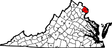
 Location of Great Falls in Fairfax County, Virginia | |
 Boundaries of the Great Falls CDP as of 2003 | |
 Great Falls, Virginia  Great Falls, Virginia  Great Falls, Virginia Location of Great Falls in Fairfax County, Virginia | |
| Coordinates: 38°59′53″N 77°17′18″W / 38.99806°N 77.28833°WCoordinates: 38°59′53″N 77°17′18″W / 38.99806°N 77.28833°W | |
| Country | United States |
| State | Virginia |
| County | Fairfax |
| Area | |
| • Total | 25.66 sq mi (66.5 km2) |
| • Land | 25.42 sq mi (65.8 km2) |
| • Water | 0.24 sq mi (0.6 km2) |
| Elevation | 344 ft (105 m) |
| Population (2010) | |
| • Total | 15,427[1] |
| • Density | 606.9/sq mi (234.3/km2) |
| Time zone | Eastern (EST) (UTC-5) |
| • Summer (DST) | EDT (UTC-4) |
| ZIP code | 22066 |
| Area code(s) | 703 |
| FIPS code | 51-32496[2] |
| GNIS feature ID | 1467429[3] |
Great Falls is a census-designated place (CDP)[1] in Fairfax County, Virginia, United States. The population as of the 2010 census was 15,427, an increase of 80.5% from the 2000 census.[4]
CNNMoney ranked Great Falls first in the nation on its list of "top earning towns" in 2011.[5]
History
Early farm settlements began to form in the area as early as the late 1700s.[6]
Early on, the village was known as Forestville (unofficially, since there was already a Forestville with a Post Office), but was named Great Falls in 1955.[7]
Geography
Great Falls is located at 38°59′53″N 077°17′18″W / 38.99806°N 77.28833°W (38.9981653, −77.2883157) at an elevation of 344 feet (105 m).[3][8] Located on Virginia State Route 7 in Northern Virginia, Great Falls is 15 miles (24 km) west-northwest of downtown Washington, D.C. and 10.5 miles (16.9 km) north of Fairfax, the county seat.[9]
Great Falls lies in the Piedmont upland on the right bank of the Potomac River.[10][11] The river forms the northern and eastern border of the CDP, and several of its tributaries flow north and east through the CDP. From north to south, these include Nichols Run, Clarks Branch, and Difficult Run. Difficult Run forms the southeastern border of the CDP. Two of its tributaries, Captain Hickory Run and Piney Run, flow southeast through the southern part of the CDP.[9][11] The Great Falls of the Potomac River, the community's namesake, are on the east side of the CDP.[11]
According to the United States Census Bureau, the CDP has a total area of 25.66 square miles (66.5 km2) of which 25.42 square miles (65.8 km2) is land and 0.24 square miles (0.62 km2) is water.[12]
As a suburb of Washington, D.C., Great Falls is a part of both the Washington Metropolitan Area and the larger Baltimore-Washington Metropolitan Area. It is bordered on all sides by other Washington suburbs, including: Darnestown and Travilah, Maryland to the north, Potomac, Maryland to the east, McLean to the southeast, Wolf Trap to the south, Reston and Dranesville to the southwest, Sterling to the west, and Lowes Island to the northwest.[12]
Demographics
| Historical population | |||
|---|---|---|---|
| Census | Pop. | %± | |
| 1990 | 6,945 | — | |
| 2000 | 8,549 | 23.1% | |
| 2010 | 15,427 | 80.5% | |
| Est. 2013 | 16,290 | 5.6% | |
| * U.S. Decennial Census | |||
As of the 2010 census, there were 15,427 people, 4,977 households, and 4,439 families residing in the CDP. The population density was 606.9 people per square mile (234.3/km²). There were 5,179 housing units at an average density of 203.7/sq mi (78.7/km²). The racial makeup of the community was 80.5% White, 13.5% Asian, 1.8% African American, 0.1% American Indian, 0.0% Pacific Islander, 0.6% from other races, and 3.4% from two or more races. Hispanics and Latinos of any race were 3.9% of the population.[2]
There were 4,977 households of which 46.1% had children under the age of 18 living with them, 82.1% were married couples living together, 4.7% had a female householder with no husband present, and 10.8% were non-families. Of all households 8.5% were made up of individuals, and 3.7% had someone living alone who was 65 years of age or older. The average household size was 3.10, and the average family size was 3.27.[2]
The age distribution of the population was 29.2% under the age of 18, 5.1% from 18 to 24, 15.9% from 25 to 44, 37.3% from 45 to 64, and 12.5% who were 65 years of age or older. The median age was 44.8 years. The gender makeup of the CDP was 50.3% male and 49.7% female.[2]
The median income for a household in the CDP was $189,545, and the median income for a family was $201,250. Males had a median income of $149,609 versus $101,289 for females. The community's per capita income was $80,422. About 0.8% of families and 1.8% of the population were below the poverty line, including 0.7% of those under age 18 and 4.7% of those age 65 or over.[2]
Education
Fairfax County Public Schools operates the local public schools.
Great Falls students attend Great Falls Elementary School, Forestville Elementary School or Colvin Run Elementary School. These schools feed into James Fenimore Cooper Middle School, the feeder for Langley High School.
Fairfax County Public Library operates the Great Falls Library.[13]
Infrastructure
Transportation
The main roads serving Great Falls are Virginia State Route 7 (Leesburg Pike) and Virginia State Route 193 (Georgetown Pike).
Parks and recreation
Although Great Falls is primarily a bedroom community for Washington, D.C., one major attraction is Great Falls Park which overlooks the Great Falls of the Potomac River, for which the community and the park are named. George Washington was involved with building a canal around the falls on the southwest, or Virginia, side, called the Patowmack Canal, which did not become commercially viable. Remnants of the canal and of a village around the canal named Matildaville are still visible in the park. The Great Falls and Old Dominion Railroad extended along Old Dominion Drive to Great Falls Park in 1906.
River Bend County Park[14] is another gathering area in Great Falls, as is the Village Green, which hosts community celebrations around Easter (Spring Festival, including an Egg Hunt), Fourth of July, Halloween, Thanksgiving, and Christmas (Tree Lighting), as well as concerts in the summer.

In popular culture
The MTV television series Finding Carter is partially set in Great Falls.
Notable people
Due to its proximity to Washington, D.C., several figures from American politics and government live or have lived in Great Falls, including Senator Rick Santorum as well as former Federal Bureau of Investigation director Louis Freeh and former Central Intelligence Agency director Stansfield Turner. Other famous residents have included political commentator Peggy Noonan, heiress Jacqueline Mars, businessman Steve Case, and Washington Redskins owner Dan Snyder.
References
- 1 2 "Great Falls CDP, Virginia". U.S Census Bureau. Retrieved April 3, 2013.
- 1 2 3 4 5 "American FactFinder". United States Census Bureau. Retrieved 2008-01-31.
- 1 2 "US Board on Geographic Names". United States Geological Survey. 2007-10-25. Retrieved 2008-01-31.
- ↑ Virginia Trend Report 2: State and Complete Places (Sub-state 2010 Census Data). Missouri Census Data Center. Accessed 2013-05-25.
- ↑ http://money.cnn.com/galleries/2011/moneymag/1108/gallery.best_places_top_earning_towns.moneymag/index.html
- ↑ Carey, Mac (May 24, 2016). "An Unhidden Gem". Virginia Living. Cape Fear Publishing. Retrieved June 27, 2016.
- ↑ Sanders, Milburn P. (August 11, 2005). "A Brief History of Great Falls". Connecting Neighbors. Retrieved 2008-01-25.
- ↑ "Great Falls". Geographic Names Information System. United States Geological Survey. Retrieved 2009-05-03.
- 1 2 "Great Falls, Virginia". Google Maps. Retrieved 2015-02-06.
- ↑ "Piedmont province". The Geology of Virginia. The College of William & Mary Department of Geology. Retrieved 2015-02-06.
- 1 2 3 "Fairfax County Transportation Plan" (PDF). Fairfax County Department of Transportation. Oct 2006. Retrieved 2015-02-06.
- 1 2 "Virginia: 2010 – Population and Housing Unit Counts" (PDF). United States Census Bureau. Retrieved 2015-02-05.
- ↑ "Library Branches." Fairfax County Public Library. Retrieved on October 21, 2009.
- ↑ "Riverbend Park - Fairfax County, Virginia". www.fairfaxcounty.gov. Retrieved 2015-11-29.