Ballico, California
| Ballico | |
|---|---|
| census-designated place | |
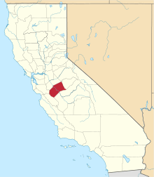
 Ballico Location in California | |
| Coordinates: 37°27′16″N 120°42′22″W / 37.45444°N 120.70611°WCoordinates: 37°27′16″N 120°42′22″W / 37.45444°N 120.70611°W | |
| Country |
|
| State |
|
| County | Merced County |
| Area[1] | |
| • Total | 3.022 sq mi (7.828 km2) |
| • Land | 3.022 sq mi (7.828 km2) |
| • Water | 0 sq mi (0 km2) 0% |
| Elevation[2] | 151 ft (46 m) |
| Population (2010) | |
| • Total | 406 |
| • Density | 130/sq mi (52/km2) |
| Time zone | Pacific (PST) (UTC-8) |
| • Summer (DST) | PDT (UTC-7) |
| ZIP Code | 95303 |
| Area code(s) | 209 |
| GNIS feature IDs | 1655810, 2582939 |
| U.S. Geological Survey Geographic Names Information System: Ballico, California; U.S. Geological Survey Geographic Names Information System: Ballico, California | |
Ballico is a census-designated place[3] in Merced County, California.[2] It is located 9 miles (14 km) northwest of Atwater,[4] at an elevation of 151 feet (46 m).[2] The population was 406 at the 2010 census.
Ballico is located in the northern part of Merced County, just north of where the Santa Fe railroad crosses the Merced River. Delhi is to the west, Denair to the northwest, and Cressey is across the river to the southeast. The ZIP Code is 95303. The area is inside area code 209.
The name is a portmanteau of Ballintine Company, owner of the ranch on which the town was built.[4]
Geography
According to the United States Census Bureau, the CDP covers an area of 3.0 square miles (7.8 km²), all of it land.
Demographics
The 2010 United States Census[5] reported that Ballico had a population of 406. The population density was 134.3 per square mile (51.9/km²). The racial makeup of Ballico was 237 (58.4%) White, 2 (0.5%) African American, 3 (0.7%) Native American, 11 (2.7%) Asian, 2 (0.5%) Pacific Islander, 128 (31.5%) from other races, and 23 (5.7%) from two or more races. Hispanic or Latino of any race were 210 persons (51.7%).
The Census reported that 406 people (100% of the population) lived in households, 0 (0%) lived in non-institutionalized group quarters, and 0 (0%) were institutionalized.
There were 121 households, of which 55 (45.5%) had children under the age of 18 living in them, 69 (57.0%) were opposite-sex married couples living together, 10 (8.3%) had a female householder with no husband present, 17 (14.0%) had a male householder with no wife present. There were 13 (10.7%) unmarried opposite-sex partnerships, and 1 (0.8%) same-sex married couples or partnerships. 20 households (16.5%) were made up of individuals and 8 (6.6%) had someone living alone who was 65 years of age or older. The average household size was 3.36. There were 96 families (79.3% of all households); the average family size was 3.73.
120 people (29.6% of the population) were under the age of 18, 52 (12.8%) were aged 18 to 24, 106 (26.1%) were aged 25 to 44, 91 (22.4%) were aged 45 to 64, and 37 (9.1%) were 65 years of age or older. The median age was 31.1 years. For every 100 females there were 113.7 males. For every 100 females age 18 and over, there were 108.8 males.
There were 132 housing units at an average density of 43.7 per square mile (16.9/km²), of which 77 (63.6%) were owner-occupied, and 44 (36.4%) were occupied by renters. The homeowner vacancy rate was 1.3%; the rental vacancy rate was 4.3%. 234 people (57.6% of the population) lived in owner-occupied housing units and 172 people (42.4%) lived in rental housing units.
Government
Local
The Turlock Irrigation District provides irrigation water and electrical service. Ballico and Cressey share an elementary school district.
State and federal
In the California State Legislature, Ballico is in the 12th Senate District, represented by Republican Anthony Cannella, and in the 21st Assembly District, represented by Democrat Adam Gray.[6]
In the United States House of Representatives, Ballico is in California's 16th congressional district, represented by Democrat Jim Costa.[7]
References
- ↑ "2010 Census U.S. Gazetteer Files – Places – California". United States Census Bureau.
- 1 2 3 "Ballico". Geographic Names Information System. United States Geological Survey. Retrieved October 20, 2014.
- ↑ U.S. Geological Survey Geographic Names Information System: Ballico, California
- 1 2 Durham, David L. (1998). California's Geographic Names: A Gazetteer of Historic and Modern Names of the State. Clovis, Calif.: Word Dancer Press. p. 742. ISBN 1-884995-14-4.
- ↑ "2010 Census Interactive Population Search: CA - Ballico CDP". U.S. Census Bureau. Retrieved July 12, 2014.
- ↑ "Statewide Database". UC Regents. Retrieved December 10, 2014.
- ↑ "California's 16th Congressional District - Representatives & District Map". Civic Impulse, LLC. Retrieved October 1, 2014.