Bakkie, Suriname
| Bakkie | |
|---|---|
| Resort | |
 Map showing resorts in Commewijne District | |
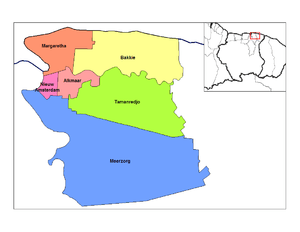
 Bakkie Map showing resorts in Commewijne District | |
| Coordinates: 5°58′N 54°50′W / 5.967°N 54.833°WCoordinates: 5°58′N 54°50′W / 5.967°N 54.833°W | |
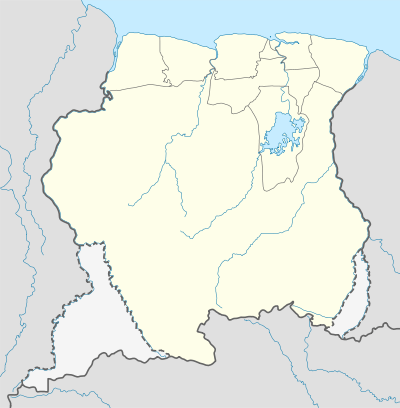
| Country |
|
| District | Commewijne District |
| Area | |
| • Total | 440 km2 (170 sq mi) |
| Population (2012) | |
| • Total | 447 |
| • Density | 1.0/km2 (2.6/sq mi) |
| Time zone | AST (UTC-3) |
Bakkie is a resort in Suriname, located in the Commewijne District. Its population at the 2012 census was 447.[1] Around 1902, the plantation was bought by the government and parceled out in small allotments for immigrants who had served out their contracts.[2] The resort lies along the Atlantic Ocean coastline.
The Museum of Bakkie, located in the village of Reyns has an impressive collection of old bottles, prints, maps, paintings and many utensils.[3]
References
| Brokopondo District |  | |
|---|---|---|
| Commewijne District | ||
| Coronie District | ||
| Marowijne District | ||
| Nickerie District | ||
| Para District | ||
| Paramaribo District | ||
| Saramacca District | ||
| Sipaliwini District | ||
| Wanica District | ||
This article is issued from Wikipedia - version of the 4/4/2014. The text is available under the Creative Commons Attribution/Share Alike but additional terms may apply for the media files.