Sarakreek
| Sarakreek | |
|---|---|
| Resort | |
 Sarakreek | |
| Coordinates: 4°54′N 55°5′W / 4.900°N 55.083°WCoordinates: 4°54′N 55°5′W / 4.900°N 55.083°W | |
| Country |
|
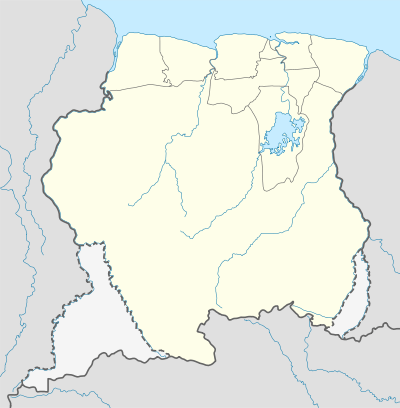
| District | Brokopondo District |
| Area | |
| • Total | 4,566 km2 (1,763 sq mi) |
| Population (2012 census) | |
| • Total | 3,076 |
| • Density | 0.67/km2 (1.7/sq mi) |
| Time zone | AST (UTC-3) |
Sarakreek is a resort (≈ municipality) in the Brokopondo District of Suriname. Its population at the 2012 census was 3,076.[1] It contains the Sarakreek Airstrip.
References
| Brokopondo District |  | |
|---|---|---|
| Commewijne District | ||
| Coronie District | ||
| Marowijne District | ||
| Nickerie District | ||
| Para District | ||
| Paramaribo District | ||
| Saramacca District | ||
| Sipaliwini District | ||
| Wanica District | ||
This article is issued from Wikipedia - version of the 5/24/2016. The text is available under the Creative Commons Attribution/Share Alike but additional terms may apply for the media files.