Districts of Suriname
 |
| This article is part of a series on the politics and government of Suriname |
| Constitution |
|
Government |
|
Legislature |
|
Suriname is divided into 10 districts.
Overview
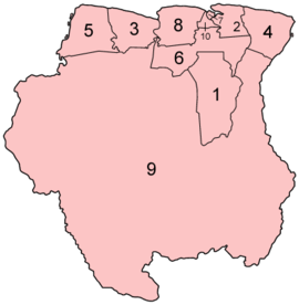
| District | Capital | Area (km²) | Area (%) | Population (2012 census)[1] |
Population (%) | Pop. dens. (inh/km²) | |
|---|---|---|---|---|---|---|---|
| 1 | Brokopondo | Brokopondo | 7,364 | 4.5 | 15,909 | 2.9 | 2.2 |
| 2 | Commewijne | Nieuw-Amsterdam | 2,353 | 1.4 | 31,420 | 5.8 | 13.4 |
| 3 | Coronie | Totness | 3,902 | 2.4 | 3,391 | 0.6 | 0.9 |
| 4 | Marowijne | Albina | 4,627 | 2.8 | 18,294 | 3.4 | 4.0 |
| 5 | Nickerie | Nieuw-Nickerie | 5,353 | 3.3 | 34,233 | 6.3 | 6.4 |
| 6 | Para | Onverwacht | 5,393 | 3.3 | 24,700 | 4.6 | 4.6 |
| 7 | Paramaribo | Paramaribo | 182 | 0.1 | 240,924 | 44.5 | 1323.8 |
| 8 | Saramacca | Groningen | 3,636 | 2.2 | 17,480 | 3.2 | 4.8 |
| 9 | Sipaliwini | none | 130,567 | 79.7 | 37,065 | 6.8 | 0.3 |
| 10 | Wanica | Lelydorp | 443 | 0.3 | 118,222 | 21.8 | 266.9 |
| SURINAME | Paramaribo | 163,820 | 100.0 | 541,638 | 100.0 | 3.3 |
History
The country was first divided up into subdivisions by the Dutch on October 8, 1834, when a Royal Decree declared that there were to be 8 divisions and 2 districts:
- Upper Suriname and Torarica
- Para
- Upper Commewijne
- Upper Cottica and Perica
- Lower Commewijne
- Lower Cottica
- Matapica
- Saramacca
- Coronie (district)
- Nickerie (district)
The divisions were areas near the capital city, Paramaribo, and the districts were areas further away from the city.
In 1927, Suriname's districts were revised, and the country was divided into 7 districts. In 1943, 1948, 1949, 1952 and 1959 further small modifications were made. On October 28, 1966, the districts were redrawn again, into
- Nickerie
- Coronie
- Saramacca
- Brokopondo
- Para
- Suriname
- Paramaribo
- Commewijne
- Marowijne
These divisions remained until 1980, when yet again, the borders of the districts were redrawn, however, with the following requirements:
- Changes in the old boundaries were made only if it leads to improved functioning
- Each area should be developed
- The new boundaries should respect the identities of indigenous people.
The districts created in 1980 remain to this day.
See also
References
External links
- "Districts of Suriname". Statoids.
| Brokopondo District | 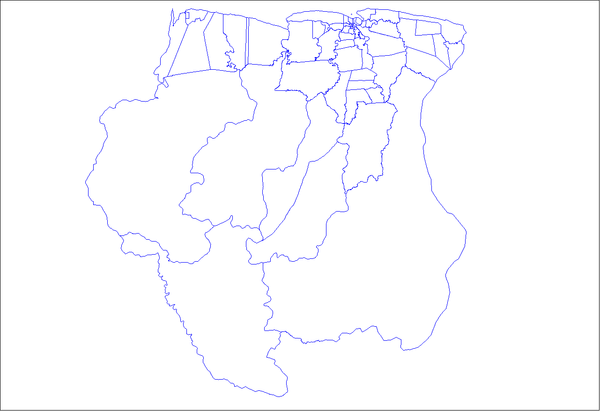 | |
|---|---|---|
| Commewijne District | ||
| Coronie District | ||
| Marowijne District | ||
| Nickerie District | ||
| Para District | ||
| Paramaribo District | ||
| Saramacca District | ||
| Sipaliwini District | ||
| Wanica District | ||
This article is issued from Wikipedia - version of the 10/17/2015. The text is available under the Creative Commons Attribution/Share Alike but additional terms may apply for the media files.