Totness, Suriname
| Totness | |
|---|---|
| Resort and town | |
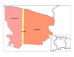 Map showing the resorts of Coronie District. | |
 Totness Map showing the resorts of Coronie District. | |
| Coordinates: 5°52′36″N 56°19′50″W / 5.87667°N 56.33056°W | |
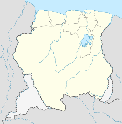
| Country |
|
| District | Coronie District |
| Area | |
| • Total | 173 km2 (67 sq mi) |
| Elevation | 0 m (0 ft) |
| Population (2012) | |
| • Total | 2,150 |
| • Density | 12/km2 (32/sq mi) |
| Time zone | AST (UTC-3) |
Totness is a town in Suriname, located in the Coronie district, of which it is the capital. Totness once had a Scottish settlement. The Surinam-Guyana Submarine Cable System has its landing station in Totness. It connects the telecommunications networks in Suriname with those in Guyana and Trinidad and from Trinidad to the rest of the world.[1] The Totness Airstrip is one of the oldest airport in Suriname, in use since 1953, when the Piper Cub (PZ-NAC) of Kappel-van Eyck named "Colibri" landed there from Zorg en Hoop Airport.
References
- ↑ Submarine Telecoms Forum, Issue 52, retrieved August 1, 2010
Coordinates: 5°53′N 56°19′W / 5.883°N 56.317°W
| Brokopondo District |  | |
|---|---|---|
| Commewijne District | ||
| Coronie District | ||
| Marowijne District | ||
| Nickerie District | ||
| Para District | ||
| Paramaribo District | ||
| Saramacca District | ||
| Sipaliwini District | ||
| Wanica District | ||
This article is issued from Wikipedia - version of the 11/30/2014. The text is available under the Creative Commons Attribution/Share Alike but additional terms may apply for the media files.