Aripuanã
For the plant genus, see Aripuana.
Not to be confused with Novo Aripuanã.
| Aripuanã | |||
|---|---|---|---|
| Municipality | |||
| |||
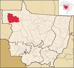 Location in Mato Grosso | |||
| Country |
| ||
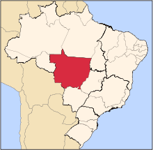
| Region | Center-West | ||
| State | Mato Grosso | ||
| Mesoregion | Norte Mato-Grossense | ||
| Established | 1943 | ||
| Area[1] | |||
| • Total | 96.714 sq mi (250.489 km2) | ||
| Elevation | 344 ft (105 m) | ||
| Population [2] | |||
| • Total | 18,581 | ||
| • Density | 190/sq mi (74/km2) | ||
| Time zone | UTC -3 | ||


Aripuanã is a town and municipality in the state of Mato Grosso in the Central-West Region of Brazil. It is located on the banks of the Aripuanã River.
The city is served by Aripuanã Airport.
The municipality contains the 8,517 hectares (21,050 acres) Rio Flor do Prado Ecological Station, a fully protected environmental unit created in 2003.[3] It also holds part of the 164,224 hectares (405,810 acres) Guariba-Roosevelt Extractive Reserve, a sustainable use unit created in 1996.[4]
References
- ↑ IBGE (10 Oct 2002). "Área territorial oficial" (in Spanish). Resolução da Presidência do IBGE de n° 5 (R.PR-5/02). Retrieved 5 Dec 2010.
- ↑ "Censo Populacional 2010". Censo Populacional 2010 (in Spanish). Instituto Brasileiro de Geografia e Estatística (IBGE). 29 Nov 2010. Archived from the original on 2011-02-20. Retrieved 11 Dec 2010.
- ↑ Blairo Borges Maggi (9 December 2003), Decreto 2.124 de 09 de Dezembro de 2003 (in Portuguese), retrieved 2016-06-05
- ↑ RESEX Guariba-Roosevelt (in Portuguese), ISA: Instituto Socioambiental, retrieved 2016-06-07
Capital: Cuiabá | |||||||||||||||||||||||||||||||
| Centro-Sul Mato-Grossense |
|  | |||||||||||||||||||||||||||||
| Nordeste Mato-Grossense |
| ||||||||||||||||||||||||||||||
| Norte Mato-Grossense |
| ||||||||||||||||||||||||||||||
| Sudeste Mato-Grossense |
| ||||||||||||||||||||||||||||||
| Sudoeste Mato-Grossense |
| ||||||||||||||||||||||||||||||
Coordinates: 10°10′01″S 59°27′32″W / 10.16694°S 59.45889°W
This article is issued from Wikipedia - version of the 10/17/2016. The text is available under the Creative Commons Attribution/Share Alike but additional terms may apply for the media files.