Juara
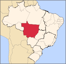
Juara is a municipality located in the state of Mato Grosso in the Central-West Region of Brazil.[1][2][3][4] It is known as the Cattle Capital. Its population in 2004 was estimated about 34,510 inhabitants. The town's economy is based in three field: Wood extraction, cattle rearing and agriculture. However, the wood is coming to an end. Because of that, the development has become slow in this place. Juara is situated about 730 km from the state capital which is Cuiabá, there are two highways of which one is MT 338 that links Juara to Cuiabá and the other is MT 220 that links Juara to Sinop. In the last years a lot of people have moved away because lack of job and education. The students who want to go to a good college have to move to other cities, they usually move to Sinop or Cuiabá. The distance from the capital of Mato Grosso is vast, it takes about 12 hours by bus from Juara to Cuiabá. For this reason, population prefer to go to Sinop by bus because it is nearer than Cuiabá and then they take an airplane there. It's possible to go to Juara by plane but it's very expensive, so, just the rich people use the airport of the town.
The city is served by Inácio Luís do Nascimento Airport. Just Asta Airlines operates in the airport because lack of structure.
See also
References
- ↑ "Divisão Territorial do Brasil" (in Portuguese). Divisão Territorial do Brasil e Limites Territoriais, Instituto Brasileiro de Geografia e Estatística (IBGE). July 1, 2008. Retrieved December 17, 2009.
- ↑ "Estimativas da população para 1º de julho de 2009" (PDF) (in Portuguese). Estimativas de População, Instituto Brasileiro de Geografia e Estatística (IBGE). August 14, 2009. Retrieved December 17, 2009.
- ↑ "Ranking decrescente do IDH-M dos municípios do Brasil" (in Portuguese). Atlas do Desenvolvimento Humano, Programa das Nações Unidas para o Desenvolvimento (PNUD). 2000. Retrieved December 17, 2009.
- ↑ "Produto Interno Bruto dos Municípios 2002-2005" (PDF) (in Portuguese). Instituto Brasileiro de Geografia e Estatística (IBGE). December 19, 2007. Retrieved December 17, 2009.
|
|---|
|
|
|
| Centro-Sul Mato-Grossense | Alto Pantanal | |
|---|
| Alto Paraguai | |
|---|
| Cuiabá | |
|---|
| Rosario Oeste | |
|---|
| |
|---|
|
| Nordeste Mato-Grossense | Canarana | |
|---|
| Medio Araguaia | |
|---|
| Norte Araguaia | |
|---|
|
|---|
|
| Norte Mato-Grossense | Alta Floresta | |
|---|
| Alto Teles Pires | |
|---|
| Arinos | |
|---|
| Aripuanã | |
|---|
| Colíder | |
|---|
| Paranatinga | |
|---|
| Parecis | |
|---|
| Sinop | |
|---|
|
|---|
|
| Sudeste Mato-Grossense | Alto Araguaia | |
|---|
| Primavera do Leste | |
|---|
| Rondonópolis | |
|---|
| Tesouro | |
|---|
|
|---|
|
| Sudoeste Mato-Grossense | Alto Guapore | |
|---|
| Jauru | |
|---|
| Tangará da Serra | |
|---|
|
|---|