Wundanyi
| Wundanyi | |
|---|---|
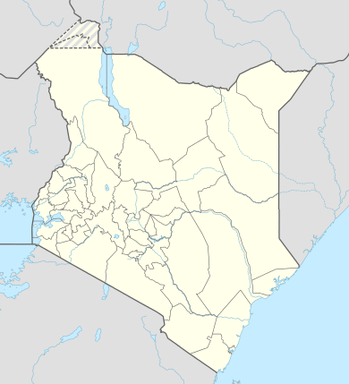 Wundanyi Location in Kenya | |
| Coordinates: 03°23′54″S 38°21′37″E / 3.39833°S 38.36028°E | |
| Country |
|
| County | Taita-Taveta County |
| Population (2015 Estimate) | |
| • Total | 62,340 |
| Time zone | EAT (UTC+3) |
Wundanyi is a town in the Taita-Taveta County of Kenya. Other urban centres in the county include Voi, Taveta and Mwatate.[1]
Location
Wundanyi is located approximately 17 kilometres (11 mi) north of Mwatate, the location of the county headquarters.[2] This is about 40 kilometres (25 mi) west of Voi, the largest town in the county.[3] Wundanyi is about 195 kilometres (121 mi) north-west of the port of Mombasa, the nearest large city.[4] This is about 368 kilometres (229 mi) south-east of Nairobi, the capital and largest city of Kenya.[5] The coordinates of Wundanyi are 03°23'54.0"S. 38°21'37.9"E (Latitude:-3.398329; Longitude:38.360526).[6]
Overview
The town is a popular base for hiking, while local attractions include the Ngangao Forest, known for its butterflies, Wesu Rock and the Cave of Skulls.[7] Shomoto Hill, across the valley from Wundanyi was the formal place of execution for the Taita.[8] Wundanyi is the centre of an agricultural area and the surrounding slopes are highly terraced.[7]
Population
In 2011, the population of Taita-Taveta County was quoted at 284,657.[9] As of May 2015, the population of Wundayi town was estimated at 21.9 percent of the county population,[10] about 62,340 people.
See also
References
- ↑ Taita-Taveta County (14 September 2016). "Taita-Taveta County Profile". Mwatate: Taita-Taveta County Government. Retrieved 14 September 2016.
- ↑ Globefeed,com (14 September 2016). "Distance between Mwatate, Taita-Taveta County, Kenya and Wundanyi, Taita-Taveta County, Kenya". Globefeed.com. Retrieved 14 September 2016.
- ↑ Globefeed.com (14 September 2016). "Distance between Voi, Taita-Taveta County, Kenya and Wundanyi, Taita-Taveta County, Kenya". Globefeed.com. Retrieved 14 September 2016.
- ↑ Globefeed.com (14 September 2016). "Distance between Mombasa, Mombasa County, Kenya and Wundanyi, Taita-Taveta County, Kenya". Globefeed.com. Retrieved 14 September 2016.
- ↑ Globefeed.com (14 September 2016). "Distance between Nairobi, Nairobi County, Kenya and Wundanyi, Taita-Taveta County, Kenya". Globefeed.com. Retrieved 14 September 2016.
- ↑ Google (14 September 2016). "Location of Wundanyi, Taita-Taveta County, Kenya" (Map). Google Maps. Google. Retrieved 14 September 2016.
- 1 2 Parkinson, Tom; Phillips, Matt & Gourlay, Will (2006). Kenya. Lonely Planet Country Guide. p. 149. ISBN 978-1-74059-743-2.
- ↑ Trillo, Richard (2010). The Rough Guide to Kenya. London: Penguin. p. 332. ISBN 978-1-84836-137-9.
- ↑ Daily Nation (18 May 2011). "Taita Taveta at a glance". Daily Nation. Nairobi. Retrieved 14 September 2016.
- ↑ HRI (31 May 2015). "Taita-Taveta County: Secondary Data Review". HumantarianResponse.Info (HRI). Retrieved 14 September 2016.
External links
Coordinates: 03°23′54″S 38°21′37″E / 3.39833°S 38.36028°E