Embu, Kenya
| Embu | |
|---|---|
| Town | |
 | |
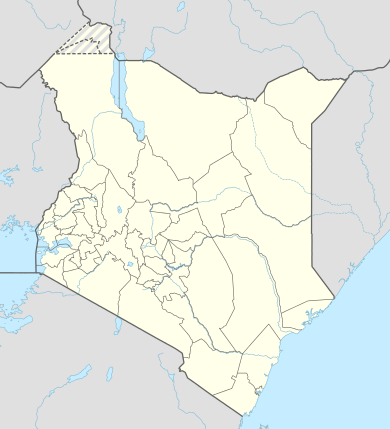 Embu Location in Kenya  MIPAKA YA EMBU NA KIGEOGRAPHIA | |
| Coordinates: 0°32′S 37°37′E / 0.533°S 37.617°E | |
| Country |
|
| County | Embu County |
| Wards | Blue Valley, Itabua, Kamiu, Kangaru, Majengo, Matakari and Njukiri |
| Government | |
| • Type | Municipal Council |
| Elevation | 4,429 ft (1,350 m) |
| Population (1999) | |
| • Total | 41,092 |
| Time zone | EAT (UTC+3) |
| Postal Code | 60100 |
| Area code(s) | 068 |
| Climate | Aw |
Embu is a town located approximately 120 kilometres (75 mi) northeast of Nairobi towards Mount Kenya. Embu serves as the provincial headquarters of Eastern Province in Kenya and is also the county headquarters of Embu County. Located on the south-eastern slopes of Mount Kenya, the town of Embu had a population of 41,092 in 1999.[1]
History
Embu town is a major trading centre in Eastern Kenya. For a long time, it was the main economic center for the Embu and Mbeere communities as well as other communities from central Kenya. Mbeere was carved out of the former Embu district in the 1990s and Siakago town, about 25 km (16 mi) east of Embu town was made its headquarters.
Geography
Embu has an elevation of 1,350 metres (4,429 ft), and is itself located on the foothills of Mount Kenya. It is the former provincial headquarters of the Eastern province, and now the Embu County Headquarters, hosting major public provincial offices including Embu Provincial General Hospital.
The area around Embu Town has conducive altitude for endurance training by athletes. As such, Kenyan athletes utilise the altitude and climate advantage of Embu for training, with specialised facilities at Kigari Teachers' Training College, about 15 km (9.3 mi) outside Embu Town.
The town of Embu, Kenya is known for its jacaranda trees that literally turn the municipality into a purple shower when in bloom. The Jacaranda trees usually bloom in October–November each year, depending on the rainfall.
The town of Embu slopes from west to east, with the highest elevation at the Ruvingaci River, up to the Kangaru School as well as from Njukiri forest in the west to Muthatari in the east, a radius of about 10 km (6 mi) in size. Embu has a small airstrip (1 km (0.62 mi) long), which is 7.1 km (4.4 mi) southeast of the heart of the town.
Way past Kigari Teachers College approximately 25 km from Embu Town is a small town known as Kianjokoma that is a centre for other shopping centres like Miandari, Kathande, Kiriari, Irangi and others; This town is fast growing due to the situated Tea factory - Mungania Tea Factory and now a County Hospital as well as a police line in the area. Other small towns in Embu are Kibugu, Karurumo, Rukuriri, Mukuuri, Kathageri, Kanja and Manyatta among others.
Climate
| Climate data for Embu, Kenya | |||||||||||||
|---|---|---|---|---|---|---|---|---|---|---|---|---|---|
| Month | Jan | Feb | Mar | Apr | May | Jun | Jul | Aug | Sep | Oct | Nov | Dec | Year |
| Average high °C (°F) | 28.7 (83.7) |
30.3 (86.5) |
30.4 (86.7) |
28.6 (83.5) |
27.2 (81) |
26.4 (79.5) |
25.1 (77.2) |
25.4 (77.7) |
28.2 (82.8) |
29.5 (85.1) |
27.5 (81.5) |
27.2 (81) |
27.9 (82.2) |
| Average low °C (°F) | 13.7 (56.7) |
14.3 (57.7) |
16.3 (61.3) |
17.4 (63.3) |
17.2 (63) |
15.6 (60.1) |
15.2 (59.4) |
15.2 (59.4) |
15.8 (60.4) |
16.9 (62.4) |
16.4 (61.5) |
14.7 (58.5) |
15.7 (60.3) |
| Average precipitation mm (inches) | 41 (1.61) |
34 (1.34) |
64 (2.52) |
218 (8.58) |
139 (5.47) |
21 (0.83) |
28 (1.1) |
11 (0.43) |
17 (0.67) |
86 (3.39) |
189 (7.44) |
45 (1.77) |
893 (35.16) |
| Average precipitation days | 4 | 3 | 7 | 13 | 10 | 3 | 3 | 4 | 2 | 8 | 15 | 5 | 77 |
| Source: World Meteorological Organization[2] | |||||||||||||
Religion
There are numerous Christian churches and ministries in Embu, including the Seventh Day Adventist (SDA), Anglican Church of Kenya's St. Paul's Cathedral, the Presbyterian Church of East Africa's Blue Valley. P.C.E.A,the national independent church of Africa(N.I.C.A), the African independent Pentecostal church of Africa (A.I.P.C.A) majimbo,kangaru kathangariri,kibugu, kavutiri,ndunduri,itabua,gichera,makengi,kirigiri among many others and the Roman Catholic Diocese of Embu's Sts. Peter and Paul Cathedral. The latter cathedral has a unique African-inspired design and is among the largest in Africa. Missions for Christ Ministries office and churches in Embu county. Churches under Missions for Christ Ministries includes Kevote Family Church, Embu town Family Church, Runyenjes Family Church, Kamugere Family Church and Kianjokoma Family Church.The national Independent church of Africa located at gakwegwori(MWAMBA IMARA)kianjokoma,kiriari, kithunguriri,kamugere, Mukuuri, keria,kibugu,kavutiri...
Another Protestant church, the first encountered, on entering Embu from Kirinyaga county is that of the Kenya Assemblies of God (K.A.G), it is better known as the Eastern Gate assembly as it is also the first church encountered on crossing into Eastern Province from all the Provinces except North Eastern.
Family Worship Church Inc is a Protestant Christian church founded in early 70s. It has continued to impact the spiritual lives of Christians through the right biblical teachings. It has the headquarters at Nembure and branches in Manyatta, Kithimu, Kiandundu, Gaikiro, Makengi and focused to start a branch in Embu town.
Electoral subdivisions
Embu forms a municipality that has seven wards (Blue Valley, Itabua, Kamiu, Kangaru, Majengo, Matakari and Njukiri). All of them belong to Manyatta Constituency, which has a total of eleven wards. The remaining four are located within Embu County Council, the rural council of Embu.[3]
Notable residents
- Cardinal John Njue, Archbishop of Nairobi and former Bishop of Embu
- Patrick Njiru, Renowned Safari Rally Driver in East Africa.
- Kithinji Kiragu - Renowned public Sector Management Consultant who is now retired.
- Martin Nyaga Wambora - First ever Governor of Embu and a former Runyenjes MP and chair of Kenya Airports Authority
- Bishop Francis Njagi Kambo - Founder of Family Worship Church Inc and a retired Ministry of Health (MOH) Administrator.
University Education
- Embu University College
- Embu College of professional studies
See also
References
- ↑ "Population of Local Authorities" (with towns), Government of Kenya, 1999, webpage: GovtKenya-Population-PDF
- ↑ "World Weather Information Service – Embu". World Meteorological Organization. Retrieved 31 August 2016.
- ↑ Electoral Commission of Kenya: Registration centres by electoral area and constituency
External links
- Embu University College
- Embu Water and Sanitation Company
- Embu Music
- Aerial imagery and geographical features around Embu, Kenya.
Coordinates: 0°32′S 37°27′E / 0.533°S 37.450°E