Taita-Taveta County
| Taita-Taveta County | |||
|---|---|---|---|
| County | |||
|
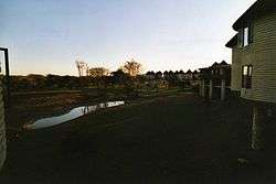
Salt Lick Lodge in the evening | |||
| |||
 Location in Kenya | |||
| Country |
| ||
| Formed | March 4th 2013 | ||
| Capital | Mwatate | ||
| Government | |||
| • Governor | John Mtuta Mrutu | ||
| Area | |||
| • Total | 17,083.9 km2 (6,596.1 sq mi) | ||
| Population (2009) | |||
| • Total | 284,657 [1] | ||
| Time zone | EAT (UTC+3) | ||
| Website | taitataveta.go.ke | ||


Taita-Taveta County is a county of Kenya. It lies approximately 200 km northwest of Mombasa and 360 km southeast of Nairobi.
The capital is Mwatate, although it is the third-largest town in the county after Voi, Wundanyi and Taveta in that order.
The population of the county 30 years ago was approximately 45,000 persons but this has shot up to well over 250,000 persons with population densities ranging from 3 persons per km2. to more than 800 persons per km2. This is due to the varied rainfall and terrain with the lower zones receiving an average 440 mm of rain per annum and the highland areas receiving up to 1900 mm of rain. The district ranges in altitude from 500 m above sea level to 2,228 m at Vuria Peak, which is the district's highest point.
In 2007, the Taita-Taveta District was split into two districts: the Taita District and the Taveta District.[2] The two were subsequently re-united to form Taita-Taveta County.
Land use
The county covers an area of 17,083.9 km2. of which a bulk 62% or 11,100 km2. is within Tsavo East and Tsavo West National Parks. The remaining 5,876 km2 is occupied by ranches, sisal estates, water bodies such as Lakes Chala and Jipe in Taveta and Mzima springs, and the hilltop forests which occupy less than 100 km2. or approximately 10 km² out of 587.5 km².
The lowland areas of the district that do not belong to national parks are divided among ranches, estates, and wildlife sanctuaries. The district has approximately 25 ranches. The main land use in ranch is cattle grazing. The three operating sisal estates of the district are the Teita Sisal Estate, Voi Sisal Estate and Taveta Sisal Estate. Many ranches utilize also wildlife tourism and conservation. The Taita Hills and Saltlick Lodges sanctuary is located in the district.
There are 48 forests which have survived on hill tops in the district of which 28 are gazetted and are under government protection and management. They range in size from small 500 square metres with a few remnant trees to modestly vast 2 square kilometres indigenous and exotic forest mountains. These forests are part of a unique Eastern Arch range of forests which are found mostly in Eastern Tanzania with the Taita Hills forming the only Kenyan Eastern Arc forest type in East Africa.
The Taita Hills forest hold a unique biodiversity with 13 taxa of plants and 9 taxa of animals found only in the Taita Hills and nowhere else in the world. In addition 22 plant species found in the Taita Hills forests are typical of the Eastern arc forests. The next being in eastern Tanzania. Some of the endemic African violet - Saintpaulia teitensis among others. Within these beautiful indigenous forests, bubble pure clean water to the lowland areas to cater for both human agricultural activities and wildlife in the Taita game sanctuary and Aruba dam in Tsavo East. The lower plains are thus supplied with water by the forests in the hills which are a good catchment of rains.
Townships and villages
The capital of the district is small town of Wundanyi, though Voi is the largest town in the district.
| Local authorities (councils) | |||
| Authority | Type | Population* | Urban pop.* |
|---|---|---|---|
| Voi | Municipality | 32,176 | 16,863 |
| Taveta | Town | 52,456 | 11,495 |
| Taita-Taveta | County | 162,039 | 8,032 |
| Total | - | 246,671 | 36,390 |
| * 1999 census. Source: | |||
| Administrative divisions | |||
| Division | Population* | Urban pop.* | Headquarters |
|---|---|---|---|
| Mwambirwa | 4,927 | 0 | |
| Mwatate | 56,365 | 3,386 | Mwatate |
| Tausa | 20,275 | 0 | |
| Taveta | 53,038 | 22,219 | Taveta |
| Tsavo West N.P. | 2,733 | 0 | |
| Voi | 54,562 | 15,382 | Voi |
| Wundanyi | 54,771 | 4,055 | Wundanyi |
| Total | 246,671 | 34,042 | |
| * 1999 census. Sources: , , | |||
The county has four constituencies:
See also
References
- ↑ http://www.scribd.com/doc/36672705/Kenya-Census-2009
- ↑ Kenya Food Security (2008). "TAITA TAVETA DISTRICT REPORT LONG RAINS FOOD SECURITY ASSESSMENT" (PDF). kenyafoodsecurity.org. Retrieved 2009-09-03.
Coordinates: 3°20′S 38°15′E / 3.333°S 38.250°E