Wajir
| Wajir | |
|---|---|
| Town | |
 | |
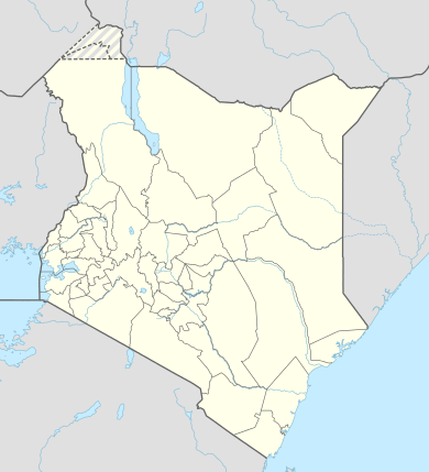 Wajir Location in Kenya | |
| Coordinates: 01°45′00″N 40°03′00″E / 1.75000°N 40.05000°E | |
| Country |
|
| County | Wajir County |
| Elevation | 1,200 m (3,900 ft) |
| Population (2009 Census)[1] | |
| • Town | 82,800 |
| • Urban | 16,838 |
| Area code(s) | 46 |
| Climate | BWh |
Wajir (Somali: Wajeer) is the capital of the Wajir County of Kenya. It is situated in the former North Eastern Province.
History
A cluster of cairns near Wajir are generally ascribed by the local inhabitants to the Madanle, a semi-legendary people of high stature, who are associated with the Somali. A. T. Curle (1933) reported the excavation of two of these large tumuli, finding traces of skeletal remains which crumbled at his touch, as well as earthenware shards and a copper ring.[2]
Overview
Wajir is located in an arid area prone to drought. It sits at a latitude and longitude of 01°45′00″N 40°03′00″E / 1.75000°N 40.05000°E. (Latitude:1.75000; Longitude:40.05000). The town is served by Wajir Airport, with flights to Nairobi, Galkacyo and Mogadishu.
Demographics
Wajir is mainly inhabited by Somalis, most belonging to the Ogaden,Ajuran and Degodia Clan. The 1999 census reported a total population of 661,941 inhabitants.[3]
Climate
| Climate data for Wajir | |||||||||||||
|---|---|---|---|---|---|---|---|---|---|---|---|---|---|
| Month | Jan | Feb | Mar | Apr | May | Jun | Jul | Aug | Sep | Oct | Nov | Dec | Year |
| Average high °C (°F) | 35 (95) |
36 (96) |
36 (96) |
34 (94) |
33 (92) |
32 (90) |
31 (88) |
32 (89) |
33 (91) |
33 (92) |
33 (91) |
33 (92) |
33 (92) |
| Average low °C (°F) | 21 (70) |
22 (72) |
23 (74) |
24 (75) |
23 (73) |
21 (70) |
21 (69) |
21 (69) |
21 (70) |
22 (71) |
22 (71) |
23 (73) |
22 (71) |
| Average precipitation mm (inches) | 5 (0.2) |
13 (0.5) |
20 (0.8) |
69 (2.7) |
36 (1.4) |
0 (0) |
5 (0.2) |
3 (0.1) |
5 (0.2) |
30 (1) |
41 (1.6) |
23 (0.9) |
241 (9.5) |
| Source: Weatherbase [4] | |||||||||||||
Education
Wajir county has several secondary schools, which are located in Wajir South,Wajir East,Wajir West,Wajir North,Tarbaj and Eldas.Some of the academic institutions include Wajir High School, Wajir Girls High, Sabunley Secondaru, Griftu High, Hon. Khalif, Eldas High, Bute High, Hadado, Habaswein High, Furaha Mixed Day School, Waberi Mixed Day Secondary School,Buna Boys,Buna Girls,Korondile Boys,Bute Girls,Bute Mixed Day Secondary, Sabunley Secondary School,Lehey Secondary,Khorofharar,Kutulo and many others.
Administrative divisions
Wajir is the capital of the Wajir County. The County is subdivided into 6 sub-counties (Wajir East, Wajir West, Wajir North, Wajir South, Tarbaj and Eldas). These sub-counties also corresponds to the constituencies represented by Members of Parliament in the National Assembly The county has a total of 30 wards. The current Governor, Ahmed Abdullahi was elected into office in 2013 as the First Governor of the county following the Promulgation of the new constitution.
See also
References
- ↑ "2009 Census Vol 1 Table 3 Rural and Urban Population". Kenya Open Data Project. 2011.
- ↑ I.M. Lewis, "132. The So-Called 'Galla Graves' of Northern Somaliland", Man 61 (1961), p. 103. Lewis cites an earlier report by Curle, "Prehistoric graves in the Northern Frontier Province of Kenya Colony," Man, 1933, p. 102;
- ↑ 1999 National Census
- ↑ "Weatherbase: Historical Weather for Wajir, Kenya". Weatherbase. 2011. Retrieved on November 24, 2011.
External links
Coordinates: 1°45′00″N 40°03′00″E / 1.75000°N 40.0500°E