Wajir County
Not to be confused with Wajir.
| Wajir County | ||
|---|---|---|
| County | ||
| ||
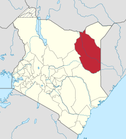 Location of Wajir County in Kenya | ||
| Coordinates: 1°44′50″N 40°04′08″E / 1.74722°N 40.0689°ECoordinates: 1°44′50″N 40°04′08″E / 1.74722°N 40.0689°E | ||
| Country |
| |
| Formed | March 4, 2013 | |
| Capital and largest town | Wajir | |
| Other towns | Habaswein | |
| Government | ||
| • Governor | Ahmed Abdullahi | |
| Area | ||
| • Total | 55,840.6 km2 (21,560.2 sq mi) | |
| Population (2009)[1] | ||
| • Total | 661,941 | |
| • Density | 12/km2 (31/sq mi) | |
| Time zone | EAT (UTC+3) | |
| Website |
www | |

Wajir County is a county in the former North Eastern Province of Kenya. Its capital and largest town is Wajir. The county has a population of 661,941[2] and an area of 55,840.6 km². Wajir County has only one local authority: Wajir county council. The county has four constituencies: Wajir North, Wajir West, Wajir East and Wajir South. Wajir County is divided into fourteen administrative divisions:
| Division | Population* | Pop. density* | Area (km²) | Headquarters |
|---|---|---|---|---|
| Buna | 29,160 | 5 | x | Buna |
| Bute | 14,684 | 20 | x | Bute |
| Central | 51,006 | 22 | x | Wajir |
| Diff | 19,052 | 3 | x | |
| Eldas | 9,166 | 4 | x | |
| Griftu | 42,333 | 6 | x | |
| Gurar | 18,087 | 7 | x | Gurar |
| Habaswein | 27,467 | 6 | x | Habaswein |
| Hadado | 19,787 | 5 | x | |
| Kotulo | 23,016 | 9 | x | |
| Lafaley | 5,883 | 12 | x | |
| Sebule | 25,699 | 3 | x | |
| Tarbaj | 22,758 | 4 | x | Tarbaj |
| Wajir-Bor | 17,046 | 4 | x | |
| Total | 319,261 | 6 (average) | x | - |
| * 1999 census. Sources:[3] | ||||
References
External links
This article is issued from Wikipedia - version of the 11/16/2015. The text is available under the Creative Commons Attribution/Share Alike but additional terms may apply for the media files.