Marsabit County
Not to be confused with Marsabit.
| Marsabit County | |||
|---|---|---|---|
| County | |||
|
Marsabit Landscape | |||
| |||
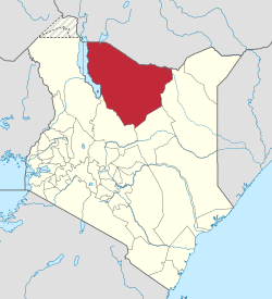 Location of Marsabit County in Kenya | |||
| Coordinates: 2°19′N 37°58′E / 2.317°N 37.967°ECoordinates: 2°19′N 37°58′E / 2.317°N 37.967°E | |||
| Country |
| ||
| Formed | March 4, 2013 | ||
| Capital | Marsabit | ||
| Largest town | Moyale | ||
| Other towns | Sololo | ||
| Government | |||
| • Governor | Ukur Yatani | ||
| Area | |||
| • Total | 66,923.1 km2 (25,839.2 sq mi) | ||
| Population (2009)[1] | |||
| • Total | 291,166 | ||
| • Density | 4.4/km2 (11/sq mi) | ||
| Time zone | EAT (UTC+3) | ||
| Website |
marsabit | ||


Marsabit County is a county of Kenya. Its capital is Marsabit and its largest town Moyale. The county has a population of 291,166.[2]
Geography
The county is located in northern Kenya. It borders the eastern shore of Lake Turkana.
Subdivisions
Marsabit County has only one local authority, Marsabit county council. The county is divided into six administrative divisions:
| Division | Population* | Urban pop.* | Headquarters |
|---|---|---|---|
| Central | 25,100 | 10,619 | Marsabit |
| Gadamoji | 12,345 | 0 | |
| Laisamis | 24,011 | 2,817 | Laisamis |
| Loiyangalani | 16,965 | 1,054 | |
| Maikona | 19,518 | 0 | Maikona |
| North Horr | 23,539 | 2,343 | North Horr |
| Total | 121,478 | 16,833 | - |
| * 1999 census. Sources:,,[3][4] | |||
Electoral constituencies
The county has four constituencies:
References
External links
- http://softkenya.com/county/marsabit-county/ Marsabit County
- http://www.aridland.go.ke/bulletins/August%202006-Marsabit.pdf
This article is issued from Wikipedia - version of the 11/16/2015. The text is available under the Creative Commons Attribution/Share Alike but additional terms may apply for the media files.