Vladičin Han
| Vladičin Han Владичин Хан | ||
|---|---|---|
| Municipality and Town | ||
|
General view | ||
| ||
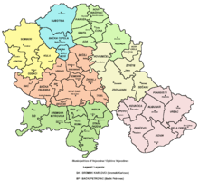
 Location of the municipality of Vladičin Han within Serbia | ||
| Coordinates: 42°42′N 22°04′E / 42.700°N 22.067°ECoordinates: 42°42′N 22°04′E / 42.700°N 22.067°E | ||
| Country |
| |
| District | Pčinja | |
| Settlements | 51 | |
| Government | ||
| • Mayor | Nenad Mitrović | |
| Area[1] | ||
| • Municipality | 366 km2 (141 sq mi) | |
| Population (2011 census)[2] | ||
| • Town | 8,053 | |
| • Municipality | 20,938 | |
| Time zone | CET (UTC+1) | |
| • Summer (DST) | CEST (UTC+2) | |
| Postal code | 17510 | |
| Area code | +381 17 | |
| Car plates | VR | |
| Website |
www | |
_-_church_and_train_station.JPG)

Municipality of Vladičin Han in Pčinja District
Vladičin Han (Serbian Cyrillic: Владичин Хан, pronounced [ʋlǎdit͡ʃiŋ xâːn])[3] is a town and municipality located in the Pčinja District of Serbia. The population of the town is 8,030, while the population of the municipality is 20,871. This picturesque town is situated along the main express route linking Belgrade and Niš with Skopje and ultimately Greece via the Republic of Macedonia.
Settlements
Aside from the town of Vladičin Han, the municipality includes the following settlements:
- Vladičin Han
- Balinovce
- Bačvište
- Belanovce
- Beliševo
- Bogoševo
- Brestovo
- Vrbovo
- Garinje
- Gornje Jabukovo
- Gramađe
- Dekutince
- Donje Jabukovo
- Dupljane
- Žitorađe
- Zebince
- Jagnjilo
- Jastrebac
- Jovac
- Kalimance
- Kacapun
- Koznica
- Kopitarce
- Kostomlatica
- Kržince
- Kukavica
- Kunovo
- Lebet
- Lepenica
- Letovište
- Ljutež
- Mazarać
- Manajle
- Manjak
- Mrtvica
- Ostrovica
- Polom
- Prekodolce
- Priboj
- Ravna Reka
- Rdovo
- Repince
- Repište
- Ružić
- Solačka Sena
- Srneći Dol
- Stubal
- Suva Morava
- Tegovište
- Urvič
- Džep
Demographics
Ethnic composition of the municipality:
| Ethnic group | Population |
|---|---|
| Serbs | 18,644 |
| Roma | 1,503 |
| Bulgarians | 88 |
| Macedonians | 23 |
| Russians | 10 |
| Others | 603 |
| Total | 20,871 |
History
From 1929 to 1941, Vladičin Han was part of the Vardar Banovina of the Kingdom of Yugoslavia.
References
- ↑ "Municipalities of Serbia, 2006". Statistical Office of Serbia. Retrieved 2010-11-28.
- ↑ "2011 Census of Population, Households and Dwellings in the Republic of Serbia: Comparative Overview of the Number of Population in 1948, 1953, 1961, 1971, 1981, 1991, 2002 and 2011, Data by settlements" (PDF). Statistical Office of Republic Of Serbia, Belgrade. 2014. ISBN 978-86-6161-109-4. Retrieved 2014-06-27.
- ↑ Vladičin / Владичин pronounced in isolation: [ʋlǎdit͡ʃin].
See also
Capital: Vladičin Han | ||
| Villages |
|  |
| Landmarks |
| |

| Wikimedia Commons has media related to Vladičin Han. |
This article is issued from Wikipedia - version of the 6/30/2015. The text is available under the Creative Commons Attribution/Share Alike but additional terms may apply for the media files.