Savski Venac
| Savski Venac Савски Венац | ||
|---|---|---|
| Municipality | ||
| ||
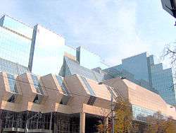
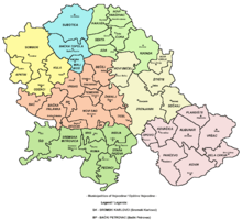
 Location within the City of Belgrade | ||
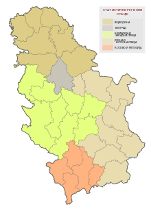
 Location within Serbia | ||
| Country | Serbia | |
| City | Belgrade | |
| Status | Municipality | |
| Settlements | 1 | |
| Government | ||
| • Type | Municipality of Belgrade | |
| • Mun. president | Irena Vujović (SNS) | |
| Area | ||
| • Total | 16 km2 (6 sq mi) | |
| Population (2011) | ||
| • Total | 38,660 | |
| • Density | 2,400/km2 (6,300/sq mi) | |
| Time zone | CET (UTC+1) | |
| • Summer (DST) | CEST (UTC+2) | |
| Postal code | 11000 | |
| Area code(s) | +381 11 | |
| Car plates | BG | |
| Website | www.savskivenac.rs | |

Savski Venac (Serbian Cyrillic: Савски Венац, pronounced [sâːv̞skiː v̞ě̞ːnat͡s]) is one of 17 city municipalities which constitute the City of Belgrade, the capital of Serbia. Savski Venac is one of the three municipalities that constitute the very center of the city (together with Stari Grad and Vračar).[1]
Location
Savski Venac is located on the right bank of the Sava river. It stretches in the north-south direction for 6 kilometers (3.7 mi) (from downtown Belgrade, just 200 meters (660 ft) from Terazije, to Banjica) and east-west direction for 3 kilometers (1.9 mi) (from Senjak and the Sava bank to Autokomanda). It borders the municipalities of Stari Grad to the north, Vračar to the north-east, Voždovac to the east, Rakovica to the south and Čukarica to the west.
Geography
With an area of 14 square kilometers (5.4 sq mi), Savski Venac is the third smallest municipality of Belgrade after Vračar and Stari Grad. Despite being small in area, it includes several diverse geographical features:
- the low section on the right bank of the Sava river (Savamala and Bara Venecija). Due to its low altitude toward the Sava, and lack of any protection, this is the only part of central urban area of Belgrade that gets flooded during the extremely high waters of the river. It was almost completely flooded in 1984 and during major floods in 2006.
- southern slopes of the hill of Terazije (Terazijska Terasa) which descends from downtown Belgrade to the Sava.
- entire western slope of the Vračar Hill (Karađorđev Park and former Zapadni Vračar) which also descends to the Sava.
- the former valley of the stream od Mokroluški Potok, now conducted underground. It is a route to the modern highway and the new railstation of Prokop.
- the hill of Topčidersko Brdo which has a cliff-like edge above the Sava (Senjak).
- the hill of Banjica in the extreme south of the municipality.
- the upper valley of Topčiderska reka and the vast park-forest of Topčider.
Population
According to the census of 2011, Savski Venac has a population of 38,660. As all the other central city municipalities, it has been depopulating for decades, however, it still remains one of the most densely populated: 2,416/km2 (6,260/sq mi) (4,686/km² or 12,136/sq mi back in 1961). Population of Savski Venac:
- 1961 - 74,971
- 1971 – 63,531
- 1981 – 53,374
- 1991 – 45,961
- 2002 – 42,505
- 2011 – 38,660
Ethnic structure:
- Serbs = 36,928 (86.87%)
- Yugoslavs = 952 (2.24%)
- Montenegrins = 878 (2.06%)
- Croats = 356 (0.84%)
- Romani = 276 (0.65%)
- Macedonians = 239 (0.56%)
Politics
Recent Presidents of the Municipality since 2000:
- 2000–2004: Branislav Belić
- October 21, 2004–June 22, 2012: Tomislav Đorđević
- June 22, 2012–June 4, 2016: Dušan Dinčić
- June 4, 2016–present: Irena Vujović
History and name
While Savski Venac and Stari Grad are often styled the oldest municipalities of Belgrade due to their inclusion of the oldest sections of urban Belgrade outside the walls of the Kalemegdan fortress, they are actually the most recently created urban municipalities of Belgrade. Both were formed in 1957 by merger of older, smaller municipalities; Savski Venac was formed in by merger of the municipalities of Zapadni Vračar (its main predecessor) and Topčidersko Brdo and a new, geographical name, Savski Venac, was coined for it.
(Venac is usually used in Belgrade's geography in term of a round street (Obilićev Venac, Kosančićev Venac) or a rim of the river (Dunavski Venac). In this case it was the "rim of the Sava".)
Neighborhoods
Features
Savski Venac constitutes the western section of the downtown Belgrade. Most government offices and administrative buildings are located in the municipality, including:
Administration
- The Government of the Republic of Serbia in Nemanjina Street
- The building of the ministries, also in Nemanjina street
- The new building of the National Bank of Serbia, (Slavija)
- The former buildings of republic and federal police (destroyed during the 1999 NATO's attack)
- The former complex of the Joint Chiefs of Staff (same as the above)
- Over 30 embassies and dozens of ambassadorial residences
- Archives of Yugoslavia (Senjak)
Traffic
- Main railway station of Belgrade (Savski trg)
- Main bus station of Belgrade (BAS)
- Main bus station of Lasta (Bara Venecija)
- Future main railway station of Belgrade (Prokop)
- The highway and all the six bridges across the Sava to Novi Beograd: Brankov, Stari savski, Gazela, Stari želenički, Novi železnički, Most na Adi)
- Both major interchanges in old Belgrade: Mostarska Petlja and Autokomanda
Economy and tourism
- "BIP" brewery
- Belgrade Fair (Beogradski sajam, on the bank of the Sava)
- Open green market "Zeleni Venac"
- Hotel "Astorija"
- Hotel "Beograd"
- Park Manjež
- Hajd Park
- Topčider Park, with the entire complex around the Konak of Prince Miloš and the Topčider wood
- Beli Dvor, former royal court
Health
- Clinical center Belgrade, with 24 clinics and hospitals (beginning at Karađorđev park)
- City ambulance (Mostar)
- Hospital Dragiša Mišović (Dedinje)
- Železnička hospital (Dedinje)
- Orthopaedic hospital (Banjica)
- Vojnomedicinska akademija ("VMA", Banjica)
Culture and education
- Yugoslav Drama Theatre
- Theater Bojan Stupica
- Student's Cultural Center (SKC)
- University of Belgrade Faculty of Economics
- Faculty of the veterinarian medicine of the Belgrade University
- Touristic high school (Jug Bogdanova street)
- French School (Ecole Française de Belgrade)
See also
References
External links
| Municipalities | ||
|---|---|---|

Coordinates: 44°41′N 20°24′E / 44.683°N 20.400°E
| Wikimedia Commons has media related to Savski Venac. |