Taylorsville, Georgia
| Taylorsville, Georgia | |
|---|---|
| Town | |
|
Farmers Supply Company in Taylorsville | |
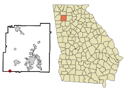 Location in Bartow County and the state of Georgia | |
| Coordinates: 34°5′5″N 84°59′7″W / 34.08472°N 84.98528°WCoordinates: 34°5′5″N 84°59′7″W / 34.08472°N 84.98528°W | |
| Country | United States |
| State | Georgia |
| Counties | Bartow, Polk |
| Area | |
| • Total | 1.5 sq mi (3.9 km2) |
| • Land | 1.5 sq mi (3.9 km2) |
| • Water | 0 sq mi (0 km2) |
| Elevation | 732 ft (223 m) |
| Population (2010) | |
| • Total | 213 |
| • Density | 152.7/sq mi (58.7/km2) |
| Time zone | Eastern (EST) (UTC-5) |
| • Summer (DST) | EDT (UTC-4) |
| ZIP code | 30178 |
| Area code(s) | 770/678/470 |
| FIPS code | 13-75664[1] |
| GNIS feature ID | 0323966[2] |

Taylorsville is a town in Bartow and Polk counties in the U.S. state of Georgia. The population was 211 at the 2012 census.
History
Taylorsville was surveyed circa 1870 by Edward G. Taylor, and named for him.[3]
2008 tornado outbreak
On March 14–15 there was a tornado outbreak across much of the southeast United States in which damage was inflicted on portions of the City of Atlanta and its northwest suburbs, including Taylorsville. An EF3 tornado struck Taylorsville killing 2 people, causing 2 serious injuries, demolishing 21 homes and damaging over 100 others. The path of the tornado across Taylorsville was estimated at 16 miles long.
2011 political scandal
On October 28, 2011, former Taylorsville Mayor, Cary Rhodes, was arrested after attempting to meet a minor for sex. In the internet sting operation, initiated by the United States Federal Bureau of Investigation, Rhodes was charged with attempted child molestation and violation of the Computer Pornography and Child Exploitation Act. The State subsequently dropped the attempted child molestation charges. On June 28, 2012, Rhodes was convicted and sentenced for inappropriate conversations over the Internet. He was given a term of two years in prison and 10 years on probation on one count of computer and electronic child exploitation.[4]
Geography and climate
Taylorsville is located at 34°5′5″N 84°59′7″W / 34.08472°N 84.98528°W (34.084798, -84.985249).[5]
According to the United States Census Bureau, the town has a total area of 1.5 square miles (3.9 km2), all of it land.
The majority of Lake Allatoona is located in Bartow County. Taylorsville is nearby.
| Climate data for Taylorsville, Georgia | |||||||||||||
|---|---|---|---|---|---|---|---|---|---|---|---|---|---|
| Month | Jan | Feb | Mar | Apr | May | Jun | Jul | Aug | Sep | Oct | Nov | Dec | Year |
| Average high °F (°C) | 56 (13) |
62 (17) |
66 (19) |
77 (25) |
84 (29) |
90 (32) |
95 (35) |
94 (34) |
86 (30) |
77 (25) |
62 (17) |
51 (11) |
75 (23.9) |
| Average low °F (°C) | 29 (−2) |
32 (0) |
46 (8) |
51 (11) |
65 (18) |
71 (22) |
78 (26) |
76 (24) |
61 (16) |
49 (9) |
40 (4) |
29 (−2) |
52.3 (11.2) |
| Source: Weatherbase[6] | |||||||||||||
Demographics
| Historical population | |||
|---|---|---|---|
| Census | Pop. | %± | |
| 1880 | 95 | — | |
| 1890 | 87 | −8.4% | |
| 1900 | 139 | 59.8% | |
| 1910 | 197 | 41.7% | |
| 1920 | 258 | 31.0% | |
| 1930 | 220 | −14.7% | |
| 1940 | 233 | 5.9% | |
| 1950 | 260 | 11.6% | |
| 1960 | 226 | −13.1% | |
| 1970 | 253 | 11.9% | |
| 1980 | 266 | 5.1% | |
| 1990 | 269 | 1.1% | |
| 2000 | 229 | −14.9% | |
| 2010 | 210 | −8.3% | |
| Est. 2015 | 214 | [7] | 1.9% |
As of the census[1] of 2010, the population was 3,796. The population density was 153.3 people per square mile (59.3/km²). There were 103 housing units at an average density of 68.9 per square mile (26.7/km²). The racial makeup of the town was 93.45% White, 4.37% African American, 0.87% from other races, and 1.31% from two or more races. Hispanic or Latino of any race were 1.75% of the population.
There were 93 households out of which 28.0% had children under the age of 18 living with them, 64.5% were married couples living together, 5.4% had a female householder with no husband present, and 25.8% were non-families. 23.7% of all households were made up of individuals and 16.1% had someone living alone who was 65 years of age or older. The average household size was 2.46 and the average family size was 2.84.
In the town the population was spread out with 21.4% under the age of 18, 6.1% from 18 to 24, 31.4% from 25 to 44, 24.0% from 45 to 64, and 17.0% who were 65 years of age or older. The median age was 38 years. For every 100 females there were 90.8 males. For every 100 females age 18 and over, there were 91.5 males.
The median income for a household in the town was $39,375, and the median income for a family was $51,250. Males had a median income of $32,500 versus $20,625 for females. The per capita income for the town was $22,135. None of the families and 2.1% of the population were living below the poverty line, including no under eighteens and 6.1% of those over 64.
Education
Students living in the Taylorsville area enroll into either the Bartow County School System located in nearby Cartersville or the Polk County School System located in nearby Rockmart.
Healthcare
Floyd Primary Care Center serves residents within the Taylorsville and Rockmart area. The Floyd Primary Care Center also holds the Center for Diabetes of Taylorsville. There are also 4 major hospitals within reach: Cartersville Medical Center (Cartersville), Floyd Medical Center (Rome), Redmond Regional Medical Center (Rome), and Wellstar Kennestone Hospital (Marietta).
Emergency services in Taylorsville are primarily provided by the Bartow County Fire Department and EMS.
Georgia Power Plant Bowen
Plant Bowen is a coal-fired power station located near Taylorsville. It is approximately 8.7 mi (14 km) west-south-west from Cartersville in western Bartow County. At 3,499 megawatts, Plant Bowen has the second largest generating capacity of any coal-fired power plant in North America, and the largest in the United States; only Ontario Power Generation's Nanticoke Generating Station in Canada has more generating capacity. Plant Bowen ranked third in the nation for net generation in 2006 producing over 22,630,000 MWh. The station is connected to the southeastern power grid by numerous 500 kV transmission lines, and is owned and operated by Georgia Power, a subsidiary of Southern Company.
Notable people
- Willard Nixon (1928–2000) Boston Red Sox player
- Charlie Sproull (1919–1980) Philadelphia Phillies player
References
- 1 2 "American FactFinder". United States Census Bureau. Retrieved 2008-01-31.
- ↑ "US Board on Geographic Names". United States Geological Survey. 2007-10-25. Retrieved 2008-01-31.
- ↑ "Bartow County". Calhoun Times. September 1, 2004. p. 24. Retrieved 24 April 2015.
- ↑ "Taylorsville mayor gets prison in 'traveler' case » Local News » The Daily Citizen, Dalton, GA". Daltondailycitizen.com. 2012-06-28. Retrieved 2012-10-16.
- ↑ "US Gazetteer files: 2010, 2000, and 1990". United States Census Bureau. 2011-02-12. Retrieved 2011-04-23.
- ↑ "Weatherbase: Historical Weather for Taylorsville, Georgia, United States of America". Retrieved July 20, 2010.
- ↑ "Annual Estimates of the Resident Population for Incorporated Places: April 1, 2010 to July 1, 2015". Retrieved July 2, 2016.
- ↑ "Census of Population and Housing". Census.gov. Retrieved June 4, 2015.
Municipalities and communities of Bartow County, Georgia, United States | ||
|---|---|---|
| Cities | 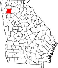 | |
| Town | ||
| Unincorporated communities | ||
| Ghost town | ||
| Footnotes | ‡This populated place also has portions in an adjacent county or counties | |
Municipalities and communities of Polk County, Georgia, United States | ||
|---|---|---|
| Cities | 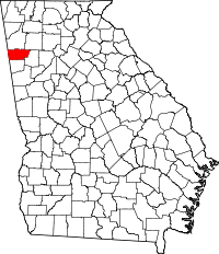 | |
| Town | ||
| Unincorporated communities | ||
| Footnotes | ‡This populated place also has portions in an adjacent county or counties | |
 |
Rome, Georgia | Adairsville, Georgia | Euharlee, Georgia | |
| Cedartown, Georgia | |
Cartersville, Georgia | ||
| ||||
| | ||||
| Rockmart, Georgia | Braswell, Georgia | Dallas, Georgia |