Suissevale, New Hampshire
| Suissevale, New Hampshire | |
|---|---|
| Census-designated place | |
 Suissevale  Suissevale | |
| Coordinates: 43°43′29″N 71°21′48″W / 43.72472°N 71.36333°WCoordinates: 43°43′29″N 71°21′48″W / 43.72472°N 71.36333°W | |
| Country | United States |
| State | New Hampshire |
| County | Carroll |
| Town | Moultonborough |
| Area | |
| • Total | 1.2 sq mi (3.1 km2) |
| • Land | 1.2 sq mi (3.0 km2) |
| • Water | 0.0 sq mi (0.0 km2) |
| Elevation | 640 ft (200 m) |
| Population (2010) | |
| • Total | 249 |
| • Density | 210/sq mi (80/km2) |
| Time zone | Eastern (EST) (UTC-5) |
| • Summer (DST) | EDT (UTC-4) |
| Area code(s) | 603 |
| FIPS code | 33-74780 |
| GNIS feature ID | 0871237 |
Suissevale is a private subdivision in the town of Moultonborough in Carroll County, New Hampshire. It is located between New Hampshire Route 109 and Moultonborough Bay, an arm of Lake Winnipesaukee. The subdivision was listed as a census-designated place for the 2010 U.S. Census and had a population of 249.[1]
References
- ↑ United States Census Bureau, American FactFinder, 2010 Census figures. Retrieved March 23, 2011.
External links
Municipalities and communities of Carroll County, New Hampshire, United States | ||
|---|---|---|
| Towns | 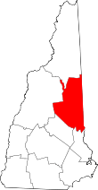 | |
| Township | ||
| CDPs | ||
| Other villages | ||
This article is issued from Wikipedia - version of the 7/10/2016. The text is available under the Creative Commons Attribution/Share Alike but additional terms may apply for the media files.