Melvin Village, New Hampshire
| Melvin Village, New Hampshire | |
|---|---|
| Census-designated place | |
|
Melvin Village in 1908 | |
 Melvin Village  Melvin Village | |
| Coordinates: 43°41′20″N 71°18′15″W / 43.68889°N 71.30417°WCoordinates: 43°41′20″N 71°18′15″W / 43.68889°N 71.30417°W | |
| Country | United States |
| State | New Hampshire |
| County | Carroll |
| Town | Tuftonboro |
| Area | |
| • Total | 0.9 sq mi (2.3 km2) |
| • Land | 0.9 sq mi (2.3 km2) |
| • Water | 0.0 sq mi (0.0 km2) |
| Elevation | 520 ft (160 m) |
| Population (2010) | |
| • Total | 241 |
| • Density | 270/sq mi (100/km2) |
| Time zone | Eastern (EST) (UTC-5) |
| • Summer (DST) | EDT (UTC-4) |
| ZIP code | 03850 |
| Area code(s) | 603 |
| FIPS code | 33-46980 |
| GNIS feature ID | 0868377 |

Melvin Village is a census-designated place within the town of Tuftonboro in Carroll County, New Hampshire, United States. Its population at the 2010 census was 241.[1]
The village is a summer vacation spot on Melvin Bay of Lake Winnipesaukee. Running through the village is N.H. Route 109. Melvin Village lies to the east of the town of Moultonborough and to the west of Center Tuftonboro and Wolfeboro.
The small center of the village, where the Melvin River enters Lake Winnipesaukee, is little changed over the last century. Most of the buildings remain and there are few new ones. The most significant change is that there is virtually no commercial activity. As recently as 1950 there were two general stores and two gas stations, all of which are now gone. The village was a stop in William Least Heat-Moon's book, Blue Highways.
It has a marina and there are also compounds of cottages and lakeside homes. Merrymount Landing is the only remaining mail-boat stop in the northeast corner of the lake.
References
- ↑ United States Census Bureau, American FactFinder, 2010 Census figures. Retrieved March 23, 2011.
External links
Municipalities and communities of Carroll County, New Hampshire, United States | ||
|---|---|---|
| Towns | 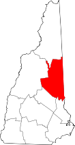 | |
| Township | ||
| CDPs | ||
| Other villages | ||