Union, New Hampshire
| Union, New Hampshire | |
|---|---|
| Census-designated place | |
|
Reunion Grange 303 | |
 Union  Union | |
| Coordinates: 43°29′29″N 71°1′23″W / 43.49139°N 71.02306°WCoordinates: 43°29′29″N 71°1′23″W / 43.49139°N 71.02306°W | |
| Country | United States |
| State | New Hampshire |
| County | Carroll |
| Town | Wakefield |
| Area | |
| • Total | 0.3 sq mi (0.8 km2) |
| • Land | 0.3 sq mi (0.8 km2) |
| • Water | 0.0 sq mi (0.0 km2) |
| Elevation | 486 ft (148 m) |
| Population (2010) | |
| • Total | 204 |
| • Density | 660/sq mi (260/km2) |
| Time zone | Eastern (EST) (UTC-5) |
| • Summer (DST) | EDT (UTC-4) |
| ZIP code | 03887 |
| Area code(s) | 603 |
| FIPS code | 33-77780 |
| GNIS feature ID | 0870569 |

Union is a village and census-designated place in the town of Wakefield in Carroll County, New Hampshire. It had a population of 204 at the 2010 census.[1]
Union is located at the junction of New Hampshire routes 125 and 153 in the southern corner of Wakefield. It lies along the Branch River.
Union has a separate ZIP code (03887) from the rest of the town of Wakefield.
References
- ↑ United States Census Bureau, American FactFinder, 2010 Census figures. Retrieved March 23, 2011.
Municipalities and communities of Carroll County, New Hampshire, United States | ||
|---|---|---|
| Towns | 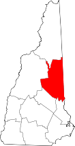 | |
| Township | ||
| CDPs | ||
| Other villages | ||
This article is issued from Wikipedia - version of the 7/10/2016. The text is available under the Creative Commons Attribution/Share Alike but additional terms may apply for the media files.