Spotswood, New Jersey
| Spotswood, New Jersey | |
|---|---|
| Borough | |
| Borough of Spotswood | |
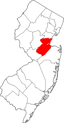
 Spotswood highlighted in Middlesex County | |
 Census Bureau map of Spotswood, New Jersey | |
| Coordinates: 40°23′44″N 74°23′24″W / 40.395687°N 74.390089°WCoordinates: 40°23′44″N 74°23′24″W / 40.395687°N 74.390089°W[1][2] | |
| Country |
|
| State |
|
| County | Middlesex |
| Incorporated | May 12, 1908 |
| Government[3] | |
| • Type | Faulkner Act (Mayor-Council) |
| • Body | Borough Council |
| • Mayor | Nicholas Poliseno (term ends December 31, 2016)[4] |
| • Administrator | Dawn McDonald[5] |
| • Clerk | Patricia DeStefano[5] |
| Area[1] | |
| • Total | 2.472 sq mi (6.402 km2) |
| • Land | 2.267 sq mi (5.872 km2) |
| • Water | 0.205 sq mi (0.531 km2) 8.29% |
| Area rank |
375th of 566 in state 20th of 25 in county[1] |
| Elevation[6] | 36 ft (11 m) |
| Population (2010 Census)[7][8][9] | |
| • Total | 8,257 |
| • Estimate (2015)[10] | 8,476 |
| • Rank |
278th of 566 in state 20th of 25 in county[11] |
| • Density | 3,642.2/sq mi (1,406.3/km2) |
| • Density rank |
175th of 566 in state 13th of 25 in county[11] |
| Time zone | Eastern (EST) (UTC-5) |
| • Summer (DST) | Eastern (EDT) (UTC-4) |
| ZIP code | 08884[12][13] |
| Area code(s) | 732[14] |
| FIPS code | 3402369810[1][15][16] |
| GNIS feature ID | 0885405[1][17] |
| Website |
spotswoodboro |
Spotswood is a borough in Middlesex County, New Jersey, United States. As of the 2010 United States Census, the borough's population was 8,257,[7][8][9] reflecting an increase of 377 (+4.8%) from the 7,880 counted in the 2000 Census, which had in turn declined by 103 (−1.3%) from the 7,983 counted in the 1990 Census.[18]
History
Its first settler James Johnston originally called the place "Spottiswoode", named for his old place of residence in Scotland, and dates back to its original settlement in 1685.[19][20][21]
Spotswood was incorporated as a borough by an act of the New Jersey Legislature on April 15, 1908, from portions of East Brunswick Township, based on the passage of a referendum held on May 12, 1908.[22][23]
Geography
According to the United States Census Bureau, the borough had a total area of 2.472 square miles (6.402 km2), including 2.267 square miles (5.872 km2) of land and 0.205 square miles (0.531 km2) of water (8.29%). To the north east edge lies Duhernal Lake.[1][2]
Unincorporated communities, localities and place names located partially or completely within the township include Outcalt, which is located along the border of Spotswood and Monroe Township.[24]
The borough borders the Middlesex County municipalities of East Brunswick Township, Helmetta, Monroe Township and Old Bridge Township.[25]
Demographics
| Historical population | |||
|---|---|---|---|
| Census | Pop. | %± | |
| 1910 | 623 | — | |
| 1920 | 704 | 13.0% | |
| 1930 | 921 | 30.8% | |
| 1940 | 1,201 | 30.4% | |
| 1950 | 2,325 | 93.6% | |
| 1960 | 5,788 | 148.9% | |
| 1970 | 7,891 | 36.3% | |
| 1980 | 7,840 | −0.6% | |
| 1990 | 7,983 | 1.8% | |
| 2000 | 7,880 | −1.3% | |
| 2010 | 8,257 | 4.8% | |
| Est. 2015 | 8,476 | [10][26] | 2.7% |
| Population sources: 1910–1920[27] 1910[28] 1910–1930[29] 1930–1990[30] 2000[31][32] 2010[7][8][9] | |||
Census 2010
The 2010 United States Census counted 8,257 people, 3,128 households, and 2,143 families residing in the borough. The population density was 3,642.2 per square mile (1,406.3/km2). The borough contained 3,242 housing units at an average density of 1,430.1 per square mile (552.2/km2). The racial makeup of the borough was 88.63% (7,318) White, 2.98% (246) Black or African American, 0.11% (9) Native American, 5.14% (424) Asian, 0.01% (1) Pacific Islander, 1.27% (105) from other races, and 1.87% (154) from two or more races. Hispanics or Latinos of any race were 8.32% (687) of the population.[7]
Out of a total of 3,128 households, 29.3% had children under the age of 18 living with them, 55.0% were married couples living together, 9.7% had a female householder with no husband present, and 31.5% were non-families. 27.1% of all households were made up of individuals, and 15.1% had someone living alone who was 65 years of age or older. The average household size was 2.56 and the average family size was 3.16.[7]
In the borough, 21.1% of the population were under the age of 18, 6.9% from 18 to 24, 24.3% from 25 to 44, 28.8% from 45 to 64, and 18.9% who were 65 years of age or older. The median age was 43.5 years. For every 100 females the census counted 91.7 males, but for 100 females at least 18 years old, it was 86.1 males.[7]
The Census Bureau's 2006–2010 American Community Survey showed that (in 2010 inflation-adjusted dollars) median household income was $70,360 (with a margin of error of +/- $9,861) and the median family income was $90,652 (+/- $8,741). Males had a median income of $59,226 (+/- $4,823) versus $43,365 (+/- $4,935) for females. The per capita income for the borough was $31,249 (+/- $1,696). About 2.5% of families and 3.3% of the population were below the poverty line, including 0.7% of those under age 18 and 6.4% of those age 65 or over.[33]
Census 2000
As of the 2000 United States Census[15] there were 7,880 people, 3,099 households, and 2,163 families residing in the borough. The population density was 3,389.8 people per square mile (1,311.4/km2). There were 3,158 housing units at an average density of 1,358.5 per square mile (525.6/km2). The racial makeup of the borough was 99.24% White, .05% African American, .5% Asian, 0.01% Pacific Islander, and 0.20% from two or more races. Hispanic or Latino of any race were 4.38% of the population.[31][32]
There were 3,099 households out of which 29.4% had children under the age of 18 living with them, 57.0% were married couples living together, 9.1% had a female householder with no husband present, and 30.2% were non-families. 26.5% of all households were made up of individuals and 15.6% had someone living alone who was 65 years of age or older. The average household size was 2.54 and the average family size was 3.10.[31][32]
In the borough the population was spread out with 22.4% under the age of 18, 6.8% from 18 to 24, 30.1% from 25 to 44, 23.4% from 45 to 64, and 17.4% who were 65 years of age or older. The median age was 40 years. For every 100 females there were 93.6 males. For every 100 females age 18 and over, there were 89.9 males.[31][32]
The median income for a household in the borough was $55,833, and the median income for a family was $73,062. Males had a median income of $45,979 versus $35,859 for females. The per capita income for the borough was $25,247. About 2.6% of families and 4.3% of the population were below the poverty line, including 5.4% of those under age 18 and 2.9% of those age 65 or over.[31][32]
Government
The Spotswood Police Department is a 24/7 law enforcement agency that serves the entire town. It currently has 18 officers and 4 dispatchers led by Chief Michael Zarro.[34]
Local government
The Borough of Spotswood operates within the Faulkner Act (formally known as the Optional Municipal Charter Law of 1950) under the Mayor-Council (Plan B), implemented based on the recommendations of a Charter Study Commission as of July 1, 1976.[35] The mayor and the five-member council are elected at-large on a non-partisan basis with each elected official serving four-year terms of office on a staggered basis, with either three council seats or two council seats and the mayoral seat up for vote every other year as part of the November general election.[3] The mayor is the chief executive and has responsibility for the administration of the government. The legislative power resides solely within the borough council. There is separation of legislative and executive power in this form of government.
As of 2016, the Mayor of Spotswood is Nicholas Poliseno whose term of office ends December 31, 2016. Members of the Borough Council are Council President Curtis Stollen (2018), Margaret Drozd (2018), Theodore "Ted" Ricci (2018), Edward T. Seely (2016) and Leo B. Servis, Jr. (2016; appointed to serve an unexpired term).[36][37][38][39][40][41][42]
In May 2015, Councilmember Frank LoSacco resigned from office from a term expiring in December 2016.[43] In the November 2015 general election, Servis was elected to serve the balance of the term of office[39] and was sworn in at the December 7, 2015, meeting after the election results were certified.[44]
Citing potential savings of $25,000, Spotswood's council approved a measure in 2010 that would allow the borough to take advantage of new state legislation under which it would to shift its non-partisan municipal elections from May to the November general election, with the first municipal race taking place in November 2012.[45] In the November 2012 general election, Nicholas Poliseno defeated Curtis Stollen in the mayoral race to succeed Thomas W. Barlow, who didn't run for re-election. Council incumbents Frank LoSacco and Edward T. Seely ran unopposed.[46]
Federal, state and county representation
Spotswood is located in the 12th Congressional District[47] and is part of New Jersey's 14th state legislative district.[8][48][49] Prior to the 2011 reapportionment following the 2010 Census, Spotswood had been in the 18th state legislative district.[50]
New Jersey's Twelfth Congressional District is represented by Bonnie Watson Coleman (D, Ewing Township).[51] New Jersey is represented in the United States Senate by Cory Booker (D, Newark, term ends 2021)[52] and Bob Menendez (D, Paramus, 2019).[53][54]
For the 2016–2017 session (Senate, General Assembly), the 14th Legislative District of the New Jersey Legislature is represented in the State Senate by Linda R. Greenstein (D, Plainsboro Township) and in the General Assembly by Daniel R. Benson (D, Hamilton Township, Mercer County) and Wayne DeAngelo (D, Hamilton Township).[55] The Governor of New Jersey is Chris Christie (R, Mendham Township).[56] The Lieutenant Governor of New Jersey is Kim Guadagno (R, Monmouth Beach).[57]
Middlesex County is governed by a Board of Chosen Freeholders, whose seven members are elected at-large on a partisan basis to serve three-year terms of office on a staggered basis, with either two or three seats coming up for election each year as part of the November general election. At an annual reorganization meeting held in January, the board selects from among its members a Freeholder Director and Deputy Director. As of 2015, Middlesex County's Freeholders (with party affiliation, term-end year, residence and committee chairmanship listed in parentheses) are Freeholder Director Ronald G. Rios (D, term ends December 31, 2015, Carteret; Ex-officio on all committees),[58] Freeholder Deputy Director Carol Barrett Bellante (D, 2017; Monmouth Junction, South Brunswick Township; County Administration),[59] Kenneth Armwood (D, 2016, Piscataway; Business Development and Education),[60] Charles Kenny ( D, 2016, Woodbridge Township; Finance),[61] H. James Polos (D, 2015, Highland Park; Public Safety and Health),[62] Charles E. Tomaro (D, 2017, Edison; Infrastructure Management)[63] and Blanquita B. Valenti (D, 2016, New Brunswick; Community Services).[64][65] Constitutional officers are County Clerk Elaine M. Flynn (D, Old Bridge Township),[66] Sheriff Mildred S. Scott (D, 2016, Piscataway)[67] and Surrogate Kevin J. Hoagland (D, 2017; New Brunswick).[65][68]
Politics
As of March 23, 2011, there were a total of 5,119 registered voters in Spotswood, of which 1,485 (29.0%) were registered as Democrats, 965 (18.9%) were registered as Republicans and 2,667 (52.1%) were registered as Unaffiliated. There were 2 voters registered to other parties.[69]
In the 2012 presidential election, Republican Mitt Romney received 50.1% of the vote (1,764 cast), ahead of Democrat Barack Obama with 48.6% (1,712 votes), and other candidates with 1.4% (48 votes), among the 3,557 ballots cast by the borough's 5,177 registered voters (33 ballots were spoiled), for a turnout of 68.7%.[70][71] In the 2008 presidential election, Republican John McCain received 52.4% of the vote (2,001 cast), ahead of Democrat Barack Obama with 45.4% (1,734 votes) and other candidates with 1.7% (64 votes), among the 3,820 ballots cast by the borough's 5,217 registered voters, for a turnout of 73.2%.[72] In the 2004 presidential election, Republican George W. Bush received 55.4% of the vote (2,014 ballots cast), outpolling Democrat John Kerry with 43.4% (1,580 votes) and other candidates with 0.7% (34 votes), among the 3,638 ballots cast by the borough's 4,952 registered voters, for a turnout percentage of 73.5.[73]
In the 2013 gubernatorial election, Republican Chris Christie received 70.2% of the vote (1,591 cast), ahead of Democrat Barbara Buono with 28.3% (640 votes), and other candidates with 1.5% (34 votes), among the 2,290 ballots cast by the borough's 5,254 registered voters (25 ballots were spoiled), for a turnout of 43.6%.[74][75] In the 2009 gubernatorial election, Republican Chris Christie received 63.2% of the vote (1,627 ballots cast), ahead of Democrat Jon Corzine with 28.6% (736 votes), Independent Chris Daggett with 6.4% (165 votes) and other candidates with 1.2% (31 votes), among the 2,576 ballots cast by the borough's 5,043 registered voters, yielding a 51.1% turnout.[76]
Education
The Spotswood Public Schools serve students in pre-Kindergarten through twelfth grade. Schools in the district (with 2011–12 enrollment data from the National Center for Education Statistics[77]) are G. Austin Schoenly Elementary School[78] (Pre-K to 1st grade; 277 students), E. R. Appleby Elementary School[79] (grades 2–5; 427), Memorial Middle School[80] (grades 6–8; 338) and Spotswood High School[81] (grades 9–12; 766).[82] The Appleby and Schoenly elementary schools offer after school and summer childcare program through the Spotswood C.A.R.E.S. (Children's After-school Recreation and Enrichment at Spotswood) program.[83]
All public students from Helmetta, a non-operating district, attend the Spotswood schools, along with students from Milltown who attend Spotswood High School as part of a sending/receiving relationship with the Milltown Public Schools.[84][85]
Immaculate Conception Pre-School (toddler-PreK) and Immaculate Conception School (K-8), which opened in September 1960, operate under the supervision of Roman Catholic Diocese of Metuchen.[86][87]
Transportation
Roads and highways
As of July 2015, the borough had a total of 29.51 miles (47.49 km) of roadways, of which 25.52 miles (41.07 km) were maintained by the municipality and 4.07 miles (6.55 km) by Middlesex County.[88]
The main roads that pass through Spotswood include Middlesex CR 613 (Devoe Avenue / Main Street / Summerhill Road) connecting Monroe Township to the south and East Brunswick Township to the north[89] and Middlesex CR 615 (Manalapan Road / Main Street) connecting Helmetta in the southwest to East Brunswick Township in the borough's northwest corner.[90]
Both Route 18 and CR 527 just miss the borough by less than a mile. The closest limited access is the New Jersey Turnpike (Interstate 95) which is accessible in both neighboring East Brunswick Township (Exit 9) and bordering Monroe Township (Exit 8A).
Public transportation
New Jersey Transit provides bus service between the borough and the Port Authority Bus Terminal in Midtown Manhattan on the 138 route.[91]
References
- 1 2 3 4 5 6 2010 Census Gazetteer Files: New Jersey County Subdivisions, United States Census Bureau. Accessed May 21, 2015.
- 1 2 US Gazetteer files: 2010, 2000, and 1990, United States Census Bureau. Accessed September 4, 2014.
- 1 2 2012 New Jersey Legislative District Data Book, Rutgers University Edward J. Bloustein School of Planning and Public Policy, March 2013, p. 84.
- ↑ 2016 New Jersey Mayors Directory, New Jersey Department of Community Affairs. Accessed June 14, 2016. As of date accessed, Poliseno's term-end date is incorrectly listed as June 30, 2016, with the shift of municipal elections from May to November was not taken into account.
- 1 2 Directory, Borough of Spotswood. Accessed July 13, 2016.
- ↑ U.S. Geological Survey Geographic Names Information System: Borough of Spotswood, Geographic Names Information System. Accessed March 14, 2013.
- 1 2 3 4 5 6 DP-1 – Profile of General Population and Housing Characteristics: 2010 for Spotswood borough, Middlesex County, New Jersey, United States Census Bureau. Accessed November 27, 2012.
- 1 2 3 4 Municipalities Grouped by 2011–2020 Legislative Districts, New Jersey Department of State, p. 7. Accessed January 6, 2013.
- 1 2 3 Profile of General Demographic Characteristics: 2010 for Spotswood borough, New Jersey Department of Labor and Workforce Development. Accessed November 27, 2012.
- 1 2 PEPANNRES – Annual Estimates of the Resident Population: April 1, 2010 to July 1, 2015 – 2015 Population Estimates for New Jersey municipalities, United States Census Bureau. Accessed May 22, 2016.
- 1 2 GCT-PH1 Population, Housing Units, Area, and Density: 2010 – State – County Subdivision from the 2010 Census Summary File 1 for New Jersey, United States Census Bureau. Accessed November 27, 2012.
- ↑ Look Up a ZIP Code for Spotswood, NJ, United States Postal Service. Accessed November 27, 2012.
- ↑ Zip Codes, State of New Jersey. Accessed November 5, 2013.
- ↑ Area Code Lookup – NPA NXX for Sparta, NJ, Area-Codes.com. Accessed November 6, 2013.
- 1 2 American FactFinder, United States Census Bureau. Accessed September 4, 2014.
- ↑ A Cure for the Common Codes: New Jersey, Missouri Census Data Center. Accessed October 30, 2012.
- ↑ US Board on Geographic Names, United States Geological Survey. Accessed September 4, 2014.
- ↑ Table 7. Population for the Counties and Municipalities in New Jersey: 1990, 2000 and 2010, New Jersey Department of Labor and Workforce Development, February 2011. Accessed November 27, 2012.
- ↑ Cheslow, Jerry. "If You're Thinking of Living in: Spotswood", The New York Times, May 30, 1993. Accessed November 6, 2013. "Named for the town of Spotteswoode in Scotland, the borough traces its history to 1685, when a Scot named James Johnstone took advantage of an offer from the British proprietors of New Jersey of 50 acres to anyone willing to move to outlying areas. Thus, Spotswood became the first European settlement in southern Middlesex County."
- ↑ Hutchinson, Viola L. The Origin of New Jersey Place Names, New Jersey Public Library Commission, May 1945. Accessed October 8, 2015.
- ↑ History, Borough of Spotswood. Accessed July 13, 2016.
- ↑ Snyder, John P. The Story of New Jersey's Civil Boundaries: 1606–1968, Bureau of Geology and Topography; Trenton, New Jersey; 1969. p. 174. Accessed October 25, 2012.
- ↑ Honeyman, Abraham Van Doren. Index-analysis of the Statutes of New Jersey, 1896–1909: Together with References to All Acts, and Parts of Acts, in the 'General Statutes' and Pamphlet Laws Expressly Repealed: and the Statutory Crimes of New Jersey During the Same Period, p. 263. New Jersey Law Journal Publishing Company, 1910. Accessed October 8, 2015.
- ↑ Locality Search, State of New Jersey. Accessed May 21, 2015.
- ↑ Areas touching Spotswood, MapIt. Accessed October 8, 2015.
- ↑ Census Estimates for New Jersey April 1, 2010 to July 1, 2015, United States Census Bureau. Accessed May 22, 2016.
- ↑ Compendium of censuses 1726–1905: together with the tabulated returns of 1905, New Jersey Department of State, 1906. Accessed November 6, 2013.
- ↑ Thirteenth Census of the United States, 1910: Population by Counties and Minor Civil Divisions, 1910, 1900, 1890, United States Census Bureau, p. 337. Accessed November 27, 2012.
- ↑ Fifteenth Census of the United States : 1930 – Population Volume I, United States Census Bureau, p. 717. Accessed November 27, 2012.
- ↑ Table 6. New Jersey Resident Population by Municipality: 1930 – 1990, New Jersey Department of Labor and Workforce Development. Accessed June 28, 2015.
- 1 2 3 4 5 Census 2000 Profiles of Demographic / Social / Economic / Housing Characteristics for Spotswood borough, New Jersey, United States Census Bureau. Accessed November 27, 2012.
- 1 2 3 4 5 DP-1: Profile of General Demographic Characteristics: 2000 – Census 2000 Summary File 1 (SF 1) 100-Percent Data for Spotswood borough, Middlesex County, New Jersey, United States Census Bureau. Accessed November 27, 2012.
- ↑ DP03: Selected Economic Characteristics from the 2006–2010 American Community Survey 5-Year Estimates for Spotswood borough, Middlesex County, New Jersey, United States Census Bureau. Accessed November 27, 2012.
- ↑ Spotswood Police Department, Borough of Spotswood. Accessed July 13, 2016.
- ↑ "The Faulkner Act: New Jersey's Optional Municipal Charter Law", New Jersey State League of Municipalities, July 2007. Accessed November 5, 2013.
- ↑ Spotswood Borough Council, Spotswood Borough. Accessed July 13, 2016.
- ↑ 2016 Municipal Data Sheet, Spotswood Borough. Accessed July 13, 2016. As of date accessed, Drozd, Ricci and Stollen are listed with incorrect term-end years of 2017.
- ↑ Borough of Spotswood, Middlesex County, New Jersey. Accessed July 12, 2016.
- 1 2 November 3, 2015 General Election Results, Middlesex County, New Jersey. Accessed July 12, 2016.
- ↑ November 4, 2014 General Election Results, Middlesex County, New Jersey. Accessed July 12, 2016.
- ↑ November 5, 2013 General Election Results, Middlesex County, New Jersey. Accessed July 12, 2016.
- ↑ November 6, 2012 General Election Results, Middlesex County, New Jersey. Accessed July 12, 2016.
- ↑ Uzialko, Adam C. "Spotswood eyes council vacancy", Sentinel-EBS News, May 7, 2015. Accessed July 13, 2016. "The Spotswood Borough Council has a vacant seat left by the resignation of Council President Frank LoSacco.... Members of the Borough Council will vote to appoint a replacement to LoSacco's unexpired term, which is set to end in December 2016. The person chosen will have to run for election in November to fill out the remainder of the unexpired term, DeStefano said."
- ↑ December 7, 2015, Meeting Minutes, Borough of Spotswood. Accessed July 12, 2016. "It is my extreme pleasure to declare the Honorable Leo B. Servis, Jr. elected Councilman for the Borough of Spotswood in accordance with the Statutes provided.... The Clerk administered the Oath of Office for Council-At-Large, Leo B. Servis, Jr. Councilman's Servis' granddaughters held the bible for him."
- ↑ Shahid, Aliyah. "9 in Perth Amboy, 4 in Spotswood seek council seats", The Star-Ledger, March 18, 2010. Accessed November 27, 2012. "Until this year, under state law, non-partisan towns were required to hold their municipal elections on the second Tuesday in May. In January, the state passed a law allowing municipalities to switch the date from May to November, on the same day as the general election.... Earlier this month, Spotswood unanimously approved the move to hold elections in November, starting in 2012."
- ↑ McEvoy, James. "Poliseno edges out Stollen in Spotswood mayoral bid; Currently the borough's volunteer fire chief, mayor-elect says voters wanted change", Sentinel, November 15, 2012. Accessed November 27, 2012. "Councilman Nicholas Poliseno will serve as the next mayor of Spotswood, having edged out longtime council President Curtis Stollen in the borough's first contested mayoral race in many years. Poliseno garnered 1,471 to Stollen's 1,222 in the Nov. 6 elections.... In the Nov. 6 council election, incumbents Frank LoSacco and Edward T. Seely, who ran with Stollen, won re-election with 1,743 and 1,734, respectively. They ran uncontested."
- ↑ Plan Components Report, New Jersey Redistricting Commission, December 23, 2011. Accessed January 6, 2013.
- ↑ 2016 New Jersey Citizen's Guide to Government, p. 64, New Jersey League of Women Voters. Accessed July 20, 2016.
- ↑ Districts by Number for 2011–2020, New Jersey Legislature. Accessed January 6, 2013.
- ↑ 2011 New Jersey Citizen's Guide to Government, p. 64, New Jersey League of Women Voters. Accessed May 22, 2015.
- ↑ Bonnie Watson Coleman Biography, United States House of Representatives. Accessed January 7, 2015.
- ↑ About Cory Booker, United States Senate. Accessed January 26, 2015. "He now owns a home and lives in Newark's Central Ward community."
- ↑ Biography of Bob Menendez, United States Senate, January 26, 2015. "He currently lives in Paramus and has two children, Alicia and Robert."
- ↑ Senators of the 114th Congress from New Jersey. United States Senate. Accessed January 26, 2015. "Booker, Cory A. - (D - NJ) Class II; Menendez, Robert - (D - NJ) Class I"
- ↑ Legislative Roster 2016-2017 Session, New Jersey Legislature. Accessed January 17, 2016.
- ↑ "About the Governor". State of New Jersey. Retrieved 2010-01-21.
- ↑ "About the Lieutenant Governor". State of New Jersey. Retrieved 2010-01-21.
- ↑ Ronald G. Rios, Middlesex County, New Jersey. Accessed January 11, 2015.
- ↑ Carol Barrett Bellante, Middlesex County, New Jersey. Accessed January 11, 2015.
- ↑ Kenneth Armwood, Middlesex County, New Jersey. Accessed January 11, 2015.
- ↑ Charles Kenny, Middlesex County, New Jersey. Accessed January 11, 2015.
- ↑ H. James Polos, Middlesex County, New Jersey. Accessed January 11, 2015.
- ↑ Charles E. Tomaro, Middlesex County, New Jersey. Accessed January 11, 2015.
- ↑ Blanquita B. Valenti, Middlesex County, New Jersey. Accessed January 11, 2015.
- 1 2 Elected County Officials, Middlesex County, New Jersey. Accessed January 11, 2015.
- ↑ County Clerk Elaine Flynn, Middlesex County, New Jersey. Accessed January 11, 2015.
- ↑ Sheriff Mildred S. Scott, Middlesex County, New Jersey. Accessed January 11, 2015.
- ↑ Surrogate Kevin J. Hoagland, Middlesex County, New Jersey. Accessed January 11, 2015.
- ↑ Voter Registration Summary – Middlesex, New Jersey Department of State Division of Elections, March 23, 2011. Accessed November 27, 2012.
- ↑ "Presidential General Election Results – November 6, 2012 – Middlesex County" (PDF). New Jersey Department of Elections. March 15, 2013. Retrieved December 24, 2014.
- ↑ "Number of Registered Voters and Ballots Cast – November 6, 2012 – General Election Results – Middlesex County" (PDF). New Jersey Department of Elections. March 15, 2013. Retrieved December 24, 2014.
- ↑ 2008 Presidential General Election Results: Middlesex County, New Jersey Department of State Division of Elections, December 23, 2008. Accessed November 27, 2012.
- ↑ 2004 Presidential Election: Middlesex County, New Jersey Department of State Division of Elections, December 13, 2004. Accessed November 27, 2012.
- ↑ "Governor – Middlesex County" (PDF). New Jersey Department of Elections. January 29, 2014. Retrieved December 24, 2014.
- ↑ "Number of Registered Voters and Ballots Cast – November 5, 2013 – General Election Results – Middlesex County" (PDF). New Jersey Department of Elections. January 29, 2014. Retrieved December 24, 2014.
- ↑ 2009 Governor: Middlesex County, New Jersey Department of State Division of Elections, December 31, 2009. Accessed November 27, 2012.
- ↑ School Data for the Spotswood Public Schools, National Center for Education Statistics. Accessed November 27, 2012.
- ↑ G. Austin Schoenly Elementary School, Spotswood Public Schools. Accessed November 6, 2013.
- ↑ E. R. Appleby Elementary School, Spotswood Public Schools. Accessed November 6, 2013.
- ↑ Memorial Middle School, Spotswood Public Schools. Accessed November 6, 2013.
- ↑ Spotswood High School, Spotswood Public Schools. Accessed November 6, 2013.
- ↑ New Jersey School Directory for the Spotswood Public Schools, New Jersey Department of Education. Accessed September 23, 2013.
- ↑ Children's After school Recreation and Enrichment at Spotswood, Spotswood Public Schools. Accessed November 27, 2012.
- ↑ Milltown Fact Sheet, Joyce Kilmer School. Accessed November 27, 2012. "Through a formal send–receive contract, approved by the Department of Education, our high school students are sent on a tuition basis to Spotswood High School. Our 2012–2013 budget of $14.3 million supports Parkview School and Joyce Kilmer School, as well as the tuition for students attending Spotswood High School."
- ↑ Parents, Spotswood High School. Accessed November 27, 2012. "Welcome to Spotswood High School, a comprehensive institution that focuses on excellence in academics, the arts, athletics, and community service. Spotswood High School has served the residents in Spotswood, Helmetta, and Milltown since 1976."
- ↑ Find a school, Roman Catholic Diocese of Metuchen. Accessed October 8, 2015.
- ↑ History, Immaculate Conception School. Accessed October 8, 2015. "The church was designed to accommodate 1,000 people. The school consisted of 12 classrooms. The total cost of the new parish facility was 1.5 million dollars. In November 1960, the complex was dedicated.In September 1960, Immaculate Conception School opened with grades one, two, and three. The initial enrollment was 198 students."
- ↑ Middlesex County Mileage by Municipality and Jurisdiction, New Jersey Department of Transportation, May 2010. Accessed November 6, 2013.
- ↑ Middlesex County Route 613 Straight Line Diagram, New Jersey Department of Transportation, December 1999. Accessed November 6, 2013.
- ↑ Middlesex County Route 615 Straight Line Diagram, New Jersey Department of Transportation, December 1999. Accessed November 6, 2013.
- ↑ Middlesex County Bus / Rail Connections, New Jersey Transit, backed up by the Internet Archive as of August 31, 2009. Accessed November 6, 2013.
External links
- Spotswood Borough website
- Spotswood Public Schools
- Spotswood Public Schools's 2014–15 School Report Card from the New Jersey Department of Education
- School Data for the Spotswood Public Schools, National Center for Education Statistics
- Spotswood Volunteer Fire Department
 |
East Brunswick Township | | ||
| Helmetta | |
Old Bridge Township | ||
| ||||
| | ||||
| Monroe Township |